MH01 - Manantial Huaper
Site MH01 - Manantial Huaper
GPS: S12°925453, W74°293884. Elevation: 2353m asl.
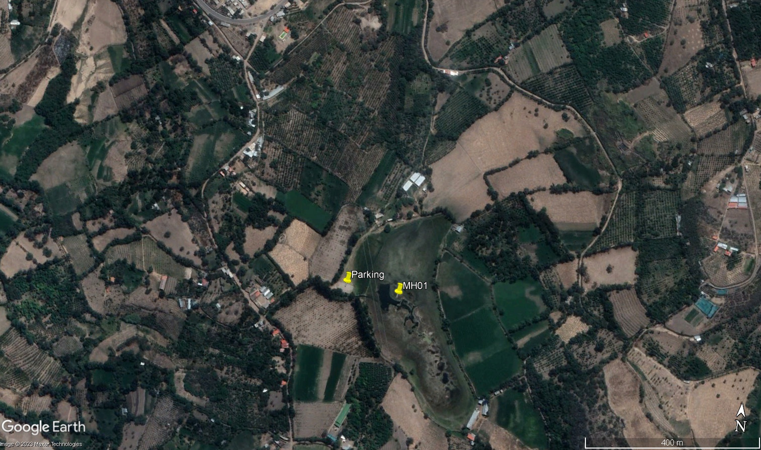 Aerial view of study site / Vista aérea del lugar del estudio (March 2023) (John Forrest)
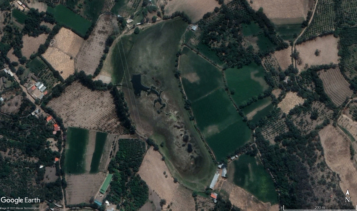 Close up aerial view of study site / Vista muy cerca del aérea del lugar del estudio (March 2023) (John Forrest)
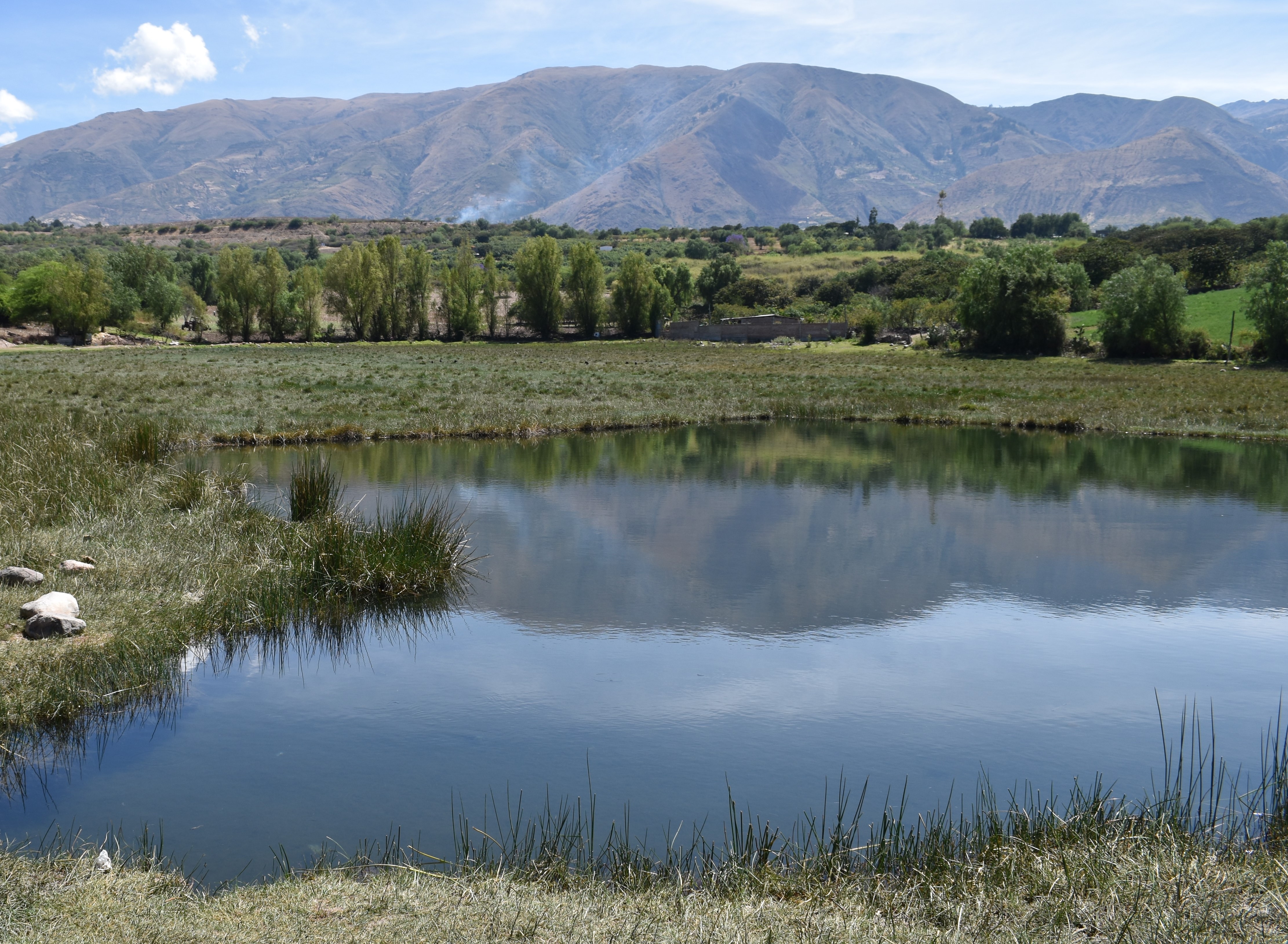 The main lagoon / La laguna principal (March 2023) (John Forrest)
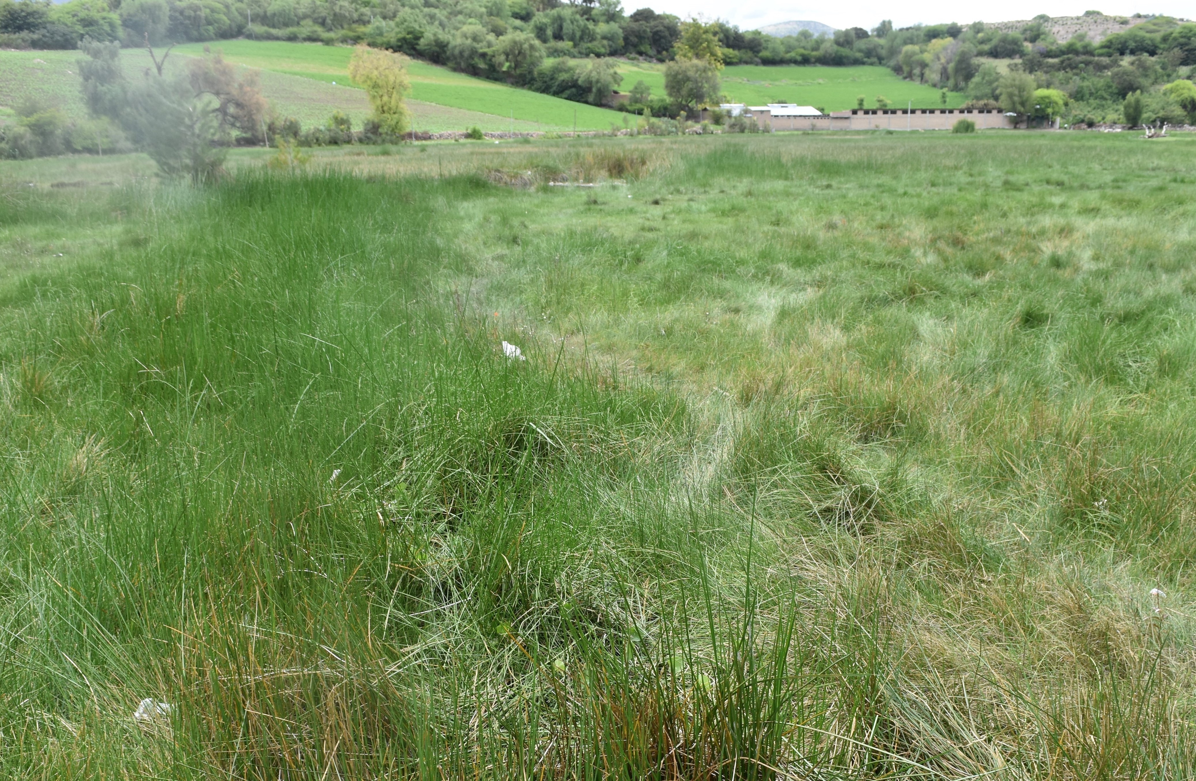 The exit channel from the main lagoon / El canal de salida de la laguna principal (November 2024) (John Forrest)
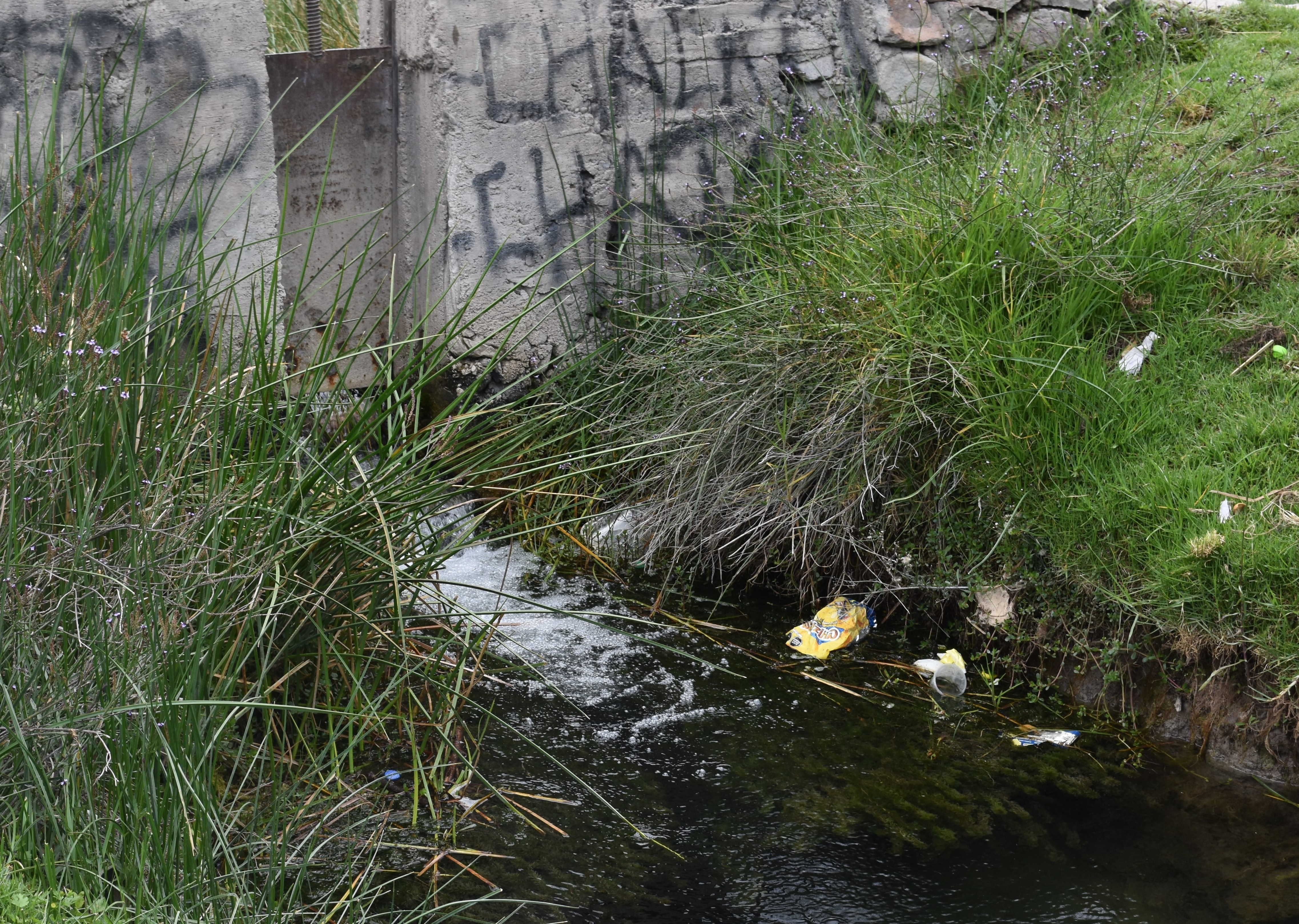 The controlled outflow from the Huaper / El flujo controlado desde el Huaper (November 2024) (John Forrest)
Site description
MH01 is located north-west of Huanta amongst the foothills lining the eastern flank of the Cachi valley. It is backed by a steep slope while the slope towards the river Cachi is gentler.
Water samples and water quality measurements were taken from within the manantial on the first visit, from the edge of one of the larger lagoons towards the centre of the Huaper but, more recently, only at the outflow point.
Discharge measurements have always been taken at the Huaper outflow but it should be noted that this is not an accurate measure of the natural discharge from the Huaper because – -it is a manmade outflow channel, artificially setting the outflow. -water may also be lost through subterranean flow.
Descripción del sitio
MH01 está situado al noroeste de Huanta, entre las estribaciones que bordean el flanco oriental del valle de Cachi. Está respaldado por una ladera abrupta, mientras que la pendiente hacia el río Cachi es más suave.
Las muestras de agua y las mediciones de la calidad del agua se tomaron dentro del manantial durante la primera visita, desde el borde de una de las lagunas más grandes hacia el centro del Huaper, pero, más recientemente, solo en el punto de salida.
Las mediciones de caudal siempre se realizaron en la desembocadura del Huaper. NB. Esta no es necesariamente una medida exacta de caudal natural del Huaper porque … -se trata de un canal de desagüe construido por el hombre, que fija artificialmente el caudal de salida. -también puede perderse agua por el flujo subterráneo.
Data analysis / Análisis de datos
NB.The water quality data is taken from one of the lagoons within the manantial while the river characteristic data recorded to obtain the discharge was taken from the outflow from the manantial.
NB: Los datos de calidad del agua proceden de una de las lagunas del manantial, mientras que los datos característicos del río registrados para obtener el caudal se tomaron de la desembocadura del manantial.
The results obtained across five visits are consistent. A discharge of approximately 30 litres per second was recorded in both dry and wet seasons. A pH of close to 7 is low compared to recordings at nearby river sites. Conductivity around 900 (µS/cm) is on the high side comapred to river recordings as is alkalinity at around 350. ORP recordings are always negative indicating that the water is not ideal for acquatic life though aquatic life - fish species, frogs, birds …. - were observed in and around the lagoons.
Los resultados obtenidos en cinco visitas son consistentes. Se registró un caudal de aproximadamente 30 litros por segundo tanto en la estación seca como en la húmeda. Un pH cercano a 7 es bajo en comparación con los registros de los ríos cercanos. La conductividad, en torno a 900 (µS/cm), es elevada en comparación con los registros de los ríos, al igual que la alcalinidad, que ronda los 350. Los registros de ORP son siempre negativos, lo que indica que el agua no es ideal para la vida acuática, aunque se observaron especies acuáticas (peces, ranas, aves…) en las lagunas y sus alrededores.
River & water quality data / Datos fluviales y de calidad del agua
The following river and water quality data was collected from this site:
En este lugar se recogieron los siguientes datos fluviales y de calidad del agua:
| Site / Sitio: MH01 | March / marzo 2023 | November / noviembre 2023 | March / marzo 2024 | November / noviembre 2024 | November / noviembre 2025 |
|---|---|---|---|---|---|
| Season / Temporada: | Austral Summer / Verano | Austral Winter / Invierno | Austral Summer / Verano | Austral Winter / Invierno | Austral Winter / Invierno |
| Date / Fecha: | 24.3.23 | 28.11.23 | 27.3.24 | 30.11.24 | 5.12.25 |
| Time / Hora: | 8.30 | 9.30 | 9.00 | 10.00 | 8.00 |
| Width / Ancho (m) | 0.45 | 0.40 | 0.40 | 0.38 | 0.40 |
| Depth / Profundidad (Av.) (m) | 0.25 | 0.065 | 0.08 | 0.06 | 0.30 |
| CSA / Area traversal (Av.) (m²) | 0.11 | 0.026 | 0.030 | 0.023 | 0.120 |
| Velocity / Velocidad (Av.) (m/s) | 0.39 | 1.245 | 0.980 | 1.121 | 0.20 |
| Discharge / Caudal (Av.) (m³/s) | 0.044 | 0.032 | 0.029 | 0.026 | 0.024 |
| Temperature (Atmopheric) (°C) | 27.9 | 27.5 | 20.3 | 28.1 | 20.2 |
| Temperature (Water / Agua) (°C) | 20.48 | 20.93 | 20.69 | 21.81 | 20.31 |
| Atmospheric pressure / presión (mbar) | 802.1 | 797.7 | 791.0 | 801.9 | 790.6 |
| Dissolved oxygen / Oxigeno disuelto (ppm) (MP)* | 2.64 | 5.71 | 1.43 | 1.93 | 1.33 |
| Dissolved oxygen / Oxigeno disuelto (%) (MP)* | 36.2 | 79.3 | 17.7 | 24.8 | 18.2 |
| pH | 6.96 | 7.02 | 6.92 | 7.22 | 7.12 |
| Conductivity / Conductividad (µS/cm) | 866 | 910 | 915 | 944 | 875 |
| Total Dissolved Solids (TDS / SDT) (ppm) | 433 | 456 | 459 | 472 | 438 |
| ORP (mV) | - 126.3 | 36.8 | - 188.9 | - 143.8 | -59.5 |
| Turbidity / Turbidez | Clear / Transparente | Slightly turbid / Poco turbidez | Slightly turbid / Poco turbidez | Clear / Transparente | Slightly turbid / Poco turbidez |
| Alkalinity/Alkalinidad (Titración) (mg/l CaCO₃)(1.6N) | 367 | 363 | 338 | 380 | 358 |
| Alkalinity Field Tester (Hanna) (ppm CaCO₃) | 311 | 347 | 310 | 362 | 341 |
| *Also refer to MT DO results post-2023 / Consulte también los resultados de MT DO posteriores a 2023. |