Q1.1 - Lower Opanccay - Opanccay Bajo
Site Q1.1: Lower Opanccay - Opanccay Bajo - Boca Opanccay
GPS: S12°837746, W74°296030 Elevation: 2266m asl.
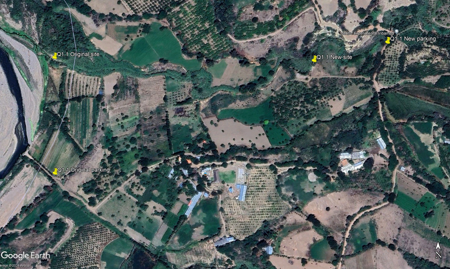
 Aerial view of study site / Vista aérea del lugar del estudio (March 2023) (John Forrest)
Original site (Q1.1L) (visited in March, June 2023, November 2024 and all 2025 visits)
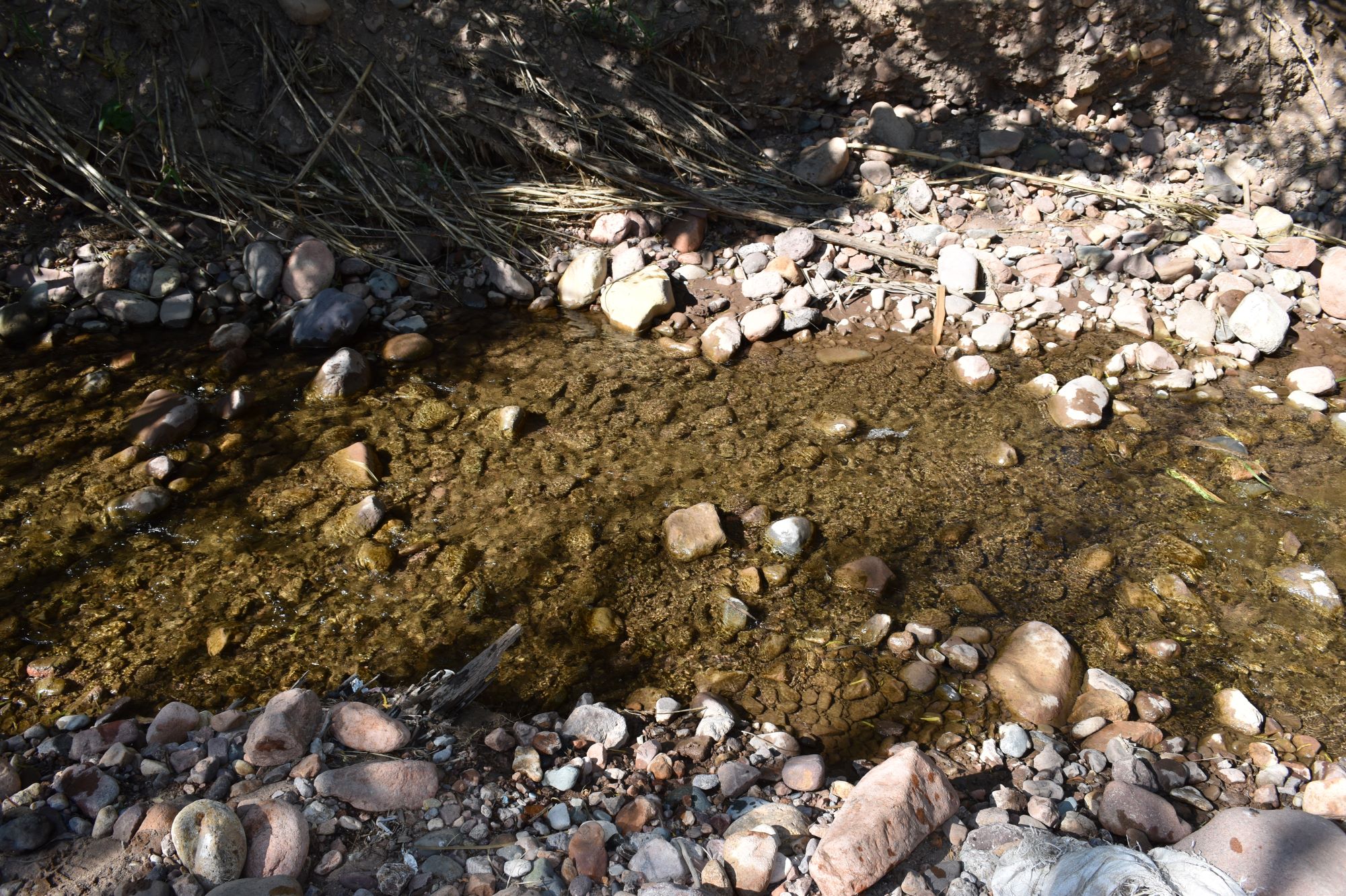
 The study site in March 2023 - its precise position and characteristics have changed significantly during the last two years / El lugar del estudio en marzo de 2023: su ubicación exacta y sus características han cambiado significativamente durante los últimos dos años. (March 2023) (John Forrest)
 View downstream from the study site / Visita rio abajo del lugar del estudio (March 2023) (John Forrest)
View downstream from the study site. The area in the foreground in the March 2023 photo has been completely eroded away. / Visita rio abajo del lugar del estudio. El área en primer plano de la foto de marzo de 2023 ha sido completamente erosionada. (June 2025) (John Forrest)
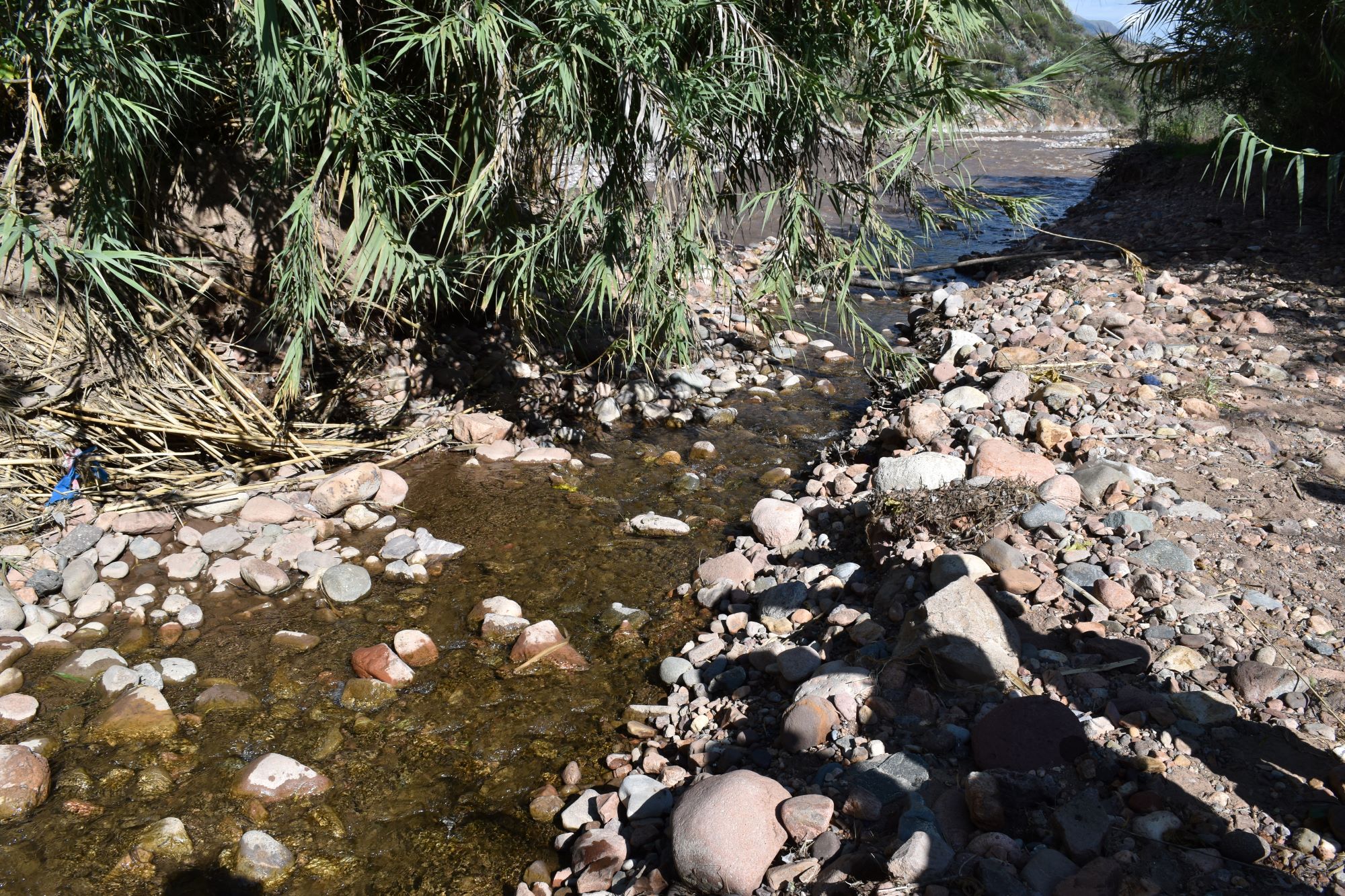
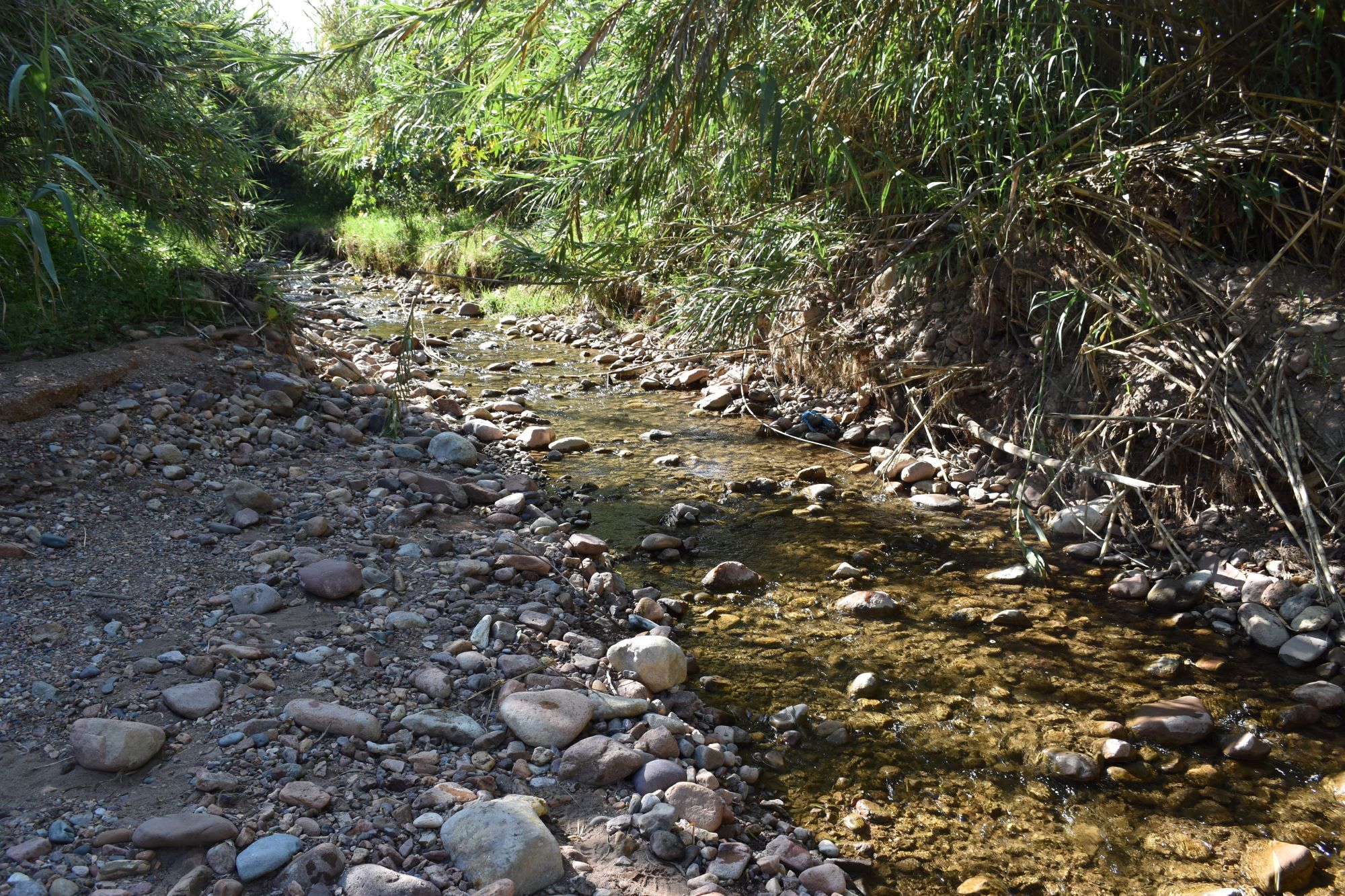
 View upstream from the study site / Vista rio arriba desde el lugar del estudio (March 2023) (John Forrest)
View upstream from the study site. The left bank (on the right in the photo) has been severely eroded since the March 2023 photo was taken. / Vista rio arriba desde el lugar del estudio. La orilla izquierda (a la derecha en la foto) ha sufrido una grave erosión desde que se tomó la foto en marzo de 2023. (June 2025) (John Forrest)
New site (Q1.1U) (visited in November 2023, March 2024 \& June 2024)
The study site on three occasions - visited when it was impossible to access the lower site / El lugar del estudio tres veces - visitado cuando era imposible acceder al lugar más bajo. (March 2024) (John Forrest)
View downstream from the study site / Visita rio abajo del lugar del estudio (March 2024) (John Forrest)
View upstream from the study site / Vista rio arriba desde el lugar del estudio (March 2024) (John Forrest)
Site description
Q1.1 is located in a small valley with a narrow flood-plain cutting through the foothills lining the eastern flank of the Cachi valley, below Huanta. The original study site - visited in March 2023, June 2023 and November 2024, is located about 25 metres above the confluence of the river Opanccay with the river Cachi. When the river is high it may not be possible to cross the river and measurements would need to be taken from the left bank.
The river banks consist of sediment deposits so the precise position of the site may vary on a seasonal basis with the shifting of the deposits. A rise and fall in the river level may also impact upon the precise location of the site.
Access is along the left side of the valley through and beyond a small settlement. The road ends on a river terrace 50 metres from the river Cachi. After descending the river terrace, it is then a 150 metre walk north along the right bank of the River Cachi to the mouth of the River Opanccay.
Due to the changing position of the Rio Cachi and weather conditions, a different site, slightly higher up the valley was visited in November 2023, March and June 2024. This is located about 100 metres downstream from the bridge over the River Opanccay on the Cangari to Azangaro road. Access is off a track running west into farmland, along the left bank, the site is down and across a field bordering the river.
Descripción del sitio
Q1.1 se encuentra en un pequeño valle con una estrecha llanura de inundación que corta a través de las estribaciones que bordean el flanco oriental del valle de Cachi, por debajo de Huanta. El sitio de estudio original - visitado en marzo de 2023, junio de 2023 y noviembre de 2024, se encuentra a unos 25 metros rio arriba de la confluencia del río Opanccay con el río Cachi. Cuando el nivel del río es alto puede no ser posible cruzar el río y las mediciones tendrían que ser tomadas desde la orilla izquierda.
Las orillas del río están formadas por depósitos de sedimentos, por lo que la posición exacta del emplazamiento puede variar estacionalmente con el desplazamiento de los depósitos. Las subidas y bajadas del nivel del río también pueden influir en la ubicación exacta del emplazamiento.
El acceso se realiza por el lado izquierdo del valle a través y más allá de un pequeño asentamiento. El camino termina en una terraza fluvial a 50 metros del Río Cachi. Después de descender la terraza del río, se camina 150 metros hacia el norte a lo largo de la orilla derecha del Río Cachi hasta la boca del Río Opanccay.
Debido a la posición cambiante del río Cachi y a las condiciones climáticas, se visitó un sitio diferente, ligeramente más arriba en el valle, en noviembre de 2023, marzo y junio de 2024. Se encuentra a unos 100 metros aguas abajo del puente sobre el Río Opanccay en la carretera de Cangari a Azangaro. El acceso es desde una pista que corre hacia el oeste en tierras de cultivo, a lo largo de la orilla izquierda, el sitio está abajo y a través de un campo que bordea el río.
Data analysis
The discharge at Q1.1 is quite variable and does not follow the link to precipitation patterns at sites higher up the Opanccay valley. Until February 2025, the highest discharge was recorded in June 2024, usually a drier month, while the lowest figures were recorded in March at the height of the wet season. However, overall, apart from in February 2025 at the height of the rainy season, the discharge is low and lower than at sites higher up the river.
Consequently, it appears that the discharge at Q1.1 is not always linked to rainfall patterns nor differences in the discharge in either sub-tributary which join together a short distant above site Q1.1, given that between sites Q1.2N and Q1.2S and site Q1.1 the channels are usually dry. On that basis, the origin of the discharge at Q1.1 is unclear and requires further investigation but may result from water entering the channel from the major Cachi irrigation canal, or manantials upstream.
In February 2025 there was significantly more water in the channel than previosuly observed and there had clearly been an even higher discharge a few days earlier given the significant changes made to the course of the channel compared to previous visits. This is the only occasion when water has been observed flowing in both sub-tributaries all the way from the sierra Razuhuilca sites to the river Cachi.
Despite the significantly higher discharge in February 2025 than during any previous visit, it would appear that the pH, alkalinity and conductivity measurements remained close to the average for all visits though in June 2025 they were higher despite a relatively low discharge. In November 2025 the pH was at its lowest while conductivity and alkalinity were high.
The core water chemistry would appear to be most closely linked to the geology of the sierra Razuhuillca but the high conductivity, for example, observed during some visits must relate to other as yet unconfirmed external factors.
Análisis de datos
El caudal en Q1.1 es bastante variable y no sigue la relación con los patrones de precipitación en los sitios más altos del valle de Opanccay. Hasta febrero de 2025, el caudal más alto se registró en junio de 2024, que suele ser un mes más seco, mientras que las cifras más bajas se registraron en marzo, en pleno apogeo de la temporada húmeda. Sin embargo, en general, salvo en febrero de 2025, en pleno apogeo de la temporada de lluvias, el caudal es bajo y menor que en los lugares situados más arriba en el rio.
Por consiguiente, parece que la descarga en Q1.1 no siempre está relacionada con los patrones de precipitación ni con las diferencias en la descarga en cualquiera de los dos afluentes que se unen a poca distancia por encima del sitio Q1.1, dado que entre los sitios Q1.2N y Q1.2S y el sitio Q1.1 los canales suelen estar secos. Por lo tanto, el origen de la descarga en Q1.1 no está claro y requiere una investigación más profunda, pero podría deberse al agua que entra en el canal desde el principal canal de riego de Cachi o desde manantiales situados aguas arriba.
En febrero de 2025 había significativamente más agua en el canal que la observada anteriormente y, a juzgar por los cambios significativos en el curso del canal en comparación con visitas anteriores, era evidente que unos días antes había habido un caudal aún mayor. Esta es la única ocasión en la que se ha observado agua fluyendo en ambos afluentes desde los sitios de la sierra Razuhuilca hasta el río Cachi.
A pesar de que el caudal registrado en febrero de 2025 fue significativamente mayor que en cualquier visita anterior, parece que las mediciones de pH, alcalinidad y conductividad se mantuvieron cercanas al promedio de todas las visitas, aunque en junio de 2025 fueron más altas a pesar de un caudal relativamente bajo.
La química del agua del núcleo parece estar estrechamente relacionada con la geología de la sierra Razuhuillca, pero la alta conductividad observada durante algunas visitas, por ejemplo, debe estar relacionada con otros factores externos aún sin confirmar.
River & water quality data / Datos fluviales y de calidad del agua
The following river and water quality data was collected from this site:
En este lugar se recogieron los siguientes datos fluviales y de calidad del agua:
| Site / Sitio: Q1.1 | Q1.1L - March / marzo 2023 | Q1.1L - June / junio 2023 | Q1.1U - November / noviembre 2023 | Q1.1U - March / marzo 2024 | Q1.1U - June / junio 2024 | Q1.1L - November / noviembre 2024 | Q1.1L - February / febrero 2025 | Q1.1L - June / junio 2025 | Q1.1L - November / noviembre 2025 |
|---|---|---|---|---|---|---|---|---|---|
| Season / Temporada: | Austral Summer / Verano | Austral Winter / Invierno | Austral Winter / Invierno | Austral Summer / Verano | Austral Winter / Invierno | Austral Winter / Invierno | Austral Summer / Verano | Austral Winter / Invierno | Austral Winter / Invierno |
| Date / Fecha: | 15.3.23 | 18.6.23 | 19.11.23 | 18.3.24 | 20.6.24 | 20.11.24 | 19.2.25 | 25.6.24 | 26.11.25 |
| Time / Hora: | 7.45 | 8.45 | 8.45 | 9.30 | 9.30 | 8.45 | 11.00 | 9.30 | 8.30 |
| Width / Ancho (m) | 2.70 | 3.10 | 3.70 | 2.20 | 4.20 | 1.86 | 17.30 | 4.06 | 2.83 |
| Depth / Profundidad (Av.) (m) | 0.08 | 0.16 | 0.175 | 0.20 | 0.21 | 0.18 | 0.16 | 0.12 | 0.13 |
| CSA / Area traversal (Av.) (m²) | 0.22 | 0.50 | 0.648 | 0.440 | 0.882 | 0.335 | 3.114 | 0.447 | 0.368 |
| Velocity / Velocidad (Av.) (m/s) | 0.20 | 0.451 | 0.590 | 0.478 | 0.494 | 0.616 | 0.980 | 0.329 | 0.212 |
| Discharge / Caudal (Av.) (m³/s) | 0.044 | 0.224 | 0.382 | 0.210 | 0.436 | 0.206 | 3.052 | 0.147 | 0.078 |
| Riverbed sediment / Sedimentos | Mainly pebbles / Mas piedritas | All sizes / Todos tamaños | Pebbles & cobbles / Piedras y Piedritas | All sizes / Todos tamaños | Pebbles & sand / Piedritas y arena | Cobbles & sand / Piedras y areana | Cobbles, pebbles & sand / Piedras, piedritas y arena | All sizes / Todos tamaños | Mainly sand / Mas arena |
| Temperature (Atmospheric) (°C) | 15.6 | 11.5 | 26.1 | 18.3 | 14.4 | 20.1 | 24.5 | 19.5 | 33.0 |
| Temperature (Water / Agua) (°C) | 16.60 | 14.89 | 20.45 | 16.27 | 15.92 | 19.57 | 15.66 | 16.74 | 19.86 |
| Atmospheric pressure / presión (mbar) | 805.7 | 807.0 | 806.3 | 805.8 | 796.8 | 807.5 | 810.4 | 806.4 | 798.2 |
| Dissolved oxygen / Oxigeno disuelto (ppm) (MP)* | 9.71 | 5.31 | 3.20 | 3.92 | 3.37 | 4.72 | 4.39 | 3.55 | |
| Dissolved oxygen / Oxigeno disuelto (%) (MP)* | 117.3 | 71.5 | 51.9 | 48.2 | 58.1 | 74.5 | 71.7 | 47.1 | |
| pH | 8.38 | 8.25 | 8.34 | 8.39 | 8.16 | 8.11 | 8.34 | 8.29 | 7.78 |
| Conductivity / Conductividad (µS/cm) | 913 | 597 | 622 | 475 | 570 | 695 | 549 | 1371 | 1021 |
| Total Dissolved Solids (TDS / SDT) (ppm) | 456 | 299 | 311 | 238 | 285 | 348 | 276 | 684 | 511 |
| ORP (mV) | 224.5 | 112.0 | 87.1 | -3.9 | 63.2 | 50.3 | 52.9 | 47.6 | 47.7 |
| Turbidity / Turbidez | Clear / Transparente | Clear / Transparente | Brown / Marron | Light brown / Marron claro | Very turbid: light brown/Marron claro | Turbid: Brown / Turbidez: Marron | Turbid: slightly green/brown / poco verde/marron | Clear / Transparente | Clear / Transparente |
| Alkalinity/Alkalinidad (Titración) (mg/l CaCO₃)(1.6N) | 340 | 202 | 150 | 232 | 175 | 209 | 162 | 256 | 341 |
| Alkalinity Field Tester (Hanna) (ppm CaCO₃) | 308 | 169 | 129 | 179 | 150 | 185 | 155 | 299 | 299 |
| *Also refer to MT DO results post-2023 / Consulte también los resultados de MT DO posteriores a 2023. |

