Q1.2N - Luricocha (Middle Opanccay Norte - Opanccay Medio Norte)
Site Q1.2N: Luricocha (Middle Opanccay Norte - Opanccay Medio Norte)
Site / Sitio Q1.2N.M: Luricocha (Middle Opanccay North Lower) - Luricocha entrance / Luricocha (Opanccay Medio Norte Bajo) - Luricocha entrada
GPS: S12°901640, W74°273065. Elevation: 2585m asl.
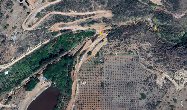
 Aerial view of study site / Vista aérea del lugar del estudio (March 2024) (John Forrest)
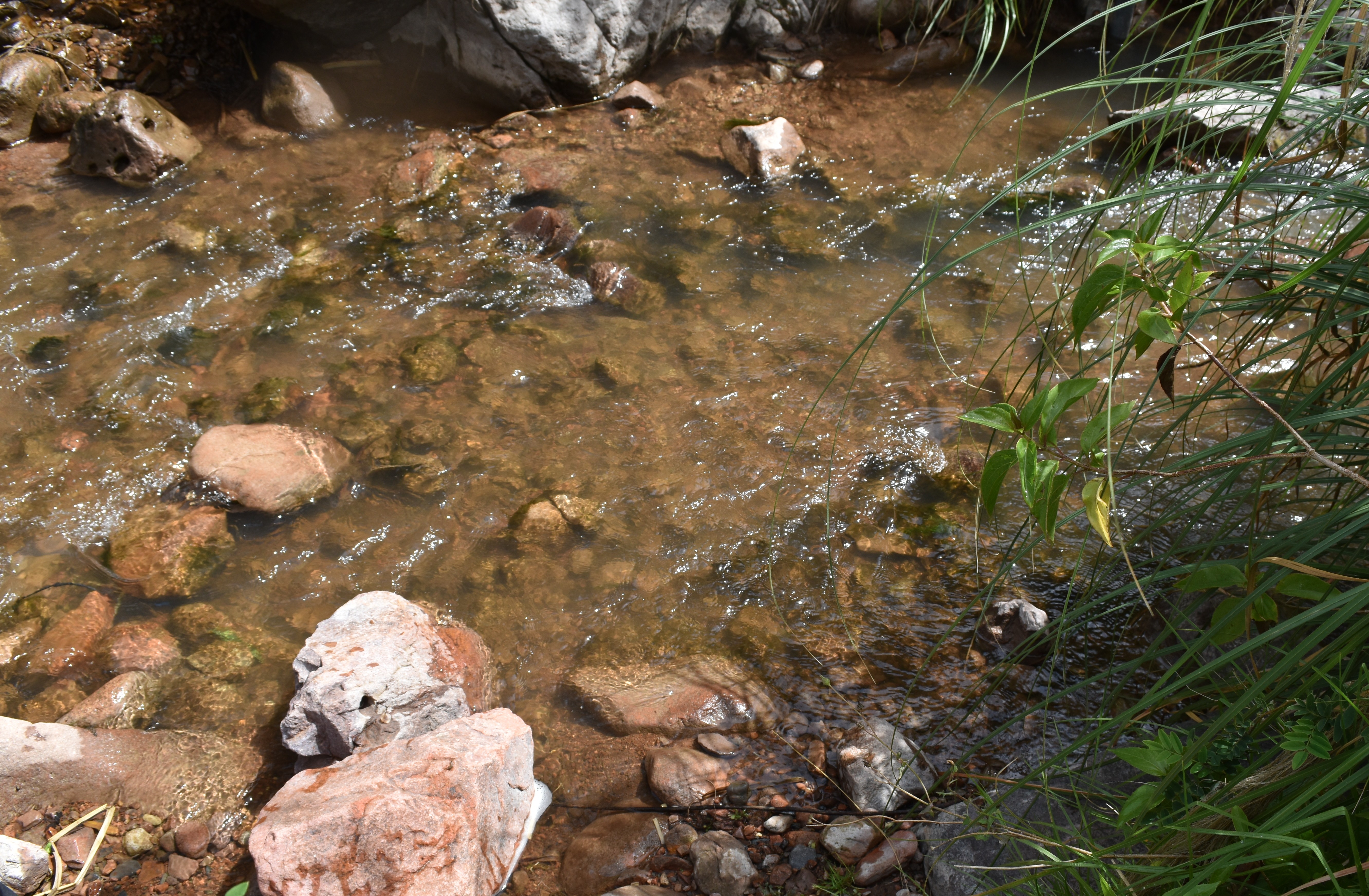
 The study site / El lugar del estudio (March 2024) (John Forrest)
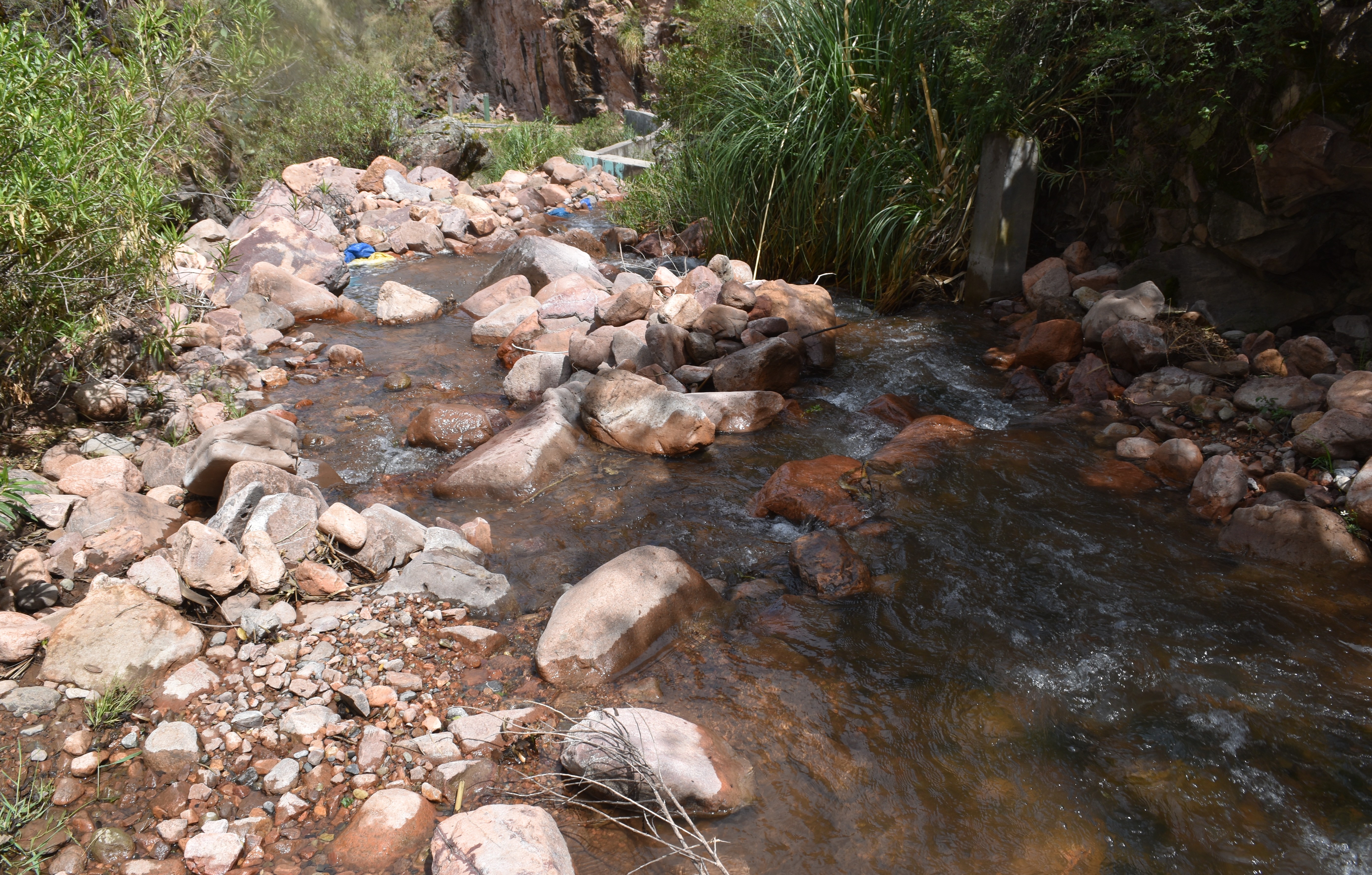
 View downstream from the study site / Visita rio abajo del lugar del estudio (March 2024) (John Forrest)
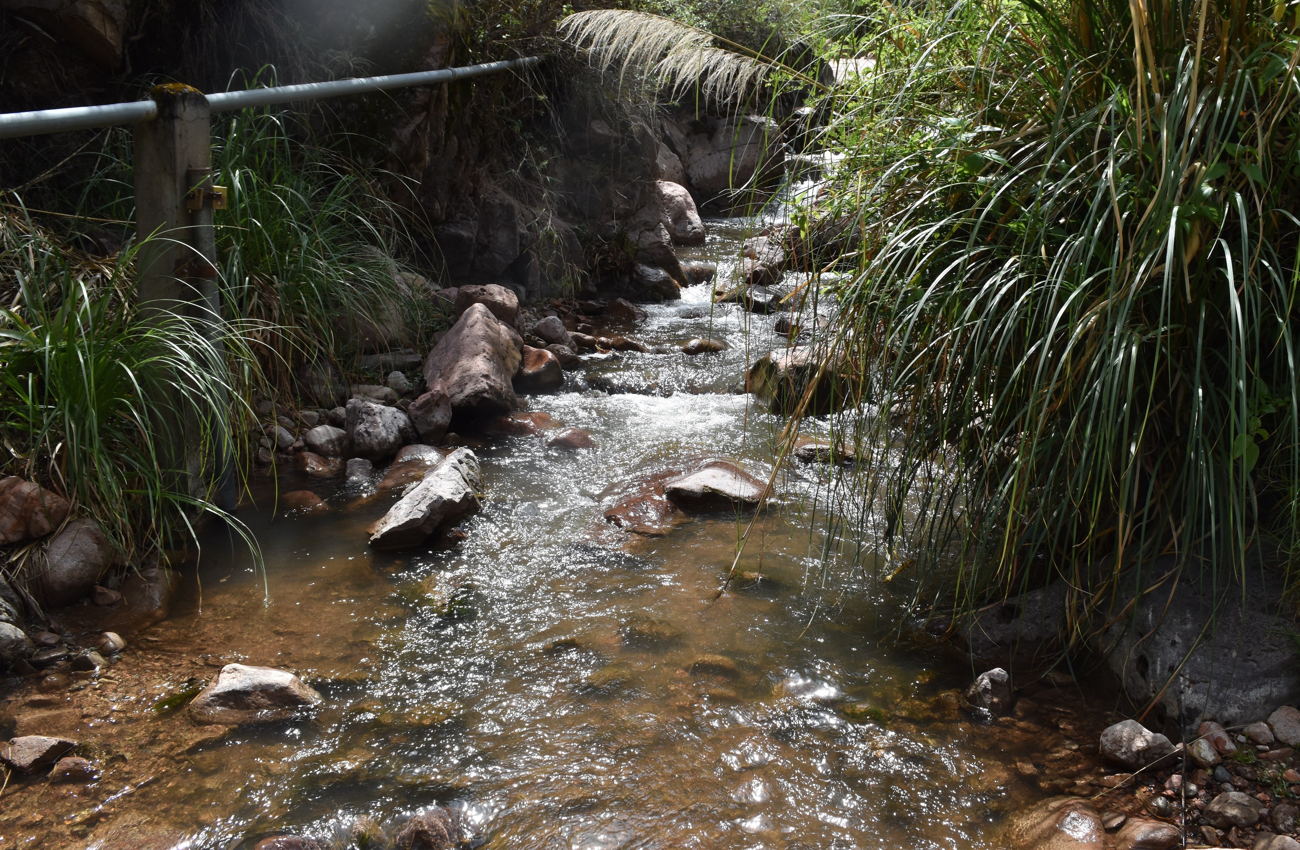
 View upstream from the study site / Vista rio arriba desde el lugar del estudio (March 2024) (John Forrest)
Site / Sitio Q1.2N.U1: Luricocha (Middle Opanccay Norte) - Upper Luricocha (Bocatoma) / Luricocha (Opanccay Medio Norte) - Luricocha Alto (Bocatoma)
GPS: S12°897215, W74°259580. Elevation: 2745m asl.
 Aerial view of study site / Vista aérea del lugar del estudio (November 2023) (John Forrest)
 The study site / El lugar del estudio (November 2025) (John Forrest)
 View downstream from the study site / Visita rio abajo del lugar del estudio (November 2025) (John Forrest)
 View upstream from the study site / Vista rio arriba desde el lugar del estudio (November 2025) (John Forrest)
Site / Sitio Q1.2N.U2: Luricocha (Middle Opanccay Norte) - Upper Luricocha (ford) / Luricocha (Opanccay Medio Norte) - Luricocha Alto (baden)
GPS: S12°897090, W74°260595. Elevation: 2720m asl.
 The study site / El lugar del estudio (November 2023) (John Forrest)
 View downstream from the study site / Visita rio abajo del lugar del estudio (November 2023) (John Forrest)
 View upstream from the study site / Vista rio arriba desde el lugar del estudio (November 2023) (John Forrest)
Site descriptions
Q1.2N.M is located close to where the Huanta to Luricocha road fords the river Luricocha (river Opanccay - northern tributary). The study site is situated immediately above the ford. The river flow is seasonal at this point. If the river is dry or there is insufficient flow then site Q1.2N.U needs to be visited.
Q1.2N.U is located where the river Luricocha (River Opanccay - northern tributary) emerges from a narrow incised valley that has cut steeply back into the lower slopes of the sierra Razuhuillca. Vehicle access is up a series of tracks running up the southern side of the valley opposite the settlement of Luricocha.
Q1.2N.U1 - is situated above the ford, bridge and bocatoma. It is reached by walking upstream beside an irrigation canal on the northern side of the valley. This is the preferred site.
Q1.2N.U2 - is situated at the ford below the bridge. If the river level is very high, it is impossible to cross the river at the bocatoma upstream to reach Q1.2N.U1 - this is the alternative site.
Descripciónes del los sitios
Q1.2N.M se encuentra cerca de donde la carretera de Huanta a Luricocha vadea el rio Luricocha (rio Opanccay - afluente norte). El sitio de estudio está situado inmediatamente por encima del vado. El caudal del río es estacional en este punto. Si el caudal es seco o insuficiente, entonces el sitio Q1.2N.U debe ser visitado.
Q1.2N.U se encuentra donde el río Luricocha (rio Opanccay - afluente norte) emerge de un estrecho valle encajonado que se ha excavado abruptamente en las laderas más bajas de la sierra Razuhuillca. El acceso en vehículo se realiza por una serie de caminos que suben por el lado sur del valle, frente al pueblito de Luricocha.
Q1.2N.U1: se encuentra sobre el vado, el puente y la bocatoma. Se llega a él caminando río arriba junto a un canal de riego en el lado norte del valle. Este es el sitio preferido.
Q1.2N.U2: se encuentra en el baden debajo del puente. Si el nivel del río es muy alto, es imposible cruzar el río en la bocatoma río arriba para llegar a Q1.2N.U1; este es el sitio alternativo.
Data analysis
Discharge follows the expected pattern of being significantly higher in February/March, especially in February 2025, the wet season, than in other months, the dry season (June). In November the discharge usually correlates with the arrival of the rains, however, in November 2025, the lowest discharge figure was recorded.
Despite another tributary joining the river above the site, the discharge at Q1.2N.U is only fractionally more than at Q1.3N.U. Most of this water is then abstracted into an irrigation canal immediately below site Q1.2N.U1 which often leaves the channel completely dry below Q1.2N.U1, or with less water downstream at Q1.2N.U2 as in November 2024 and February 2025.
Despite the significantly higher discharge in February 2025 than during any previous visit, the pH was only slightly lower while the alkalinity remained similar to the average of previous visits, but the conductivity measurements were noticeably higher. ORP results are consistently higher in November when there is a reasonable flow but few sediments are being carried.
The results are best explained by the sedimentary geology of the sierra Razuhuillca. However, there appears to be a volcanic ash deposit higher up the valley where the more incised valley opens out (around Q1.3S.L) which may also have some impact upon the pH, conductivity, etc.
Análisis de datos
La descarga sigue el patrón esperado de ser significativamente mayor en febrero/marzo, especialmente en febrero 2025, la estación húmeda, que en otros meses, la estación seca (junio). En noviembre, el caudal suele estar relacionado con la llegada de las lluvias; sin embargo, en noviembre de 2025 se registró el caudal más bajo.
A pesar de que otro afluente se une al río rio arriva del sitio, la descarga en Q1.2N.U es sólo una fracción mayor que en Q1.3N.U. La mayor parte de esta agua se extrae en un canal de riego inmediatamente por debajo del sitio Q1.2N.U, que a menudo deja el canal completamente seco por debajo de Q1.2N.U o con menos agua aguas abajo en Q1.2N.U2 como en noviembre de 2024 and febrero de 2025.
A pesar de la descarga significativamente mayor en febrero de 2025 que durante cualquier visita anterior, el pH fue sólo ligeramente inferior, mientras que la alcalinidad volvió a ser similar a la media de las visitas anteriores, pero las mediciones de conductividad fueron notablemente superiores. Los resultados del ORP son sistemáticamente más altos en noviembre, cuando hay un caudal razonable pero se transportan pocos sedimentos.
Los resultados se explican mejor por la geología sedimentaria de la sierra Razuhuillca.
River & water quality data / Datos fluviales y de calidad del agua
The following river and water quality data was collected from this site:
En este lugar se recogieron los siguientes datos fluviales y de calidad del agua:
| Site / Sitio: Q1.2N | Q1.2N.U2 - Nov. / nov. 2023 | Q1.2N.M - March / marzo 2024 | Q1.2N.U2 - June / junio 2024 | Q1.2N.M - Nov. / nov. 2024 | Q1.2N.U1 - Nov. / nov. 2024 | Q1.2N.M - February / febrero 2025 | Q1.2N.U2 - February / febrero 2025 | Q1.2N.U1 - June / junio 2025 | Q1.2N.U1 - Nov. / nov. 2025 | Q1.2N.M - March / marzo 2024 |
|---|---|---|---|---|---|---|---|---|---|---|
| Season / Temporada: | Austral Winter / Invierno | Austral Summer / Verano | Austral Winter / Invierno | Austral Winter / Invierno | Austral Winter / Invierno | Austral Summer / Verano | Austral Summer / Verano | Austral Winter / Invierno | Austral Winter / Invierno | Austral Summer / Verano |
| Date / Fecha: | 26.11.23 | 19.3.24 | 21.6.24 | 25.11.24 | 25.11.24 | 20.2.25 | 22.2.25 | 26.6.25 | 27.11.25 | 17.3.26 |
| Time / Hora: | 10.00 | 8.30 | 9.00 | 8.30 | 10.30 | 10.30 | 8.45 | 9.30 | 9.00 | 9.00 |
| Width / Ancho (m) | 4.60 | 3.42 | 2.86 | 1.50 | 3.35 | 4.80 | 8.00 | 2.70 | 2.85 | 4.00 |
| Depth / Profundidad (Av.) (m) | 0.08 | 0.22 | 0.09 | 0.06 | 0.14 | 0.33 | 0.21 | 0.13 | 0.16 | 0.35 |
| CSA / Area traversal (Av.) (m²) | 0.350 | 0.752 | 0.257 | 0.090 | 0.469 | 1.584 | 1.680 | 0.351 | 0.456 | 1.400 |
| Velocity / Velocidad (Av.) (m/s) | 0.393 | 0.493 | 0.327 | 0.101 | 0.476 | 1.062 | 1.565 | 0.324 | 0.430 | 1.243 |
| Discharge / Caudal (Av.) (m³/s) | 0.138 | 0.371 | 0.084 | 0.009 | 0.223 | 1.682 | 2.629 | 0.114 | 0.196 | 1.740 |
| Riverbed sediment / Sedimentos | Cobbles & Pebbles / Piedras y Piedritas | Rocks & Cobbles/ Rocas y Piedras | Mainly Boulders / Mas Rocas | Mainly Boulders / Mas Rocas | Mainly Boulders / Mas Rocas | Rocks, Cobbles & Pebbles / Rocas, Piedras y Piedritas | Rocks & Cobbles/ Rocas y Piedras | Mixed / Una mezcla | Mainly Rocks & Pebbles / Mas Rocas y Piedritas | Mainly Rocks & Pebbles / Mas Rocas y Piedritas |
| Temperature (Atmospheric) (°C) | 26.0 | 18.3 | 14.1 | 17.0 | 20.0 | 15.8 | 15.9 | 12.7 | 17.0 | 19.6 |
| Temperature (Water / Agua) (°C) | 13.71 | 14.52 | 11.35 | 15.68 | 13.09 | 12.50 | 11.35 | 11.70 | 12.58 | 11.85 |
| Atmospheric pressure / presión (mbar) | 774.6 | 782.5 | 762.3 | 782.6 | 772.3 | 781.9 | 773.0 | 770.7 | 759.9 | 780.4 |
| Dissolved oxygen / Oxigeno disuelto (ppm) (MP)* | 6.62 | 3.41 | 4.54 | 4.25 | 4.60 | 4.74 | 4.98 | 4.35 | 3.64 | 10.89 |
| Dissolved oxygen / Oxigeno disuelto (%) (MP)* | 83.8 | 56.4 | 55.0 | 72.1 | 75.8 | 75.2 | 78.5 | 68.6 | 45.7 | 129.8 |
| pH | 8.58 | 8.49 | 8.31 | 8.56 | 8.50 | 8.43 | 8.29 | 8.24 | 8.51 | 8.73 |
| Conductivity / Conductividad (µS/cm) | 300 | 310 | 267 | 365 | 322 | 491 | 481 | 473 | 272 | 411 |
| Total Dissolved Solids (TDS / SDT) (ppm) | 150 | 155 | 133 | 183 | 161 | 246 | 241 | 237 | 136 | 206 |
| ORP (mV) | 117.4 | 74.2 | 52.5 | 77.6 | 125.8 | 80.8 | 90.3 | 48.7 | 129.8 | 223.6 |
| Turbidity / Turbidez | Clear / Transparente | Clear / Transparente | Clear / Transparente | Clear / Transparente | Slightly turbid / Un poco turbidez | Turbid: light brown / Turbidez: marron ligero | Turbid: slightly grey green / Turbidez: un poco gris verde | Clear / Transparente | Clear - slightly milky / Transparente - un poco lechero | Turbid: light brown / Turbidez: marron ligero |
| Alkalinity/Alkalinidad (Titración) (ppm CaCO₃)** | 192 | 176 | 160 | 175 | 150 | 174 | 171 | 154 | 140 | 158 |
| Alkalinity Field Tester (Hanna) (ppm CaCO₃) | 149 | 135 | 134 | 161 | 138 | 147 | 141 | 132 | 137 | 146 |
| *Also refer to MT DO results post-2023 / Consulte también los resultados de MT DO posteriores a 2023. | ** 1.6N |