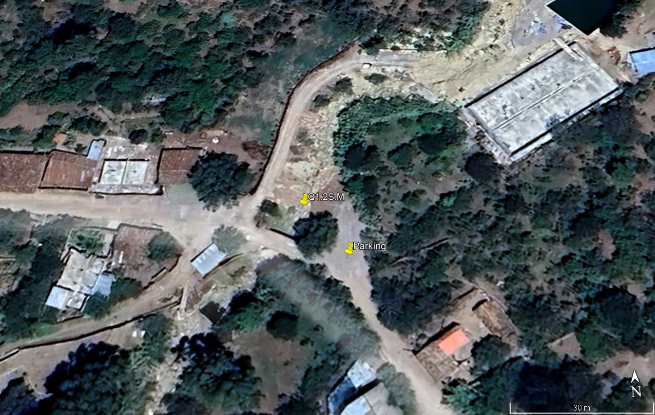
Q1.2S - Middle Opanccay South - Medio Opanccay Sur
Site Q1.2S: Middle Opanccay South
Site Q1.2S.M: Middle Opanccay South (Middle)
Site / Sitio Q1.2S.M1: Middle Opanccay South (middle) - Old Luricocha road bridge / Medio Opanccay Sur (Medio) - Puente Luricocha carreterra antiguo
GPS: S12°912930, W74°262960. Elevation: 2587m asl.
 Aerial view of study site / Vista aérea del lugar del estudio (November 2024) (John Forrest)
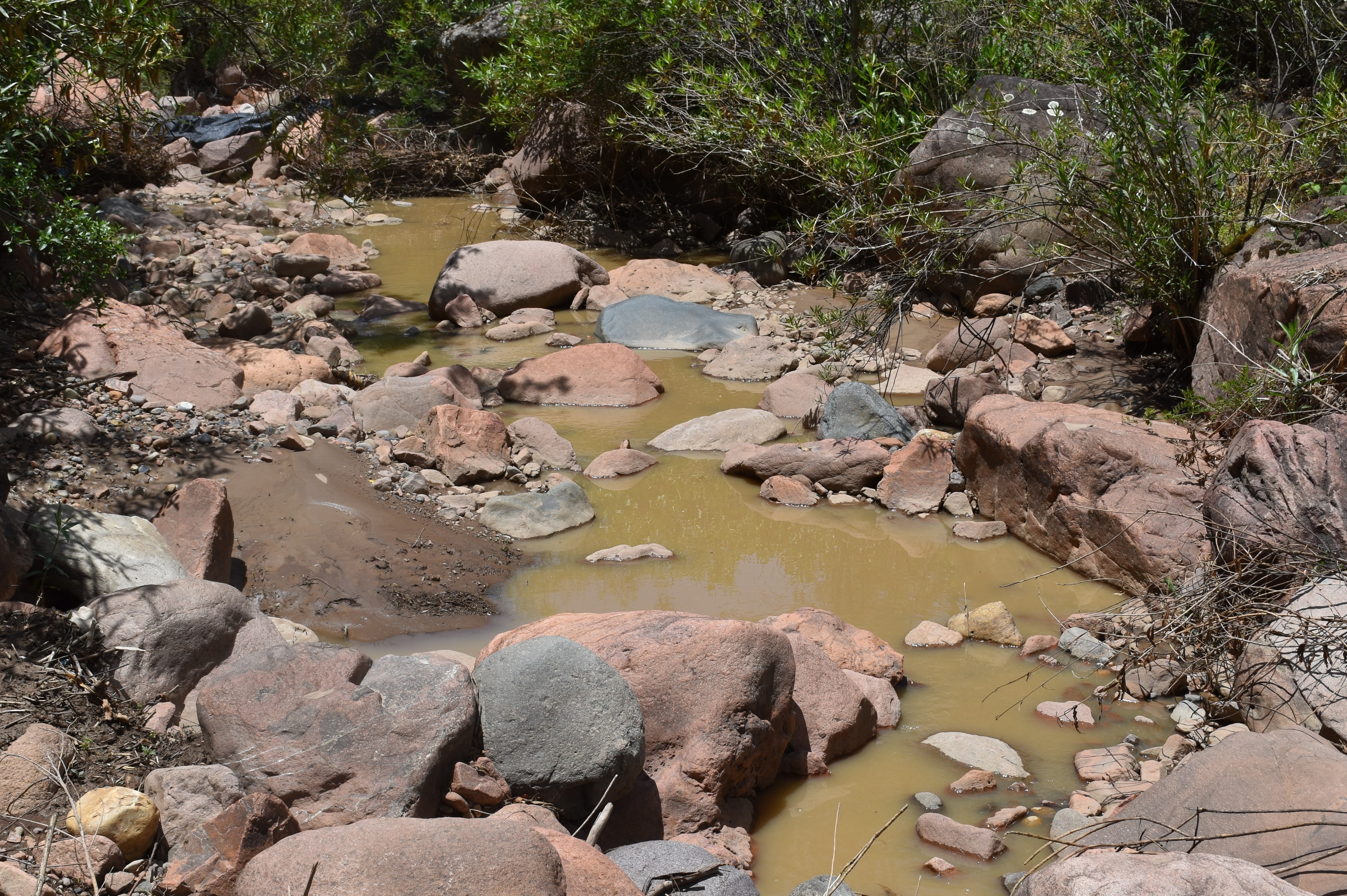
 The study site / El lugar del estudio (November 2024) (John Forrest)
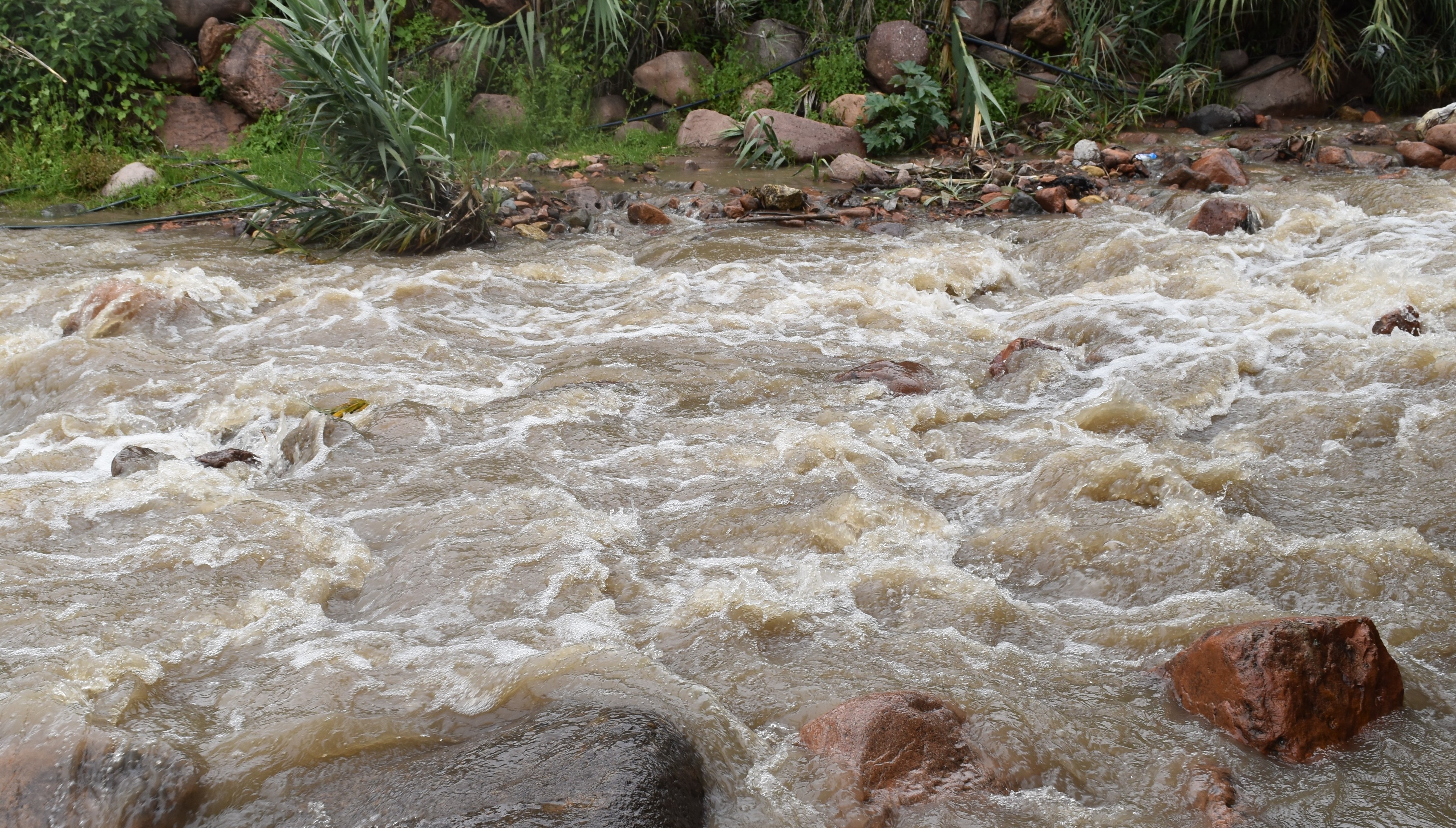
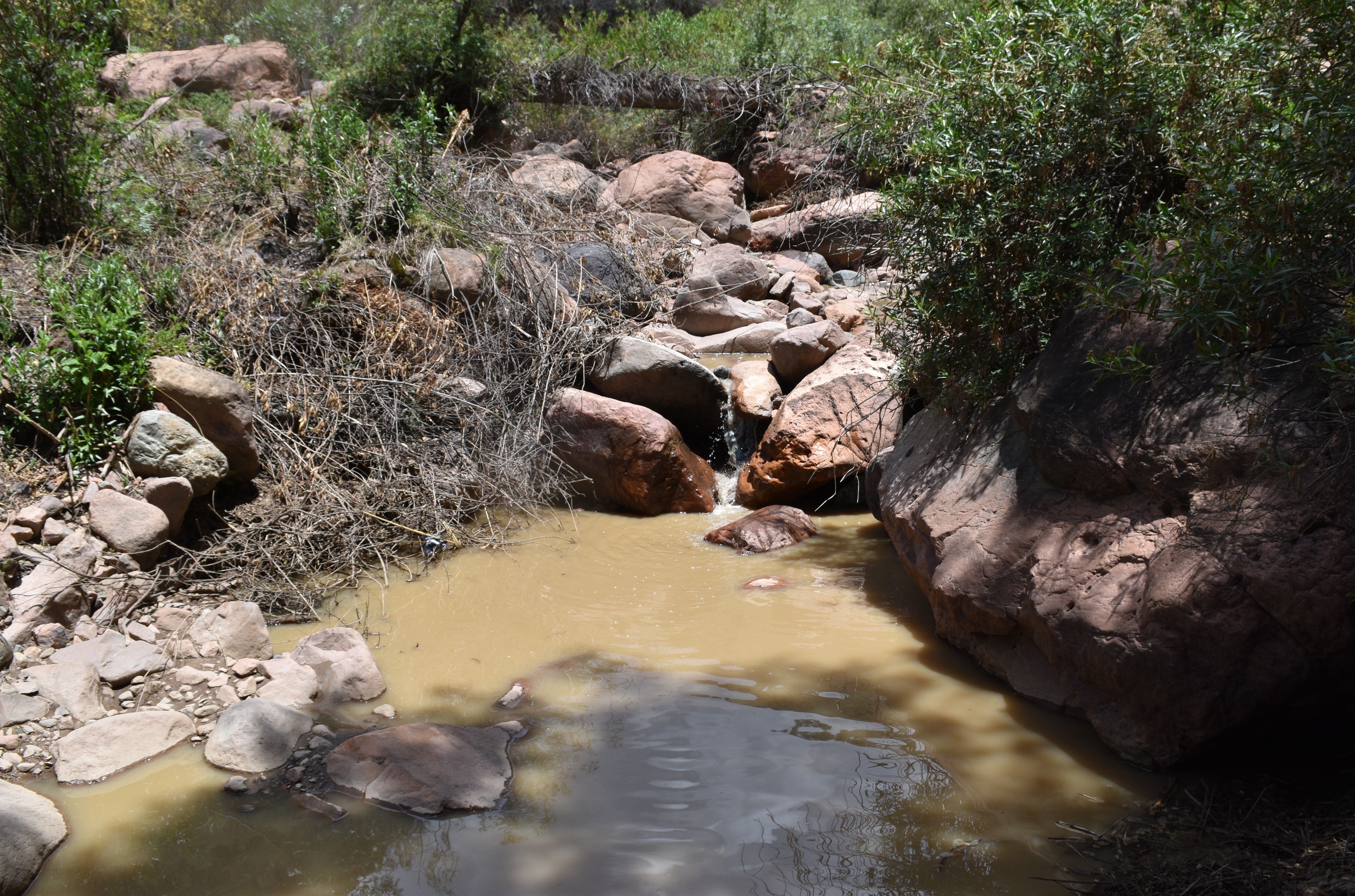
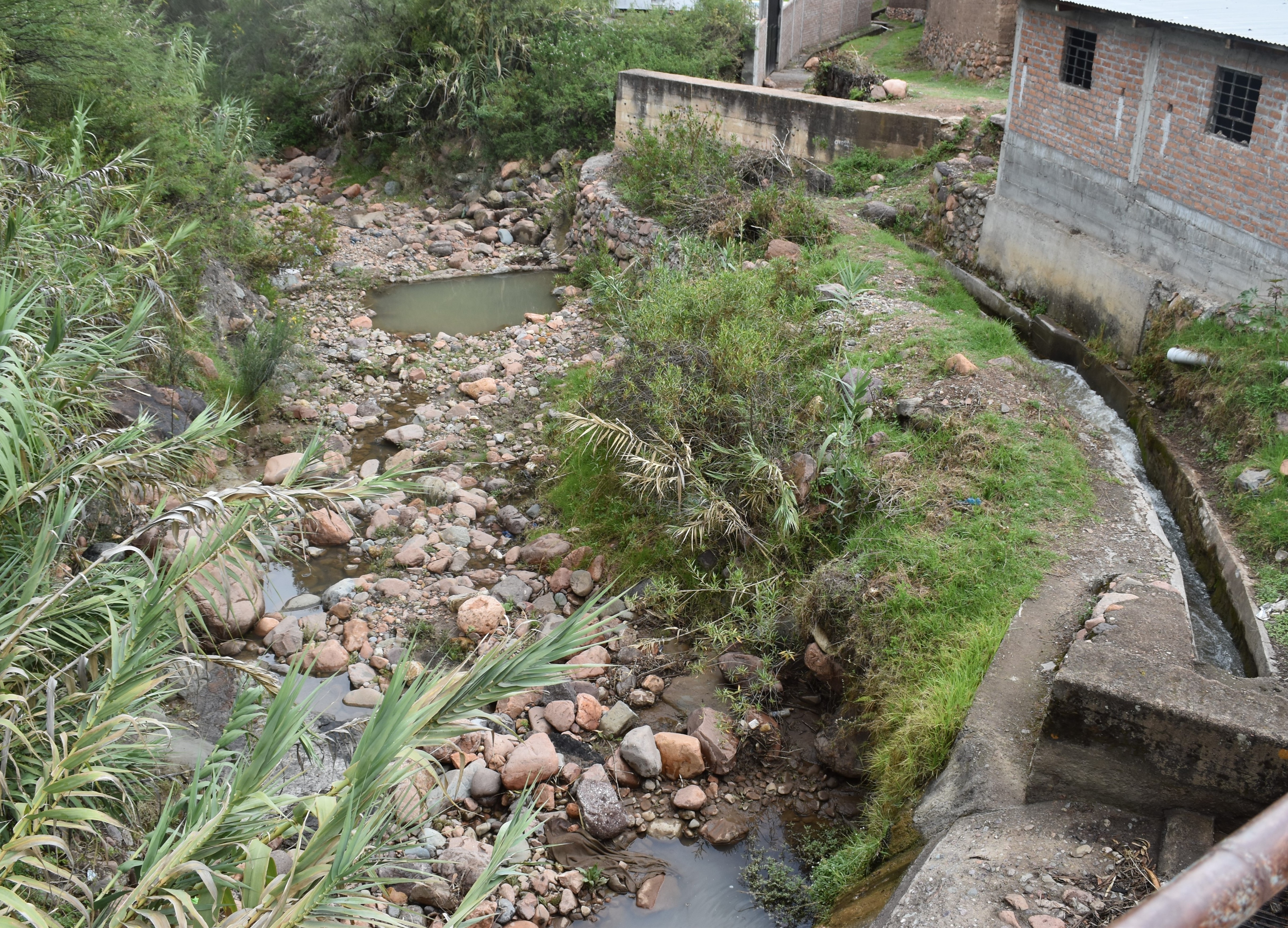 View downstream from the study site - most water is removed from the river channel via the irrgiation canal on the right / Visita rio abajo del lugar del estudio - la mayor parte del agua se retira del cauce del río a través del canal de irrigación de la derecha (November 2024) (John Forrest)
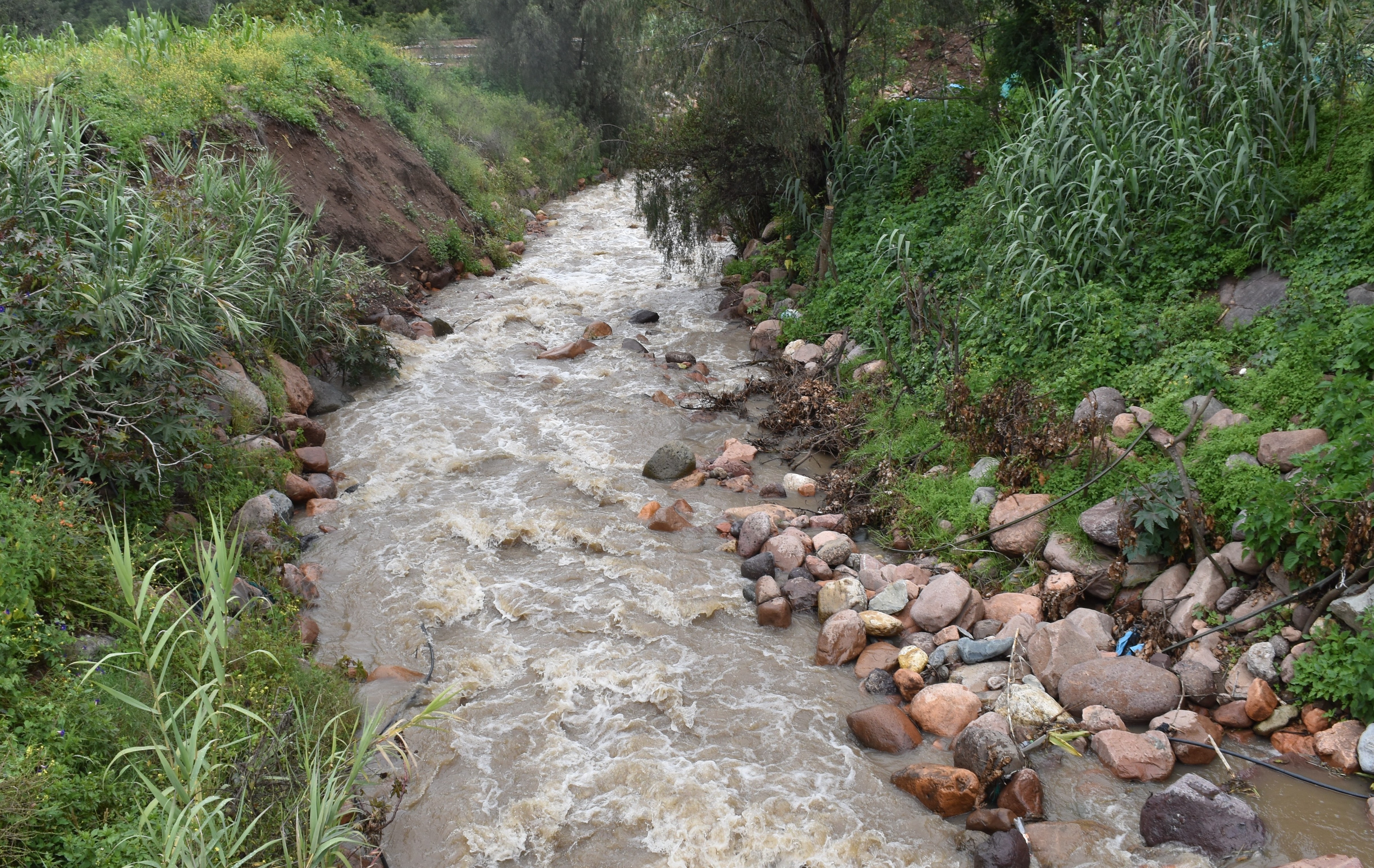
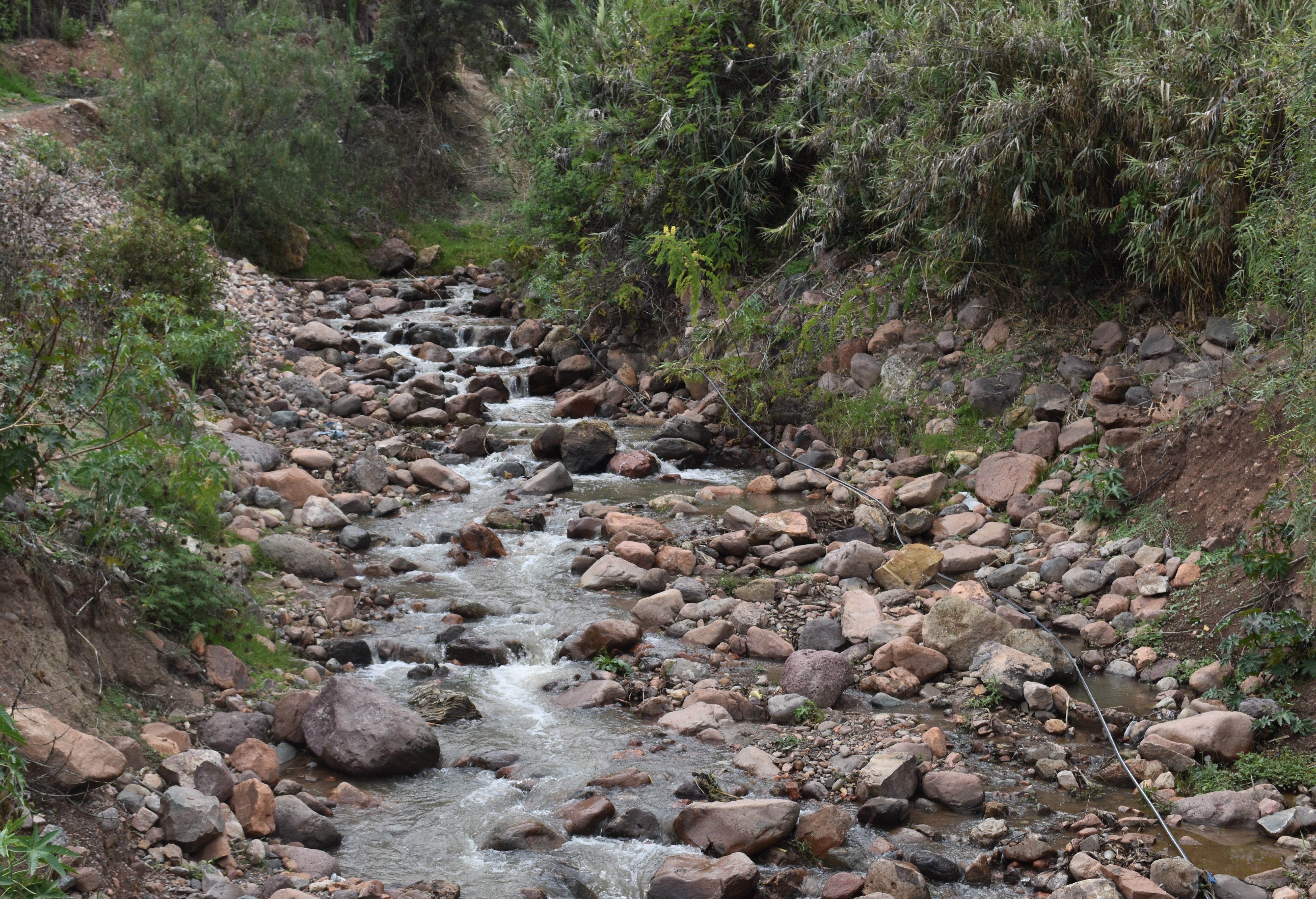 View upstream from the study site / Vista rio arriba desde el lugar del estudio (November 2024) (John Forrest)
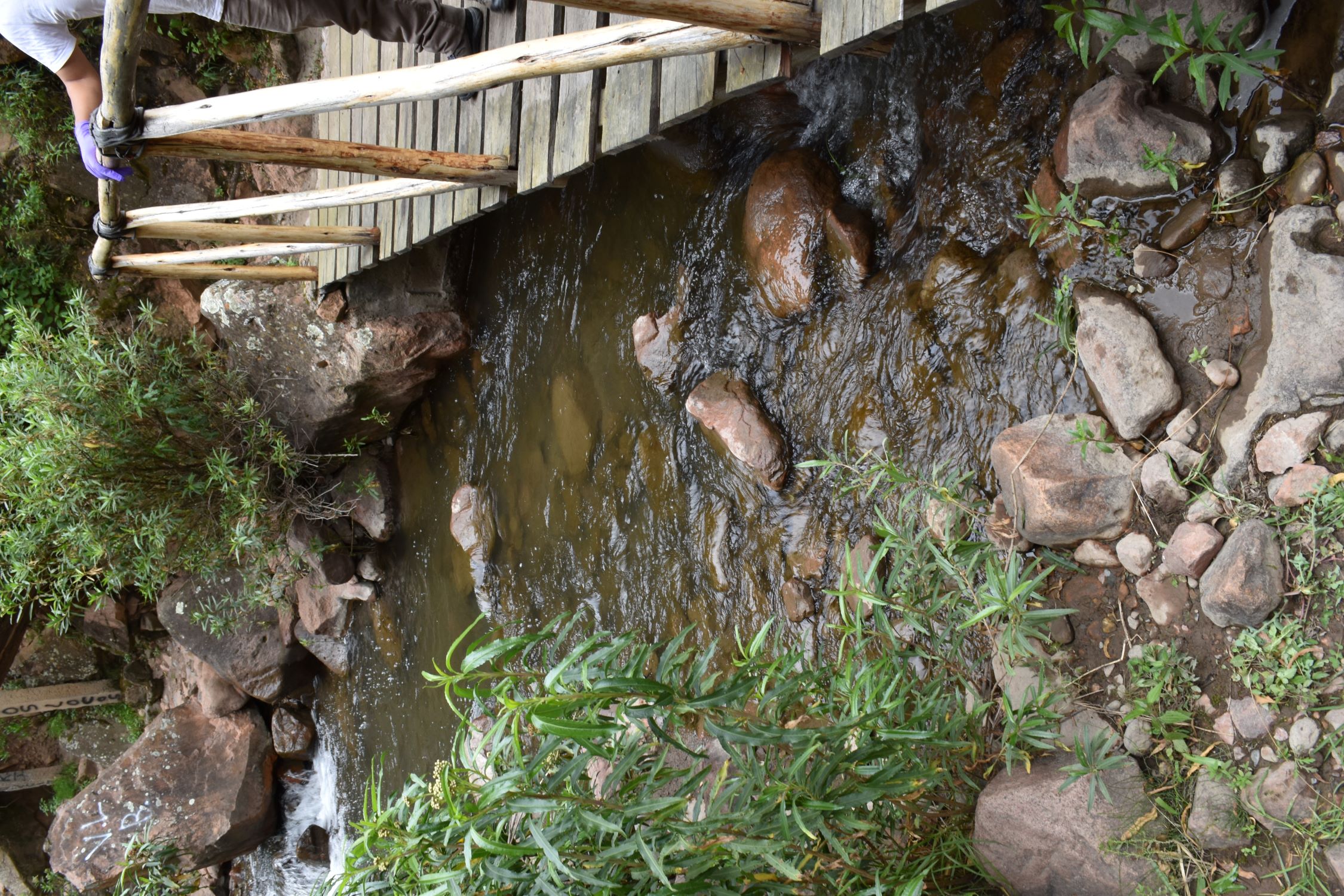
Site / Sitio Q1.2S.M2: Middle Opanccay South (middle) - Luricocha road ford / Medio Opanccay Sur (Medio) - el baden carreterra a Luricocha
GPS: S12°9123940, W74°264315. Elevation: 2570m asl.
 Aerial view of study site / Vista aérea del lugar del estudio (February 2025) (John Forrest)
 The study site immediately above the ford / El lugar del estudio inmediatemente rio arriba del baden (February 2025) (John Forrest)
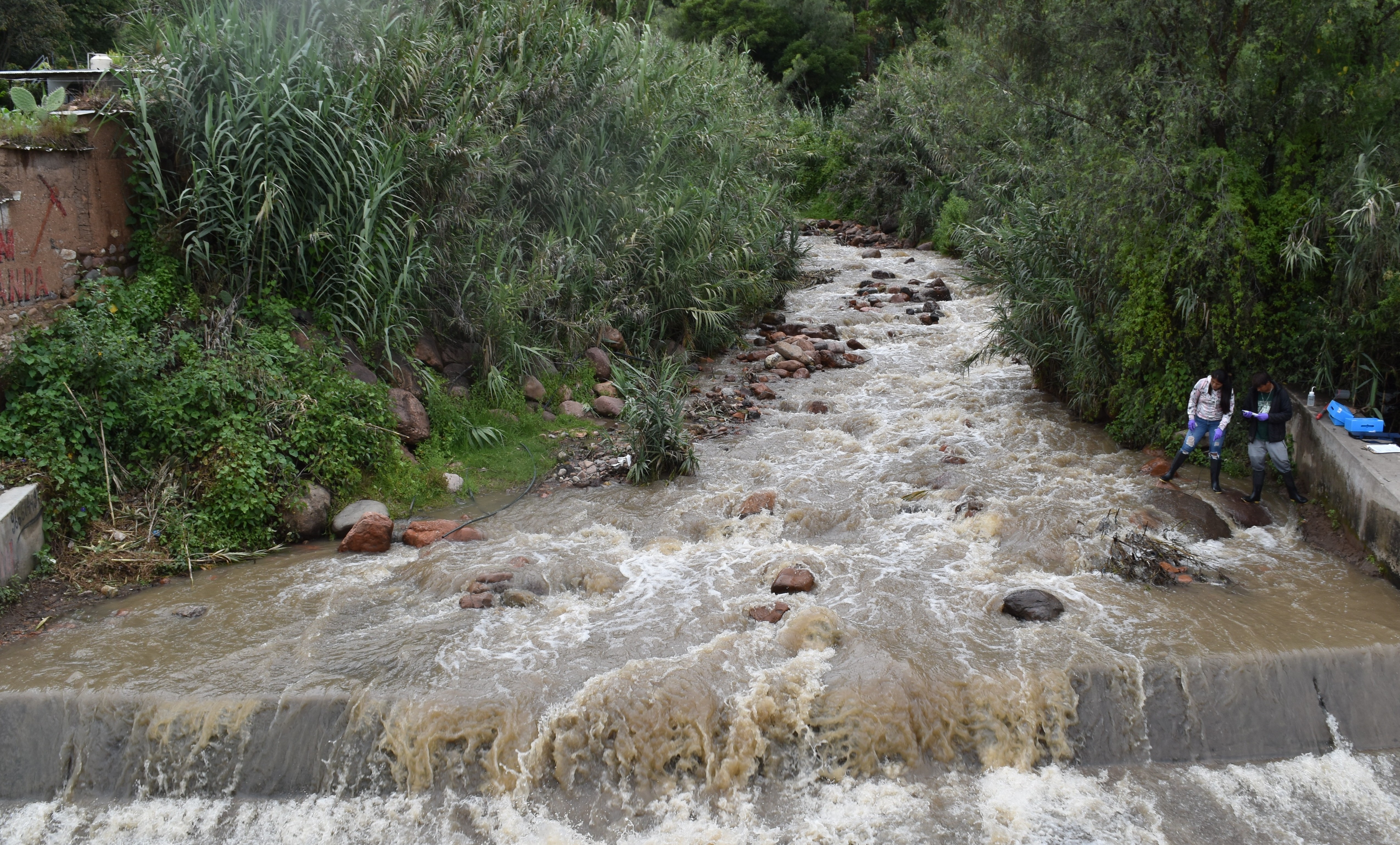
 View downstream from the study site below the ford / Visita rio abajo del lugar del estudio rio abajo del baden (February 2025) (John Forrest)
 View upstream from the study site / Vista rio arriba desde el lugar del estudio (February 2025) (John Forrest)
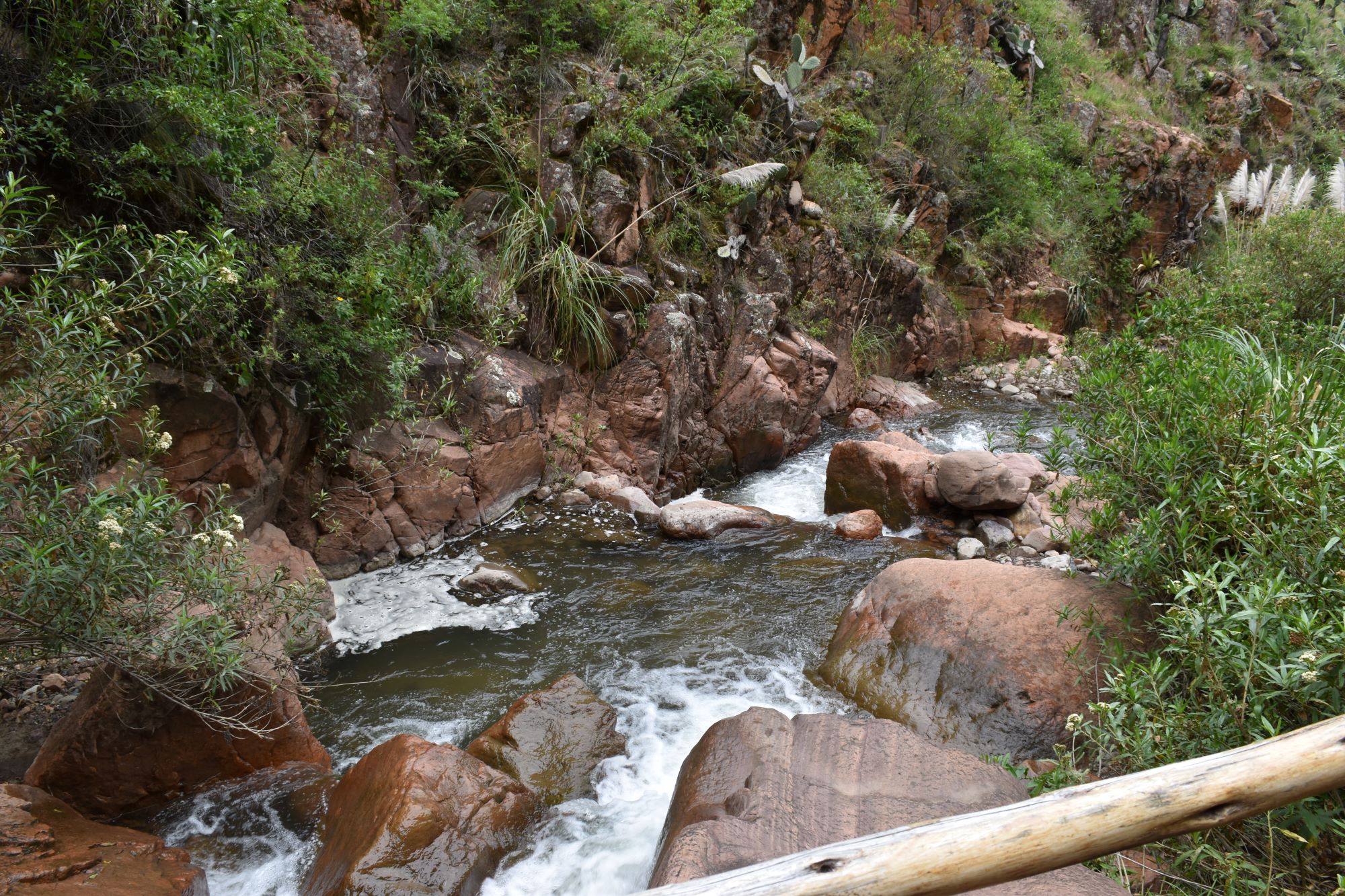
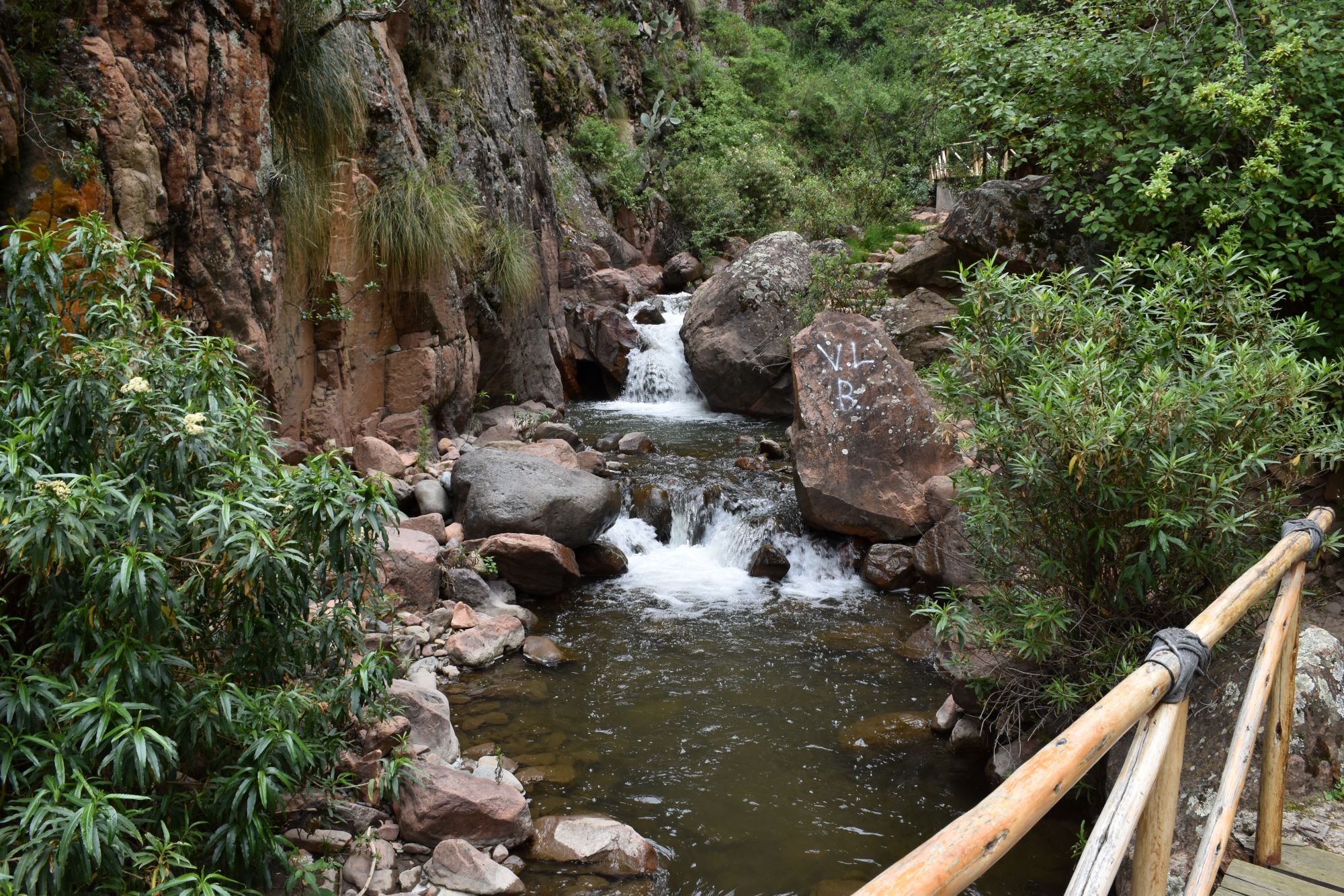
Site / Sitio Q1.2S.U: Middle Opanccay South (Upper)
Site / Sitio Q1.2S.U: Middle Opanccay South (Upper) - Sirenachayoc Waterfall / Medio Opanccay Sur (Alto) - Catarata Sirenachayoc
GPS: S12°906633, W74°250332. Elevation: 2830m asl.
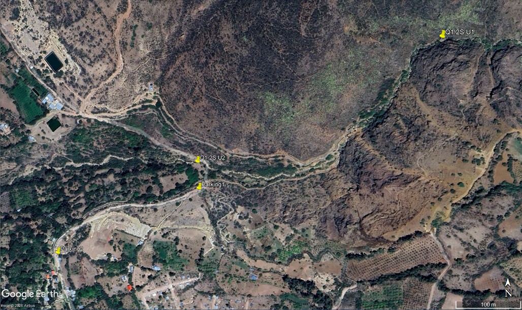 Aerial view of study site / Vista aérea del lugar del estudio (November 2025) (John Forrest)
 The study site / El lugar del estudio (March 2023) (John Forrest)
 View downstream from the study site / Visita rio abajo del lugar del estudio (March 2023) (John Forrest)
 View upstream from the study site / Vista rio arriba desde el lugar del estudio (March 2023) (John Forrest)
Site / Sitio Q1.2S.U2: Middle Opanccay South (Upper) - El Molino / Medio Opanccay Sur (Alto) - El Molino
GPS: S12°907915, W74°254180. Elevation: 2715m asl.
 The study site / El lugar del estudio (November 2025) (John Forrest)
 View downstream from the study site / Visita rio abajo del lugar del estudio (November 2025) (John Forrest)
 View upstream from the study site / Vista rio arriba desde el lugar del estudio (November 2025) (John Forrest)
Site description
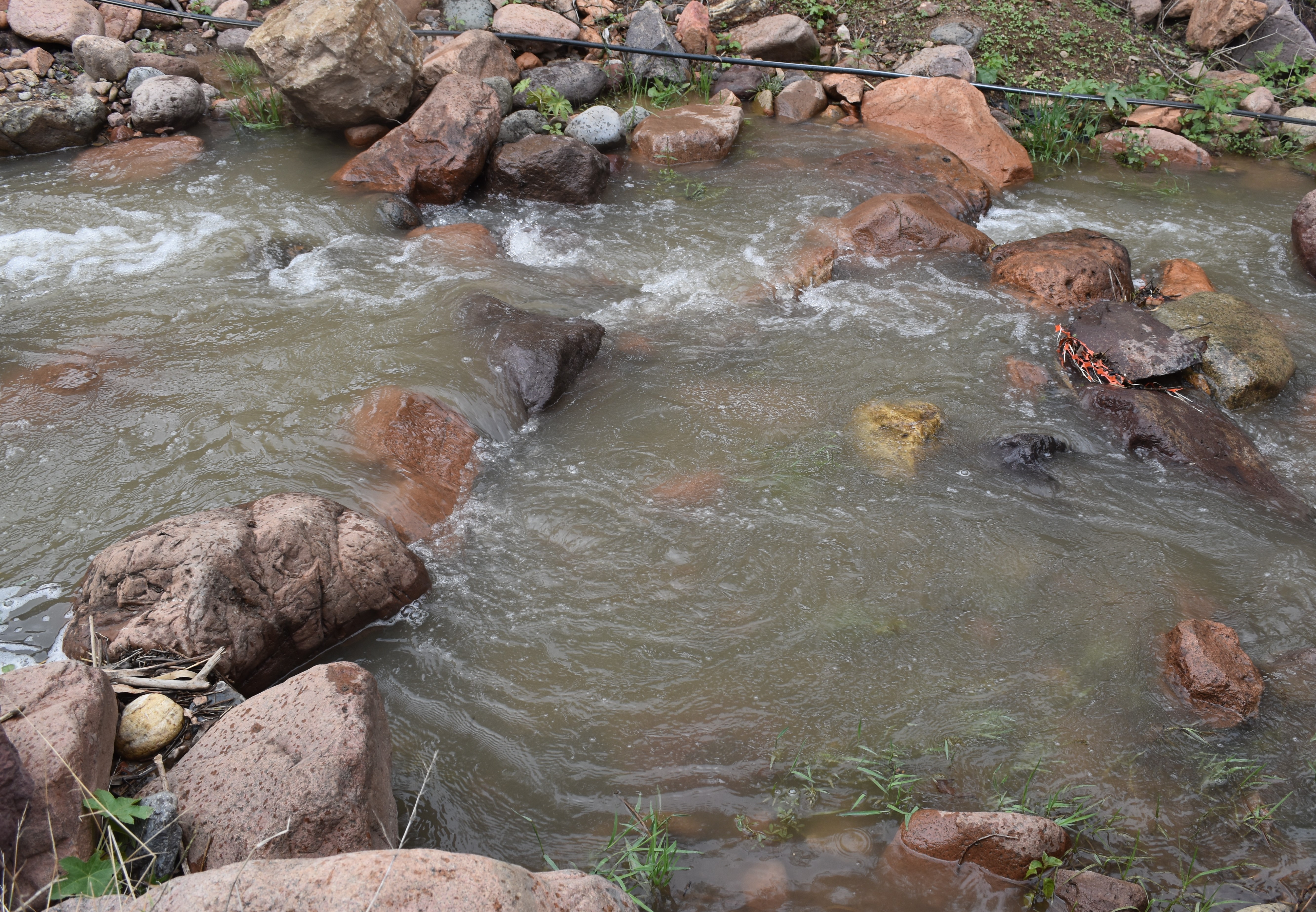
Q1.2S.M1 is located immediately above where the old Huanta to Luricocha road bridge crosses the river Opanccay (southern tributary). A small path descends steeply to the river on the upper side of the bridge - there are high steep banks on both sides. There is often no water in the river at this point.
Q1.2S.M2 is located immediately above where the new Huanta to Luricocha road fords the river Opanccay (southern tributary). However, there is often no water in the river at this point. This is the prefererd site if there is water in the channel.
Q1.2S.U1 is located in a very narrow valley where the river Opanccay (southern tributary) has cut steeply back in to the lower slopes of the sierra Razuhuillca. The study site is situated immediately above a footbridge crossing the river on the steep trail up to the nearby Sirenachayoc waterfall. A large rock forms the left bank while the right bank, formed from stones and silt, is less clearly defined. However, in March 2026 the path for 25 metres below the site was eroded away and there was no access to the site. Access for taking measurements is best from the right bank when the river level is low, however, its precise position may vary on a seasonal basis with the shifting of the deposits, while some measurements are best taken from the bridge. A rise and fall in the river level may also impact upon the precise location of the site.
Q1.2S.U2 is located where the valley has broaden out slightly. There is a steep trail down from the car park and the site is just below a rustic bridge over the channel.
Access and parking for both sites is from the small settlement of Ñahuinpuquio (where a s/1 per person entry fee is sometimes charged to visit the waterfall). Q1.2S.U1 is located about 750 metres up the trail to the waterfall. Q1.2S.U2 is located below the car park about 250 metres along the trail.
Descripción del sitio
Q1.2S.M1 se encuentra inmediatamente por encima de donde el antiguo puente de la carretera de Huanta a Luricocha cruza el rio Opanccay (afluente sur). Un pequeño sendero desciende abruptamente rio arriba de la puenete hacia el río - hay altas orillas abruptas a ambos lados. A menudo no hay agua en el río en este punto.
Q1.2S.M2 está ubicado inmediatamente arriba de donde la nueva carretera de Huanta a Luricocha vadea el rio Opanccay (afluente sur). Sin embargo, a menudo no hay agua en el río en este punto. Este es el lugar preferido si hay agua en el canal.
Q1.2S.U está situado en un valle muy estrecho donde el río Opanccay (afluente sur) ha cortado abruptamente en las laderas más bajas de la sierra Razuhuillca.
El sitio de estudio está situado inmediatamente por encima de un puente que cruza el río en el sendero que sube a la cercana cascada de Sirenachayoc. Una roca forma la orilla izquierda, mientras que la orilla derecha, formada por piedras y limo, está menos claramente definida. Sin embargo, en marzo de 2026, el camino por 25 metros debajo del sitio quedó erosionado y ya no se podía acceder al sitio. El mejor acceso para realizar mediciones es desde la orilla derecha cuando el nivel del río es bajo; sin embargo, su posición exacta puede variar estacionalmente con el desplazamiento de los depósitos, mientras que algunas medidas se toman mejor desde el puente. Las subidas y bajadas del nivel del río también pueden influir en la ubicación exacta del lugar.
Q1.2S.U2 se encuentra en un lugar donde el valle se ensancha ligeramente. Hay un sendero empinado que baja desde el estacionamiento y el sitio se encuentra justo debajo de un puente rústico sobre el canal.
El acceso y el estacionamiento por ambos sitios se encuentran en el pequeño asentamiento de Ñahuinpuquio (donde a veces se cobra una entrada de 1 sol por persona para visitar la cascada). Q1.2S.U1 se encuentra a unos 750 metros por el sendero que lleva a la cascada. Q1.2S.U2 se encuentra debajo del estacionamiento, a unos 250 metros por el sendero.
Data analysis
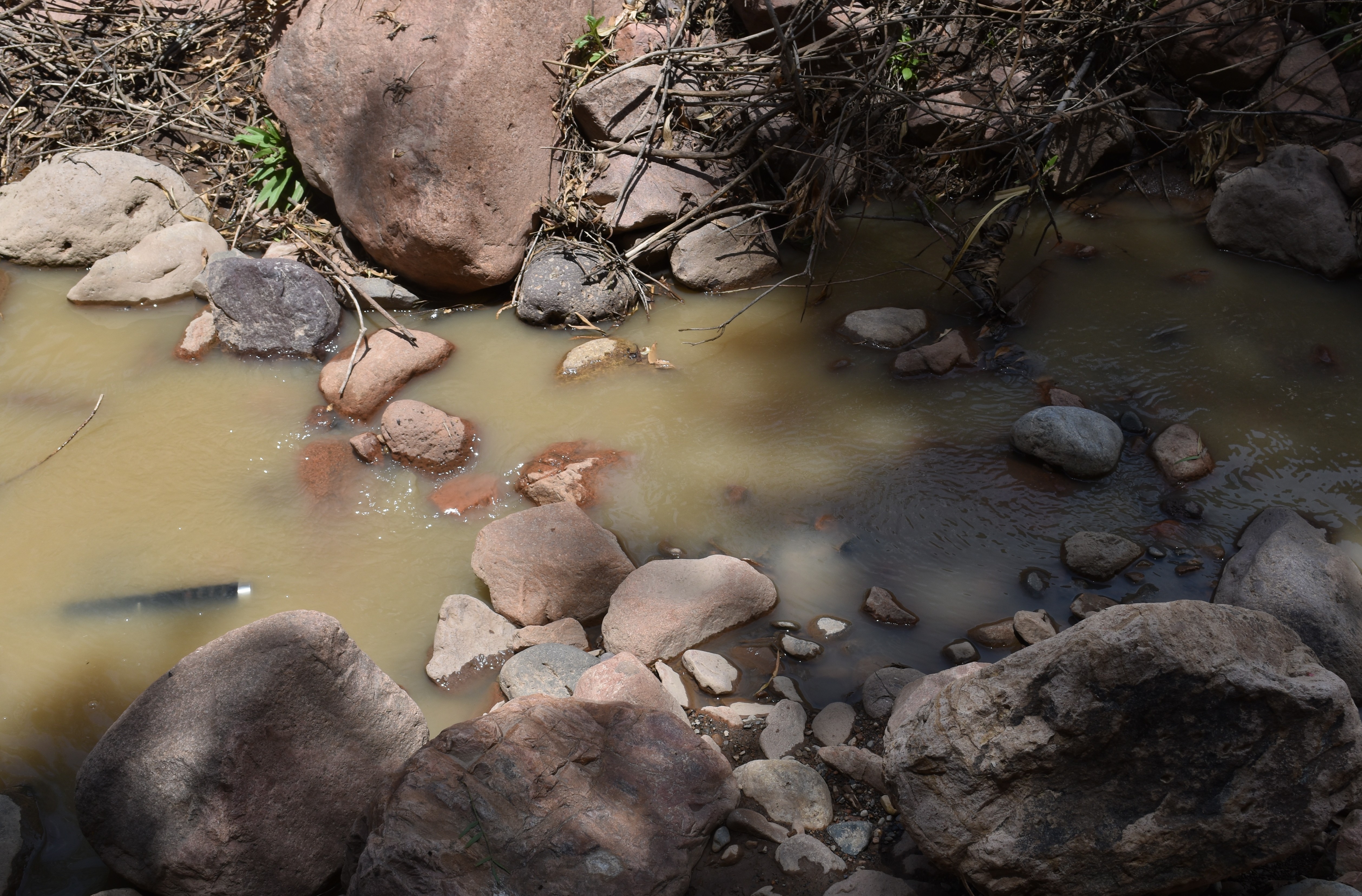
Discharge follows the expected pattern of being significantly higher in February/March, the wet season, than in other months, the dry season. In March 2024 it was ten times greater than in June 2024 and in February 2025 even higher.
Almost all of this water is then abstracted into an irrigation canal immediately below site Q1.2S.U1 which usually leaves the channel completely dry below this point, including at Q1.2S.M. However, in February 2025 and March 2026 there was a significant amount of water in the channel at Q1.2S.M2, even more than at Q1.2S.U1. In November 2025 there was a very limited flow at Q1.2S.U2 due to works upstream on the Alta Esmeralda project.
The results show a degree of consistency across all visits but in February 2025 the pH and alkalinity measurements were lower while conductivity was slightly above the average of the previous visits.
The results are best explained by the sedimentary geology of the sierra Razuhuillca and the relative absence of human activity upstream. However, there appears to be a volcanic ash deposit higher up the valley where the more incised valley opens out (around Q1.3S.L) which may also have some impact upon the pH, conductivity, etc.
Análisis de datos
La descarga sigue el patrón esperado de ser significativamente mayor en febrero/marzo, la estación húmeda, que en otros meses, la estación seca. De hecho, en marzo de 2024 fue diez veces mayor que en junio de 2024 y en febrero 2025 aún mayor.
Casi toda esta agua se extrae a un canal de riego situado inmediatamente debajo del punto Q1.2S.U, que suele dejar el canal completamente seco por debajo de este punto, incluso en Q1.2S.M. Sin embargo, en febrero de 2025 y en marzo 2026 había una cantidad significativa de agua en el canal en Q1.2S.M2, incluso más que en Q1.2S.U. En noviembre de 2025, hubo un flujo muy limitado en Q1.2S.U2 debido a las obras realizadas aguas arriba en el proyecto Alta Esmeralda.
Los resultados muestran un grado de consistencia en todas las visitas, pero en febrero de 2025 las mediciones de pH y alcalinidad fueron más bajas, mientras que la conductividad fue ligeramente superior a la media de las visitas anteriores.
Los resultados se explican mejor por la geología sedimentaria de la sierra Razuhuillca y la relativa ausencia de actividad humana rio arriba. Sin embargo, parece haber un depósito de ceniza volcánica más arriba en el valle, donde se abre el valle más encajado (alrededor de Q1.3S.L), lo que también puede tener algún impacto en el pH, la conductividad, etc.
River & water quality data / Datos fluviales y de calidad del agua
The following river and water quality data was collected from this site:
En este lugar se recogieron los siguientes datos fluviales y de calidad del agua:
| Site / Sitio: Q1.2S | Q1.2S.U1 - March/ marzo 2023 | Q1.2S.U1 - June / junio 2023 | Q1.2S.U1 - Nov. / nov. 2023 | Q1.2S.U1 - March / marzo 2024 | Q1.2S.U1 - June / junio 2024 | Q1.2S.M1 - Nov. / nov. 2024 | Q1.2S.M2 - February / febrero 2025 | Q1.2S.U1 - February / febrero 2025 | Q1.2S.U2 - Nov. / nov. 2025 | Q1.2S.M2 - March / marzo 2026 |
|---|---|---|---|---|---|---|---|---|---|---|
| Season / Temporada: | Austral Summer / Verano | Austral Winter / Invierno | Austral Winter / Invierno | Austral Summer / Verano | Austral Winter / Invierno | Austral Winter / Invierno | Austral Summer / Verano | Austral Summer / Verano | Austral Winter / Invierno | Austral Summer / Verano |
| Date / Fecha: | 16.3.23 | 21.6.23 | 19.11.23 | 19.3.24 | 21.6.24 | 25.11.24 | 20.2.25 | 22.2.25 | 27.11.25 | 17.3.26 |
| Time / Hora: | 9.15 | 9.00 | 12.00 | 11.00 | 12.00 | 8.30 | 12.15 | 11.30 | 12.00 | 11.00 |
| Width / Ancho (m) | 4.70 | 3.24 | 2.70 | 5.40 | 3.80 | 1.50 | 10.0 | 5.30 | 0.90 | 12.80 |
| Depth / Profundidad (Av.) (m) | 0.22 | 0.22 | 0.17 | 0.32 | 0.16 | 0.06 | 0.35 | 0.46 | 0.08 | 0.16 |
| CSA / Area traversal (Av.) (m²) | 1.030 | 0.710 | 0.459 | 1.728 | 0.608 | 0.090 | 3.500 | 2.438 | 0.072 | 2.048 |
| Velocity / Velocidad (Av.) (m/s) | 0.450 | 0.207 | 0.230 | 0.658 | 0.244 | 0.566 | 0.966 | 0.733 | 0.104 | 1.617 |
| Discharge / Caudal (Av.) (m³/s) | 0.465 | 0.148 | 0.106 | 1.137 | 0.148 | 0.419 | 3.381 | 1.787 | 0.008 | 3.312 |
| Riverbed sediment / Sedimentos | Mainly boulders / Mas rocas | Mainly boulders / Mas rocas | Mainly boulders / Mas rocas | Mainly boulders / Mas rocas | Mainly boulders / Mas rocas | A mix / Una mezcla | Mainly boulders / Mas rocas | Mainly boulders / Mas rocas | Mainly boulders / Mas rocas | Mainly boulders & cobbles / Mas piedras y rocas |
| Temperature (Atmospheric) (°C) | 17.9 | 11.5 | 28.2 | 20.5 | 16.7 | 20.4 | 18.3 | 19.5 | 23.0 | 19.0 |
| Temperature (Water / Agua) (°C) | 11.84 | 7.35 | 16.04 | 13.42 | 11.25 | 15.83 | 12.62 | 12.09 | 18.75 | 12.57 |
| Atmospheric pressure / presión (mbar) | 767.4 | 767.7 | 770.1 | 770.6 | 758.8 | 778.6 | 781.9 | 768.8 | 763.2 | 782.1 |
| Dissolved oxygen / Oxigeno disuelto (ppm) (MP)* | 10.05 | 6.39 | 3.47 | 4.56 | 4.41 | 4.69 | 4.81 | 3.42 | 10.97 | |
| Dissolved oxygen / Oxigeno disuelto (%) (MP)* | 112.0 | 86.9 | 57.7 | 55.7 | 75.1 | 74.4 | 78.1 | 48.9 | 132.1 | |
| pH | 8.68 | 8.56 | 8.66 | 8.47 | 8.52 | 8.38 | 7.75 | 8.07 | 8.33 | 8.53 |
| Conductivity / Conductividad (µS/cm) | 220 | 281 | 229 | 206 | 283 | 390 | 261 | 303 | 211 | 282 |
| Total Dissolved Solids (TDS / SDT) (ppm) | 110 | 141 | 114 | 103 | 142 | 195 | 130 | 152 | 105 | 141 |
| ORP (mV) | 228.1 | 146.1 | 121.2 | 116.2 | 87.2 | 142.7 | 118.8 | 156.3 | 114.6 | 269.3 |
| Turbidity / Turbidez | Slightly green - brown / Un poco verde - marron | Clear / Transparente | Clear / Transparente | Turbid / Turbidez | Clear / Transparente | Turbid – slightly green / Turbidez – un poco verde | Turbid – grey/ green / Turbidez – gris/verde | Turbid – grey/ green / Turbidez – gris/verde | Turbid: light brown/Marron claro | Green brown / Verde marron |
| Alkalinity/Alkalinidad (Titración) (ppm CaCO₃)** | 123 | 184 | 158 | 124 | 175 | 177 | 93 | 114 | 109 | 101 |
| Alkalinity Field Tester (Hanna) (ppm CaCO₃) | 116 | 144 | 122 | 89 | 145 | 149 | 80 | 99 | 100 | 95 |
| *Also refer to MT DO results post-2023 / Consulte también los resultados de MT DO posteriores a 2023. | ** 1.6N |