Q1.3N - Luricocha (Upper Opanccay North - Opanccay Alto Norte)
Site Q1.3N.U: Luricocha (Upper Opanccay North - Opanccay Alto Norte) - Yanaraccay
GPS: S12°846435, W74°205410. Elevation: 3965m asl.
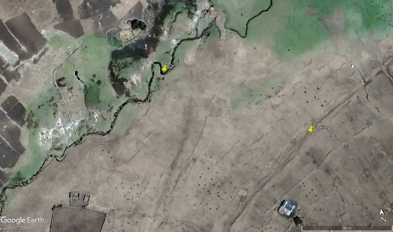
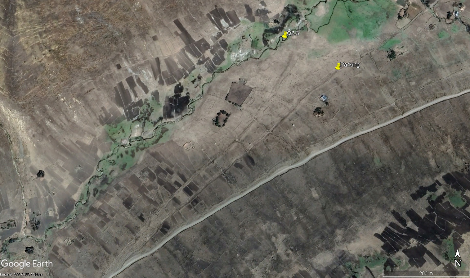 Aerial view of study site / Vista aérea del lugar del estudio (March 2023) (John Forrest)
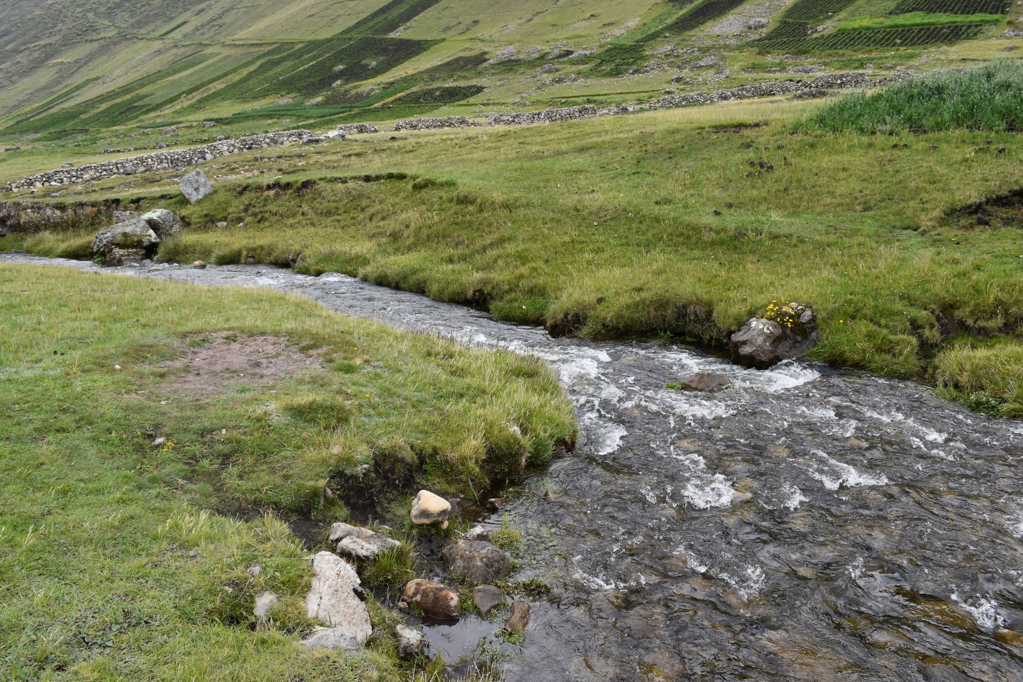
 The study site / El lugar del estudio (March 2023) (John Forrest)
 View downstream from the study site / Visita rio abajo del lugar del estudio (March 2023) (John Forrest)
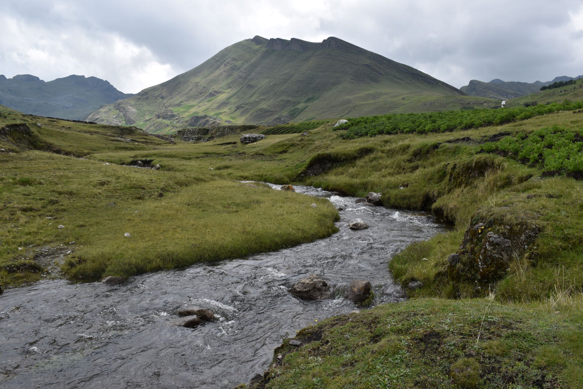 View upstream from the study site / Vista rio arriba desde el lugar del estudio (March 2023) (John Forrest)
Site description
Q1.3N is located in a broad valley whose sides begin to rise rapidly so the flood-plain is narrow.
The study site is situated below a bofedal and an old stone dam, now in ruins, where an animal track crosses the river. Just above the bofedal, there is a small group of houses known as Yanaraccay.
Access is from the Huanta to Uchuraccay road where a track turns off it and runs down parallel to the river towards Yanaraccay.
NB.Permission should be obtained on arrival from the residents of Yanaraccay, if anyone is present, to visit the site.
Descripción del sitio
Q1.3N está situado en un amplio valle cuyas laderas comienzan a elevarse rápidamente, por lo que la llanura de inundación es estrecha.
El lugar de estudio está situado bajo un bofedal y una antigua presa de piedras, ahora en ruinas, donde una trocha para animales cruza el río. Hay un pequeño grupo de casas justo encima del bofedal conocido como Yanaraccay.
El acceso se realiza desde la carretera Huanta-Uchuraccay, donde se desvía un camino que desciende paralelo al río hasta Yanaraccay en la parte alta del valle.
NB.Se debe obtener permiso a la llegada de los residentes de Yanaraccay, si hay alguien presente, para visitar el lugar.
Data analysis
Discharge at site Q1.3N reflects seasonal precipitation patterns in the sierra Razuhuillca with significantly higher discharge in the wet season (February/March). Much the highest figure was recorded in February 2025, six times greater than any other measurement, at the height of the wet season in a wetter year.
However, the size of the catchment above the site is small and there are several bofedales above the site that can absorb large quantities of water so the overall discharge, even in the wet season, is reduced unless there is very heavy recent rainfall.
When discharge is higher, pH is lower - it was lowest in February 2025: below 8.0. Conductivity was seven times higher in June 2025 compared to the next highest figure when the discharge was very low. The alkalinity level recorded was also higher when the discharge is low.
The results are best explained by the sedimentary geology of the sierra Razuhuillca combined with varying precipitation levels impacting upon discharge. It is also possible that a large number of animals grazing the bofedales may impact on the water chemistry of the river at certain times.
Análisis de datos
La descarga en el sitio Q1.3N refleja los patrones de precipitación estacionales en la sierra Razuhuillca, con una descarga significativamente mayor en la estación húmeda (febrero/marzo). La cifra más alta se registró en febrero de 2025, seis veces mayor que cualquier otra medición, en el punto álgido de la estación húmeda en un año más lluvioso.
Sin embargo, el tamaño de la cuenca hidrográfica situada por encima del emplazamiento es pequeño y hay varios bofedales por encima del emplazamiento que pueden absorber grandes cantidades de agua, por lo que el caudal total, incluso en la estación húmeda, se reduce a menos que haya lluvias muy intensas.
Cuando el caudal es mayor, el pH es menor; el valor más bajo se registró en febrero de 2025: por debajo de 8,0. La conductividad fue siete veces mayor en junio de 2025 en comparación con la siguiente cifra más alta, cuando el caudal era muy bajo. El nivel de alcalinidad registrado también fue mayor cuando el caudal era bajo.
Los resultados se explican mejor por la geología sedimentaria de la sierra Razuhuillca, combinada con los distintos niveles de precipitación que afectan al caudal. También es posible que un gran número de animales que pastan en los bofedales puedan afectar la química del agua del río en determinados momentos.
River & Water quality data / Datos fluviales y de calidad del agua
The following river and water quality data was collected from this site:
En este lugar se recogieron los siguientes datos fluviales y de calidad del agua:
| Site / Sitio: Q2.1 | March / marzo 2023 | June / junio 2023 | November / noviembre 2023 | March / marzo 2024 | June / junio 2024 | November / noviembre 2024 | February / febrero 2025 | June / junio 2025 |
|---|---|---|---|---|---|---|---|---|
| Season / Temporada: | Austral Summer / Verano | Austral Winter / Invierno | Austral Winter / Invierno | Austral Summer / Verano | Austral Winter / Invierno | Austral Winter / Invierno | Austral Summer / Verano | Austral Winter / Invierno |
| Date / Fecha: | 17.3.23 | 19.6.23 | 21.11.23 | 27.3.24 | 26.6.24 | 26.11.24 | 25.2.25 | 1.7.25 |
| Time / Hora: | 7.30 | 9.00 | 9.30 | 11.30 | 9.30 | 10.00 | 9.45 | 9.30 |
| Width / Ancho (m) | 3.09 | 2.38 | 1.25 | 1.50 | 1.00 | 1.10 | 4.10 | 4.20 |
| Depth / Profundidad (Av.) (m) | 0.16 | 0.21 | 0.09 | 0.09 | 0.05 | 0.18 | 0.30 | 0.15 |
| CSA / Area traversal (Av.) (m²) | 0.49 | 0.50 | 0.113 | 0.135 | 0.050 | 0.198 | 1.320 | 0.630 |
| Velocity / Velocidad (Av.) (m/s) | 0.42 | 0.450 | 0.427 | 0.685 | 0.261 | 0.971 | 1.122 | 0.277 |
| Discharge / Caudal (Av.) (m³/s) | 0.208 | 0.225 | 0.048 | 0.092 | 0.013 | 0.192 | 1.481 | 0.175 |
| Riverbed sediment / Sedimentos | Mainly pebbles / Mas piedritas | Cobbles & Pebbles / Piedras y Piedritas | Mainly pebbles / Mas piedritas | Mainly pebbles / Mas piedritas | Mainly pebbles & sand / Mas piedritas y arena | Mainly pebbles & sand / Mas piedritas y arena | Mainly sand / Mas arena | A mix / Una mezcla |
| Temperature (Atmospheric) (°C) | 20.3 | 20.9 | 24.4 | 19.5 | 15.6 | 19.7 | 16.9 | 18.2 |
| Temperature (Water / Agua) (°C) | 17.92 | 14.95 | 18.99 | 15.86 | 15.28 | 18.19 | 14.4 | 16.31 |
| Atmospheric pressure / presión (mbar) | 804.1 | 807.3 | 803.6 | 795.9 | 797.2 | 806.4 | 805.3 | 795.7 |
| Dissolved oxygen / Oxigeno disuelto (ppm) (MP)* | 9.39 | 5.47 | 3.36 | 3.88 | 4.07 | 5.03 | 4.55 | |
| Dissolved oxygen / Oxigeno disuelto (%) (MP)* | 113.3 | 72.3 | 41.8 | 47.0 | 68.8 | 77.3 | 76.1 | |
| pH | 8.38 | 8.36 | 8.41 | 7.87 | 8.05 | 8.54 | 7.86 | 8.34 |
| Conductivity / Conductividad (µS/cm) | 847 | 874 | 923 | 409 | 835 | 1007 | 246 | 1701 |
| Total Dissolved Solids (TDS / STD) (ppm) | 424 | 437 | 462 | 205 | 418 | 504 | 124 | 851 |
| ORP (mV) | 223.8 | 80.8 | 5.9 | -26.0 | -57.3 | - 45.9 | 79.6 | 96.6 |
| Turbidity / Turbidez | Grey/Brown - Gris/Marron | Clear / Transparente | Clear / Transparente | Light Brown / Marron ligero | Clear / Transparente | Clear: slightly grey / Transparente: un poco gris | Turbid: Light Brown / Turbidez; Marron ligero | Clear: slightly grey / Transparente: un poco gris |
| Alkalinity/Alkalinidad (Titración) (mg/l CaCO₃)(1.6N) | 320 | 323 | 350 | 158 | 362 | 368 | 84 | 361 |
| Alkalinity Field Tester (Hanna) (ppm CaCO₃) | 286 | 382 | 272 | 125 | 337 | 343 | 69 | 367 |
| *Also refer to MT results in 2024. |