Q1.3S - Upper Opanccay South - Opanccay Alto Sur
Site Q1.3S: Upper Opanccay South - Opanccay Alto Sur -
Q1.3S.U (Upper / Alto)
GPS: S12°875185, W74°199290. Elevation: 4000m asl.
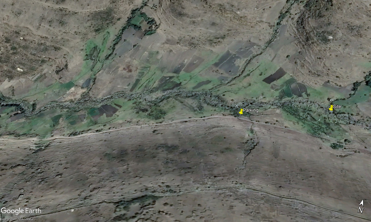 Aerial view of site Q1.3S.U / Vista aérea del lugar del estudio Q1.3S.U (March 2024) (John Forrest)
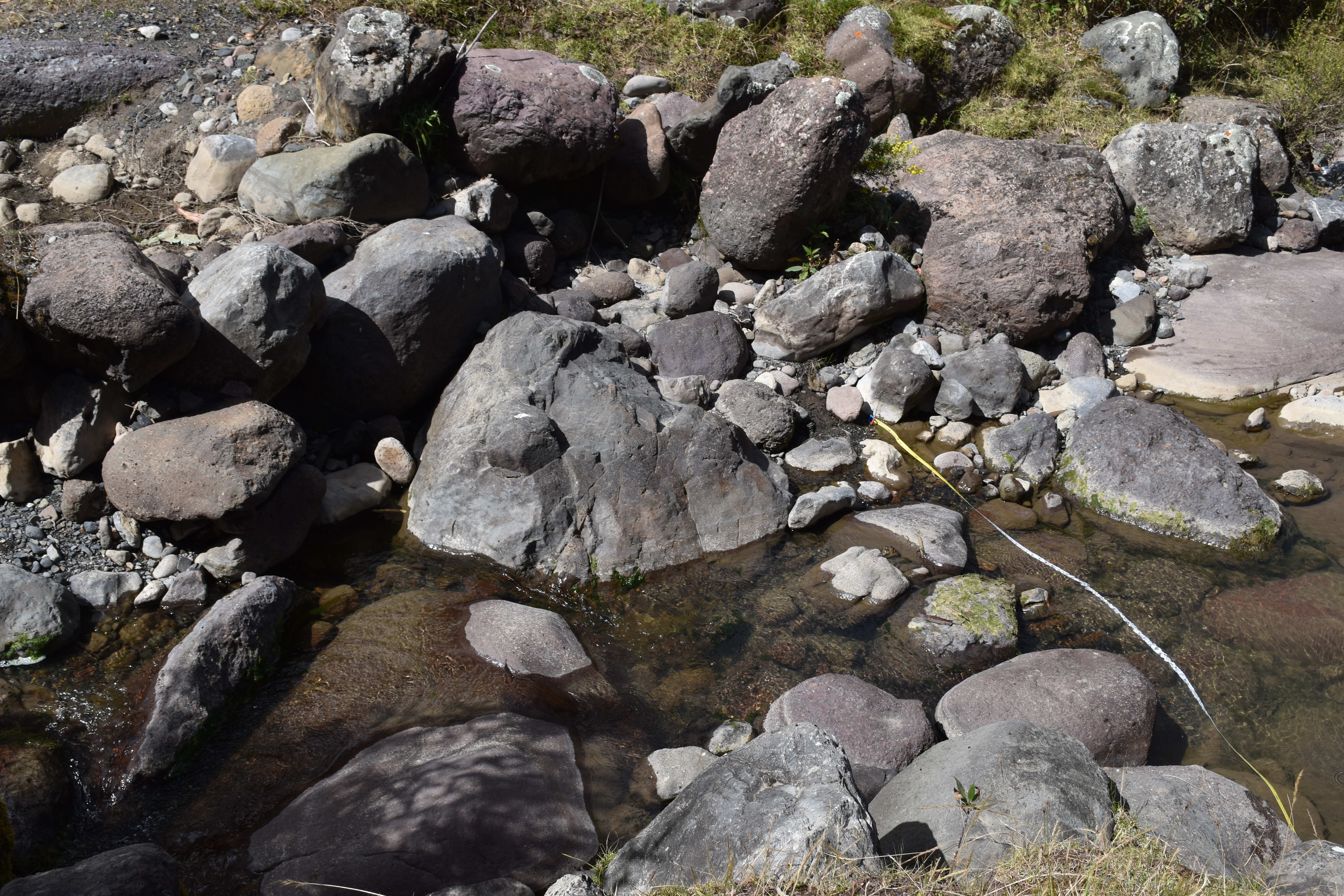
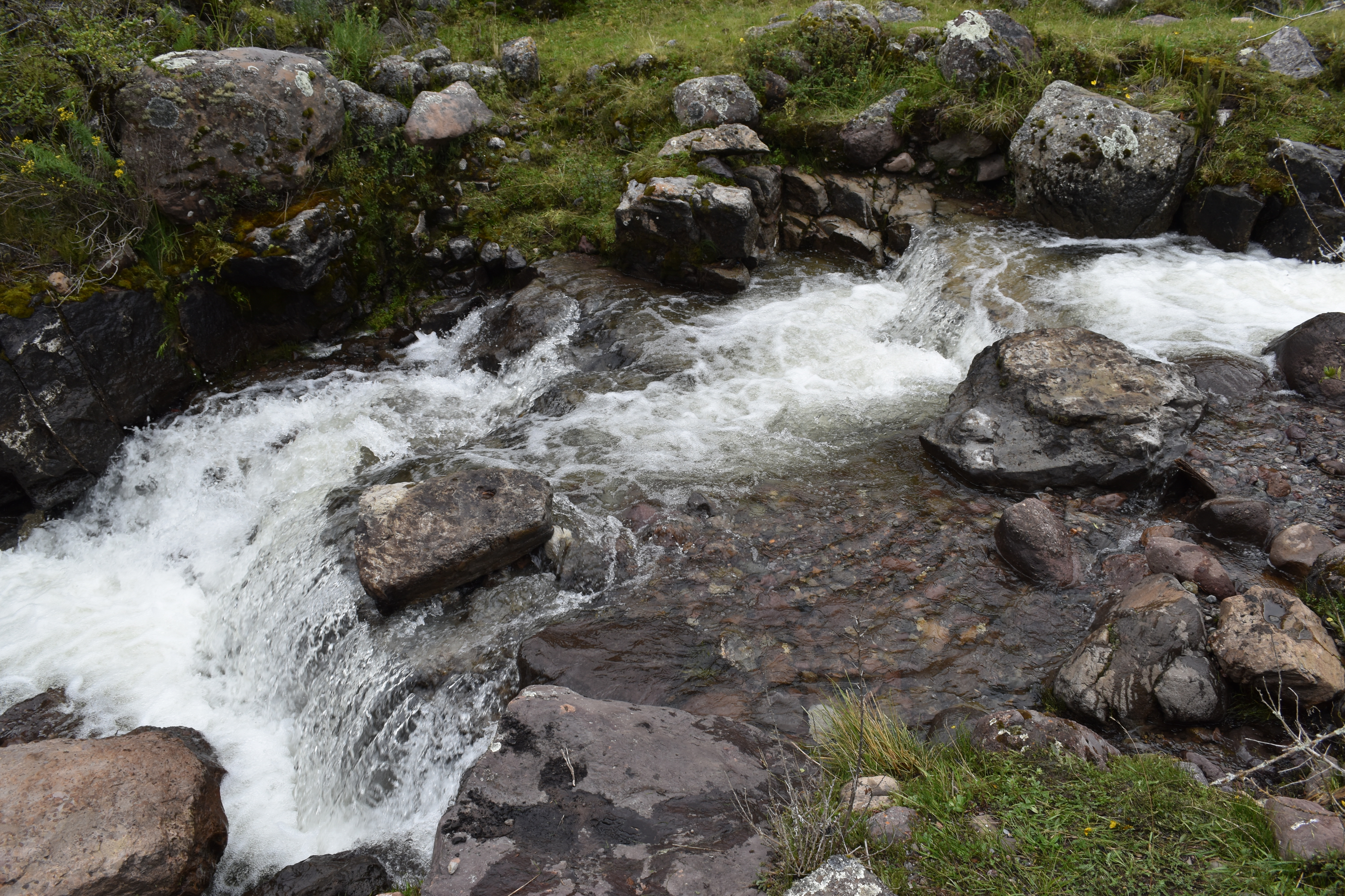 The study site (Q1.3S.U) / El lugar del estudio (Q1.3S.U) (March 2024) (John Forrest)
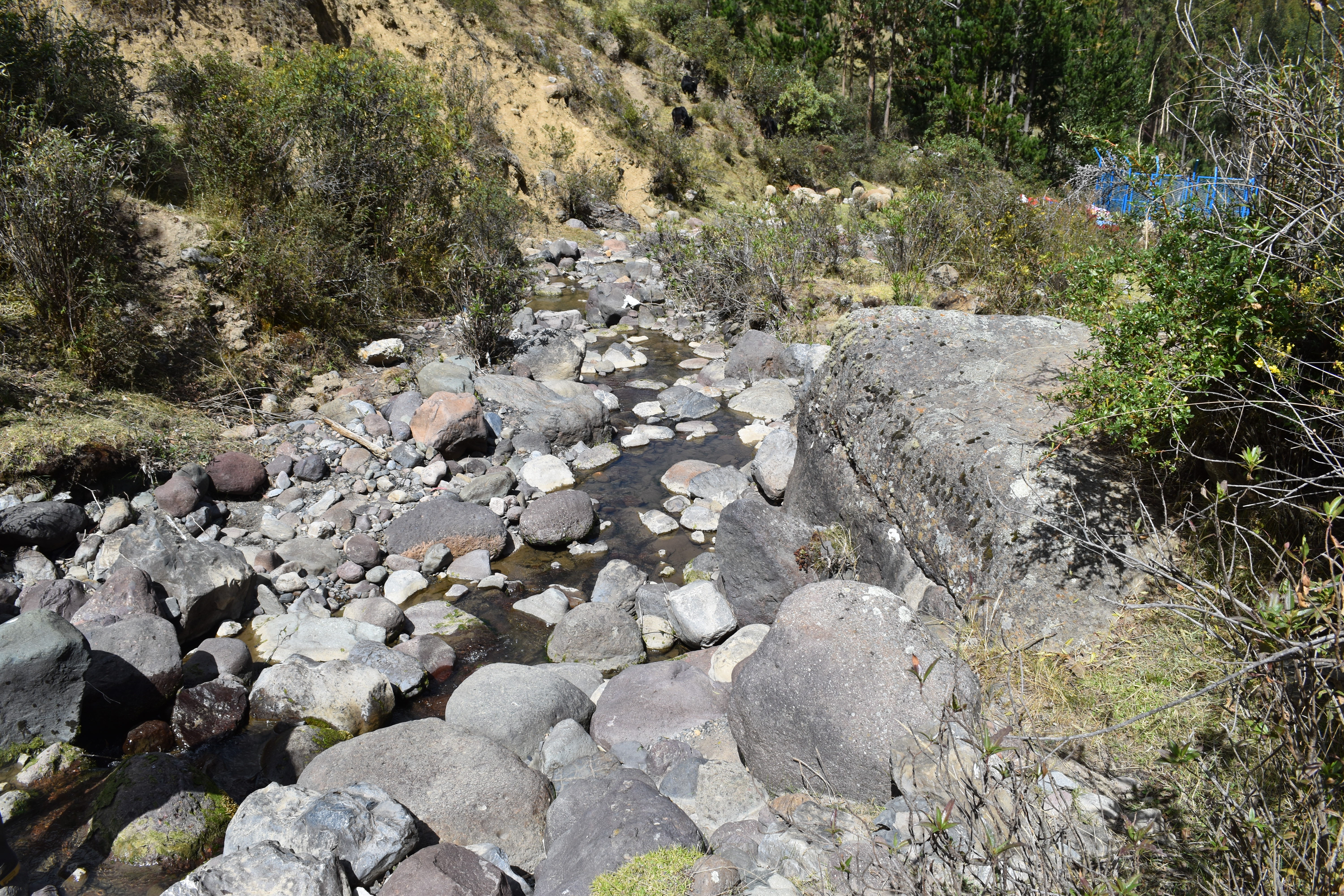
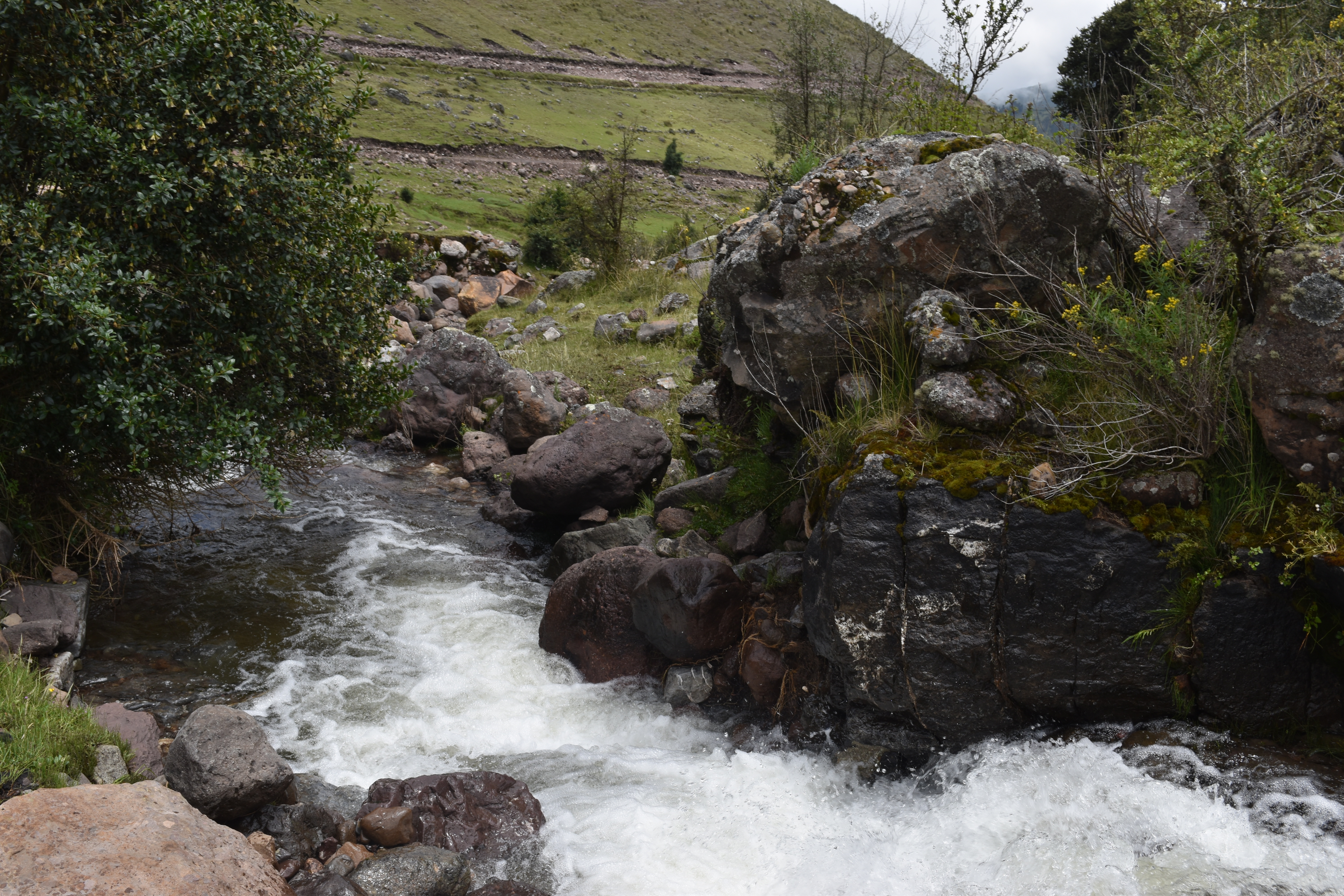 View downstream from the study site (Q1.3S.U) / Visita rio abajo del lugar del estudio (Q1.3S.U) (March 2024) (John Forrest)
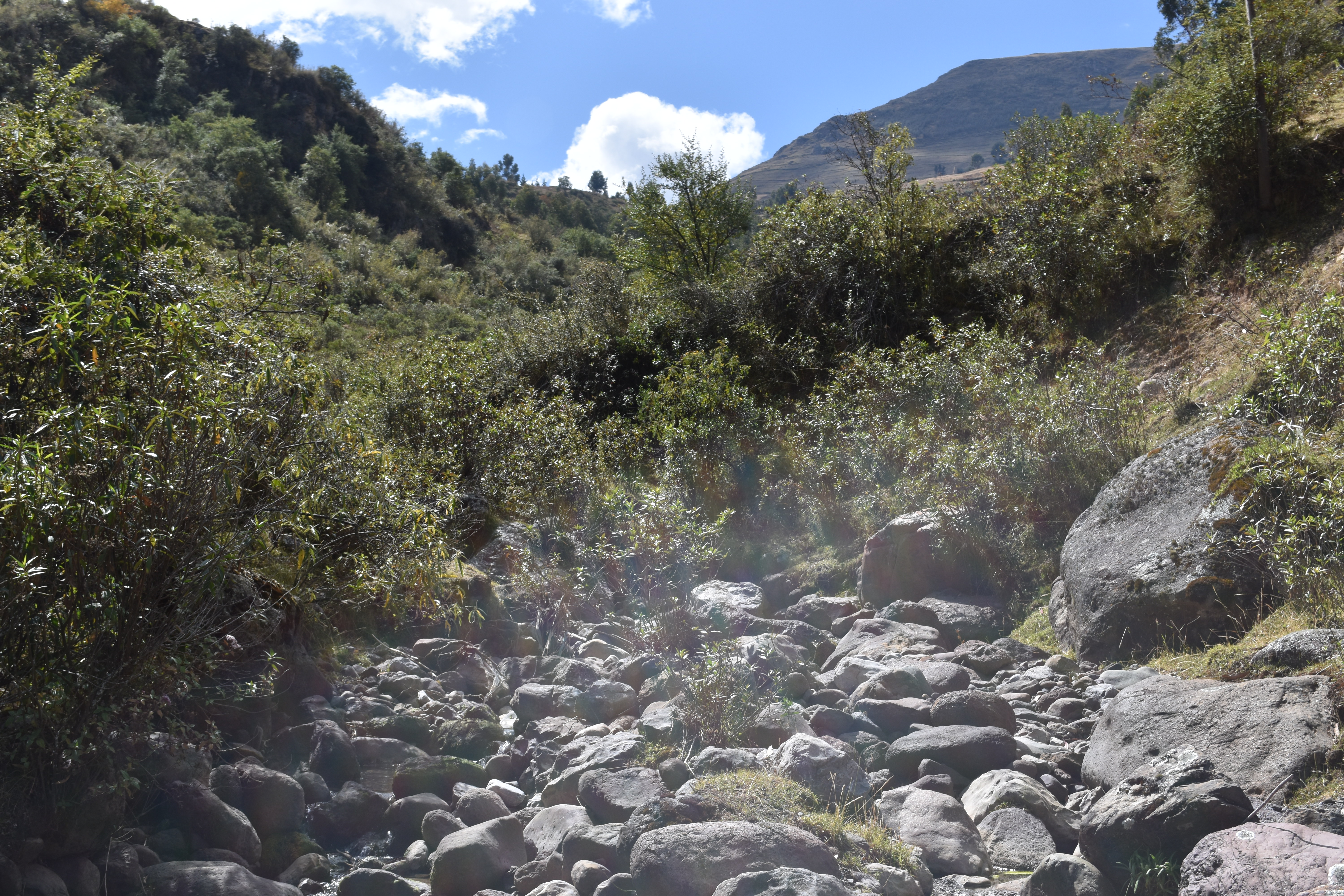
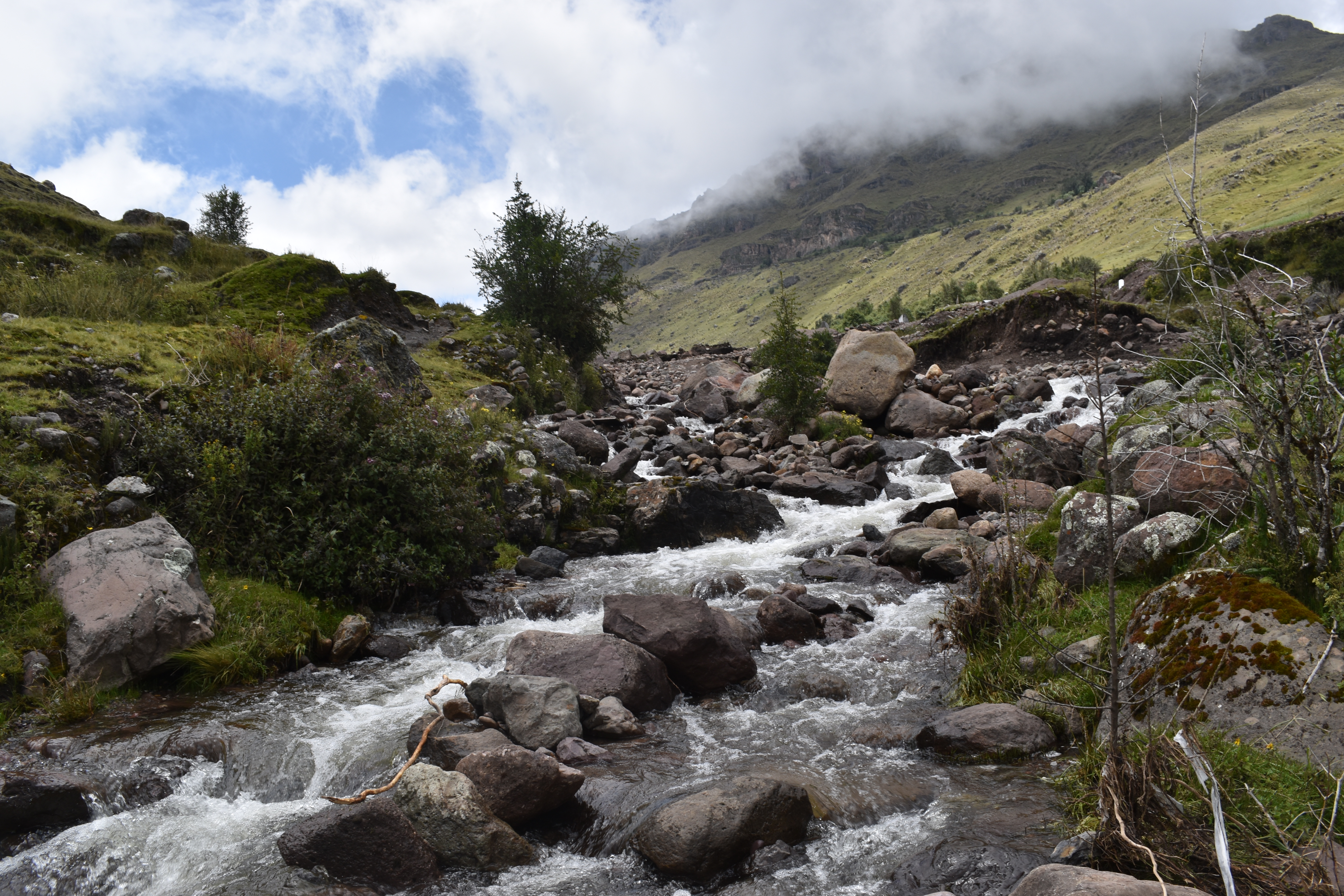 View upstream from the study site (Q1.3S.U) / Vista rio arriba desde el lugar del estudio (Q1.3S.U) (March 2024) (John Forrest)
Q1.3S.M (Middle / Medio)
GPS: S12°882155, W74°220005. Elevation: 3608m asl.
 Aerial view of site Q1.3S.M / Vista aérea del lugar del estudio Q1.3S.M (March 2024) (John Forrest)
 The study site (Q1.3S.M) / El lugar del estudio (Q1.3S.M) (March 2024) (John Forrest)
 View downstream from the study site (Q1.3S.M) / Visita rio abajo del lugar del estudio (Q1.3S.M) (March 2024) (John Forrest)
 View upstream from the study site (Q1.3S.M) / Vista rio arriba desde el lugar del estudio (Q1.3S.M) (March 2024) (John Forrest)
Site description
Q1.3S.U is located above the ex-Hacienda Santa Ana in a valley running north from the Razuhuillca peak. A track leads off the Huanta to Uchuraccay road up to the hacienda. In the community above the hacienda a turning to the left gives access up into the higher valley. Above the houses the road deteriorates into a rough track. It may not be possible to reach the point where work is taking place to construct a canal in which case the river can be accessed at a lower point where there is a turning point (NB.There are very few turning points along the track).
More precisely, Q1.3S.U is located at a point in the valley where the valley narrows and the sides begin to rise rapidly from the valley floor so the flood-plain becomes very narrow at this point. Just above the site there has been some activity associated with the construction of a new irrigation system lower down the valley.
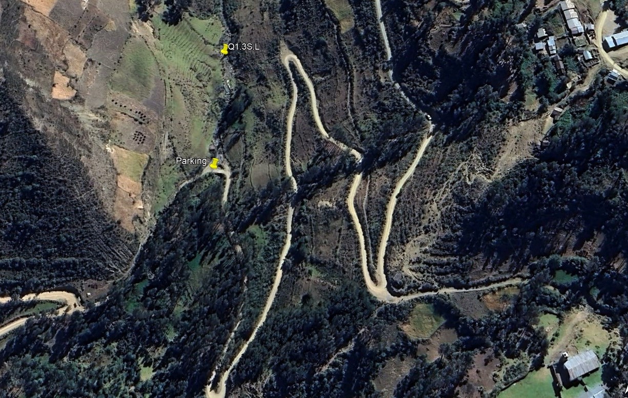
Q1.3S.L is located on the track leading off the Huanta to Uchuraccay road up to the hacienda Santa Ana, where it crosses the river Opanccay. More precisely, Q1.3S.L is located a short walk upstream above a spring which, itself, is just above the river bridging point.
There is a good chance that the new irrigation project extracting water from the river higher up the valley will significantly reduce discharge lower down the valley.
Descripción del sitio
El sitio se encuentra por encima de la ex-Hacienda Santa Ana en un valle que corre hacia el norte desde el pico Razuhuillca. Una tocha conduce desde la carretera de Huanta a Uchuraccay hasta la hacienda. En la comunidad por encima de la hacienda un giro a la izquierda da acceso al valle superior. Por encima de las casas el camino se deteriora y se convierte en una tocha muy accidentado. Es posible que no se pueda llegar al punto donde se está trabajando en la construcción de un canal, en cuyo caso se puede acceder al río en un punto más bajo donde hay un desvío (NB.Hay muy pocos desvíos a lo largo de la trocha).
Más concretamente, Q1.3S.U se encuentra en un punto del valle en el que éste se estrecha y las laderas comienzan a elevarse rápidamente desde el fondo del valle, por lo que la llanura de inundación se vuelve muy estrecha en este punto. Justo encima del yacimiento hay cierta actividad asociada a la construcción de un sistema de riego más abajo en el valle.
Q1.3S.L se encuentra en la pista que sale de la carretera Huanta-Uchuraccay y sube hasta la hacienda Santa Ana, donde cruza el río Opanccay. Más concretamente, Q1.3S.L se encuentra a pocos pasos río arriba, sobre un manantial que, a su vez, se encuentra justo encima del puente sobre el río.
Es muy probable que el nuevo proyecto de riego que extrae agua del río en la parte alta del valle reduzca significativamente el caudal en la parte baja del valle.
Data analysis
Discharge at site Q1.3S reflects seasonal precipitation patterns in the sierra Razuhuillca with significantly higher discharge in the wet season (March). The highest figure was recorded in March 2024 at the height of the wet season in a wetter year at the higher site. However, the size of the catchment above the site is small and there are several bofedales above the site that can absorb large quantities of water so the overall discharge, even in the wet season, is small.
At the lower site a new irrigation project extracting water from the river higher up the valley - above Q1.3S.U - significantly reduces discharge lower down the valley. At this site the pH, conductivity and alkalinity recorded were all lower than at the higher site.
Overall, the data recorded is best explained by the sedimentary geology of the sierra Razuhuillca and precipitation levels as well, now, as the impact of the new irrigation project reducing the discharge lower down the valley.
Análisis de datos
La descarga en el sitio Q1.3S refleja patrones estacionales de precipitación en la sierra Razuhuillca con una descarga significativamente mayor en la estación húmeda (marzo). La cifra más alta se registró en marzo de 2024, en plena estación húmeda de un año más lluvioso. Sin embargo, el tamaño de la cuenca por encima del sitio es pequeño y hay varios bofedales por encima del sitio que pueden absorber grandes cantidades de agua por lo que la descarga total, incluso en la estación húmeda, es pequeña.
En el sitio más bajo, un nuevo proyecto de riego que extrae agua del río más arriba en el valle, por encima de Q1.3S.U, reduce significativamente el caudal más abajo en el valle. En este sitio, el pH, la conductividad y la alcalinidad registrados fueron todos más bajos que en el sitio más alto.
En general, los datos registrados se explican mejor por la geología sedimentaria de la sierra Razuhuillca y los niveles de precipitación, así como por el impacto del nuevo proyecto de irrigación, que reduce el caudal en la parte baja del valle.
River & water quality data / Datos fluviales y de calidad del agua
The following river and water quality data was collected from this site:
En este lugar se recogieron los siguientes datos fluviales y de calidad del agua:
| Site / Sitio: Q1.3S | Q1.3S.U - March / marzo 2024 | Q1.3.L - June / junio 2024 | Q1.3S.L - June / junio 2025 |
|---|---|---|---|
| Season / Temporada: | Austral Summer / Verano | Austral Winter / Invierno | Austral Winter / Invierno |
| Date / Fecha: | 23.3.24 | 24.6.24 | 30.6.25 |
| Time / Hora: | 11.30 | 12.30 | 11.30 |
| Width / Ancho (m) | 4.60 | 2.70 | 1.62 |
| Depth / Profundidad (Av.) (m) | 0.21 | 0.09 | 0.18 |
| CSA / Area traversal (Av.) (m²) | 0.966 | 0.243 | 0.340 |
| Velocity / Velocidad (Av.) (m/s) | 0.718 | 0.072 | 0.196 |
| Discharge / Caudal (Av.) (m³/s) | 0.694 | 0.018 | 0.066 |
| Riverbed sediment / Sedimentos | Mainly Boulders / Rocks | Mainly Boulders / Mas Rocas | Mainly Boulders / Mas Rocas |
| Temperature (Atmospheric) (°C) | 18.2 | 15.3 | 14.6 |
| Temperature (Water / Agua) (°C) | 13.68 | 10.23 | 9.34 |
| Atmospheric pressure / presión (mbar) | 664.3 | 695.1 | 692.4 |
| Dissolved oxygen / Oxigeno disuelto (ppm) (MP)* | 2.46 | 4.39 | 2.40 |
| Dissolved oxygen / Oxigeno disuelto (%) (MP)* | 42.0 | 62.4 | 34.2 |
| pH | 8.19 | 8.48 | 8.51 |
| Conductivity / Conductividad (µS/cm) | 123 | 345 | 656 |
| Total Dissolved Solids (TDS / STD) (ppm) | 62 | 173 | 328 |
| ORP (mV) | 101.9 | 124.2 | 125.4 |
| Turbidity / Turbidez | Clear / Transparente | Clear / Transparente | Clear / Transparente |
| Alkalinity/Alkalinidad (Titración) (mg/l CaCO₃)(1.6N) | 87 | 188 | 185 |
| Alkalinity Field Tester (Hanna) (ppm CaCO₃) | 53 | 167 | 167 |
| *Also refer to MT results in 2024. |