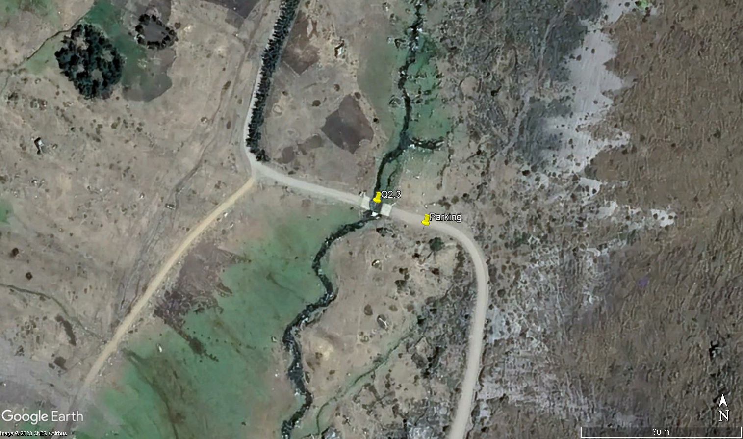
Q2.3 - Lower Razuhuillca - Bajo Razuhuillca
Site Q2.3 - Razuhuillca - Razuhuillca
Site Q2.3U - Razuhuillca Ford - Razuhuillca Batan
GPS: S12°904776, W74°172655. Elevation: 3987m asl.
 Aerial view of study site / Vista aérea del lugar del estudio (March 2023) (John Forrest)
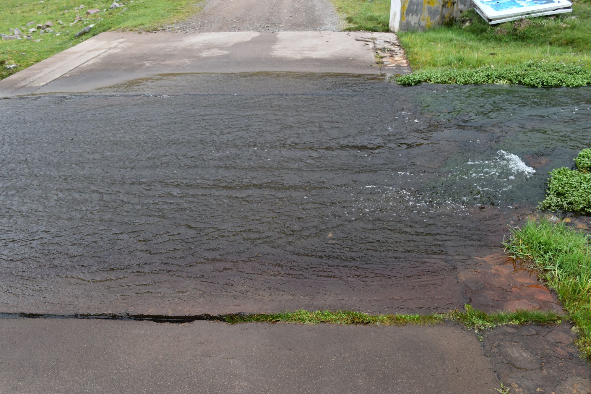 The study site (looking north) / El lugar del estudio (Vista al norte) (March 2023) (John Forrest)
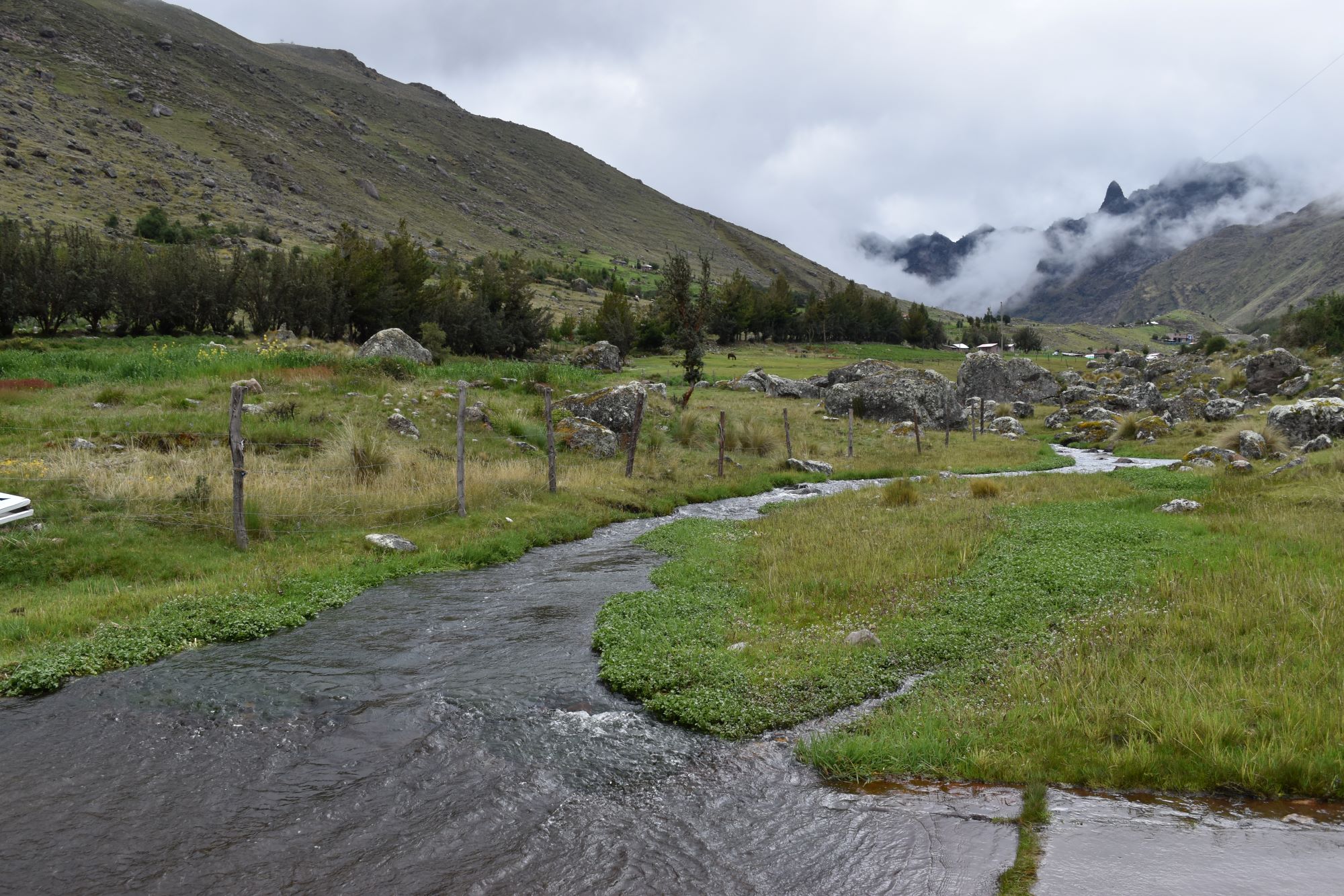
 View downstream from the study site / Visita rio abajo del lugar del estudio (March 2023) (John Forrest)
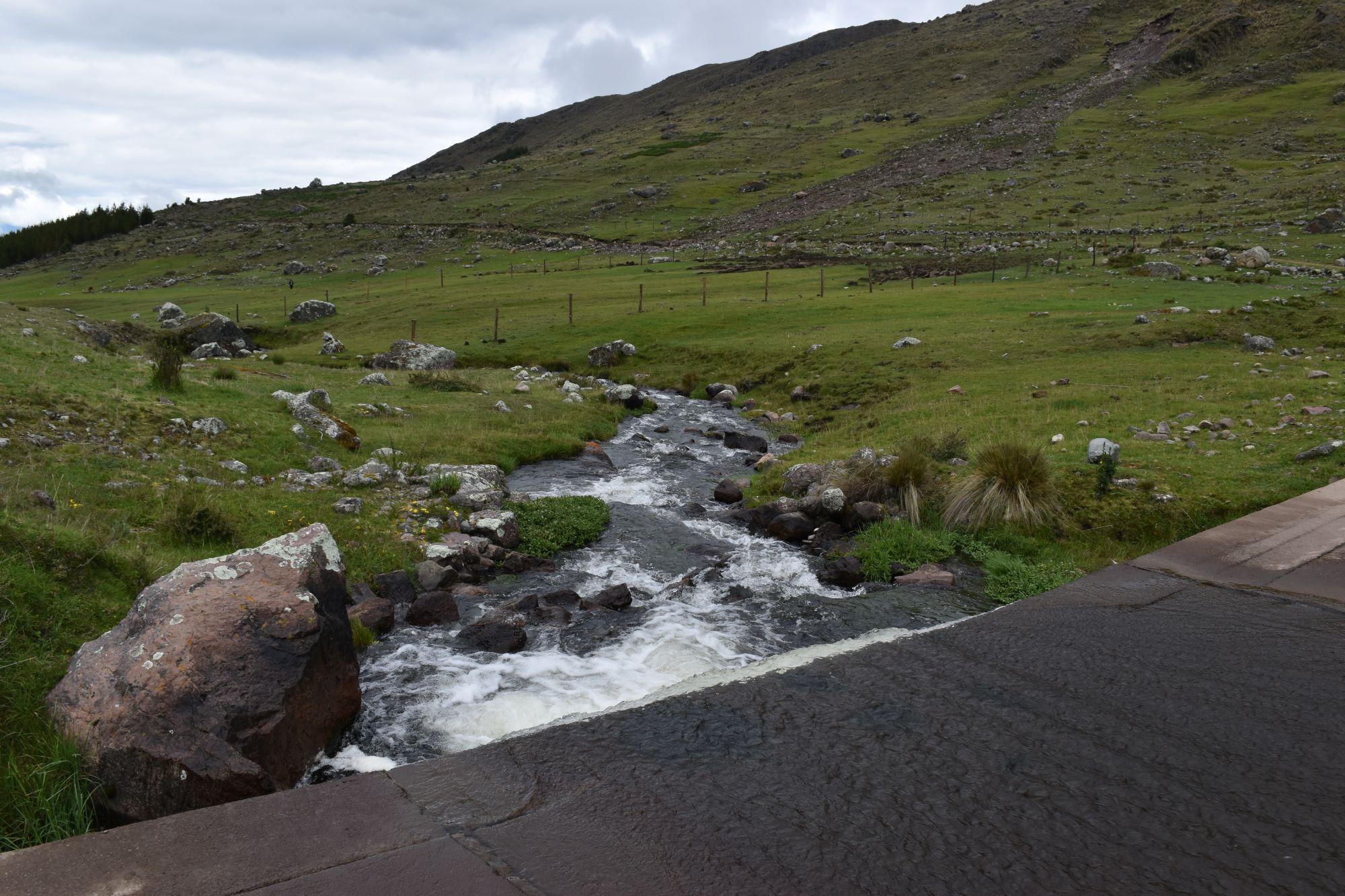
 View upstream from the study site / Vista rio arriba desde el lugar del estudio (March 2023) (John Forrest)
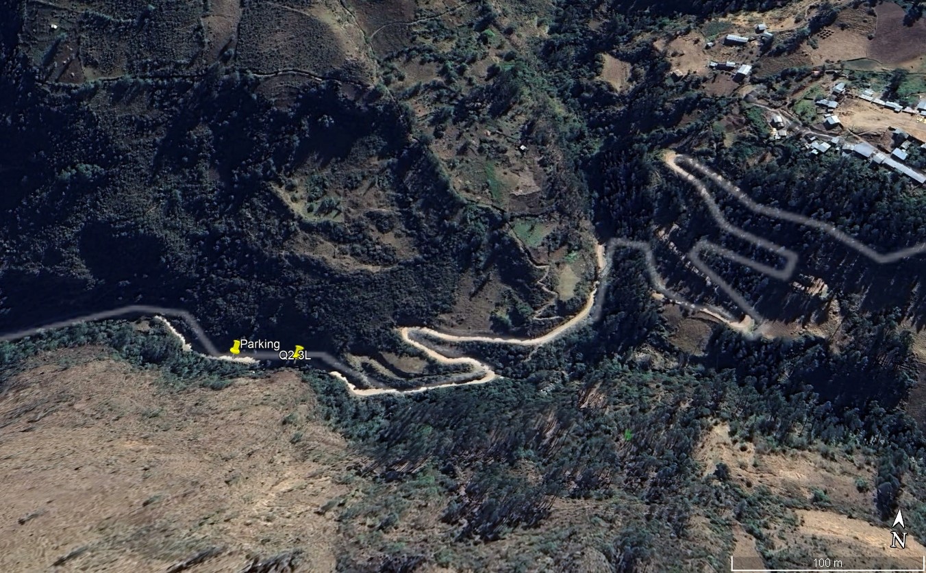
Site Q2.3L - Lower Razuhuillca - Razuhuillca Bajo
GPS: S12°93304, W74°210870. Elevation: 3155m asl.
 Aerial view of study site / Vista aérea del lugar del estudio (November 2024) (John Forrest)
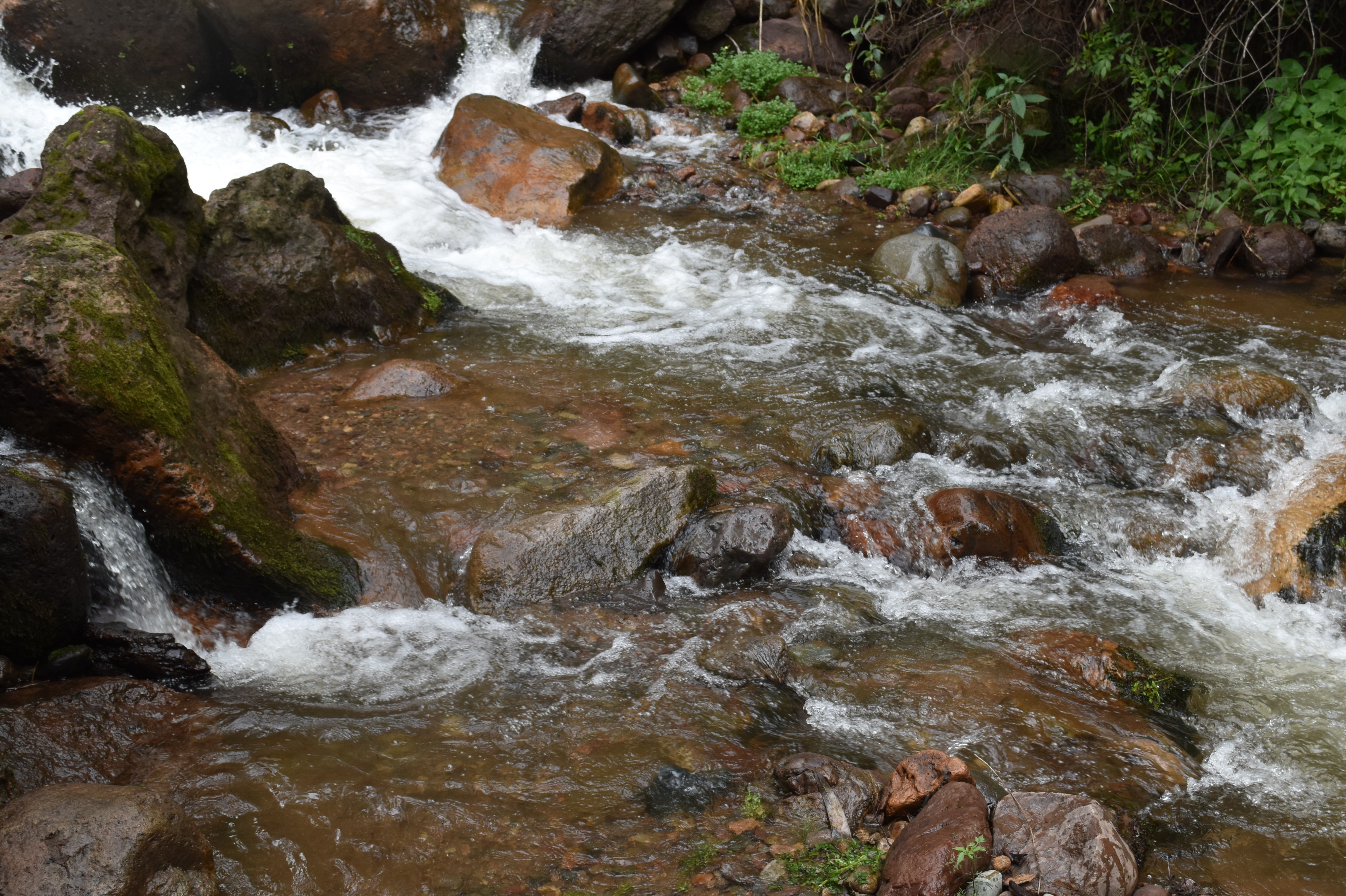 The study site (looking north) / El lugar del estudio (Vista al norte) (November 2024) (John Forrest)
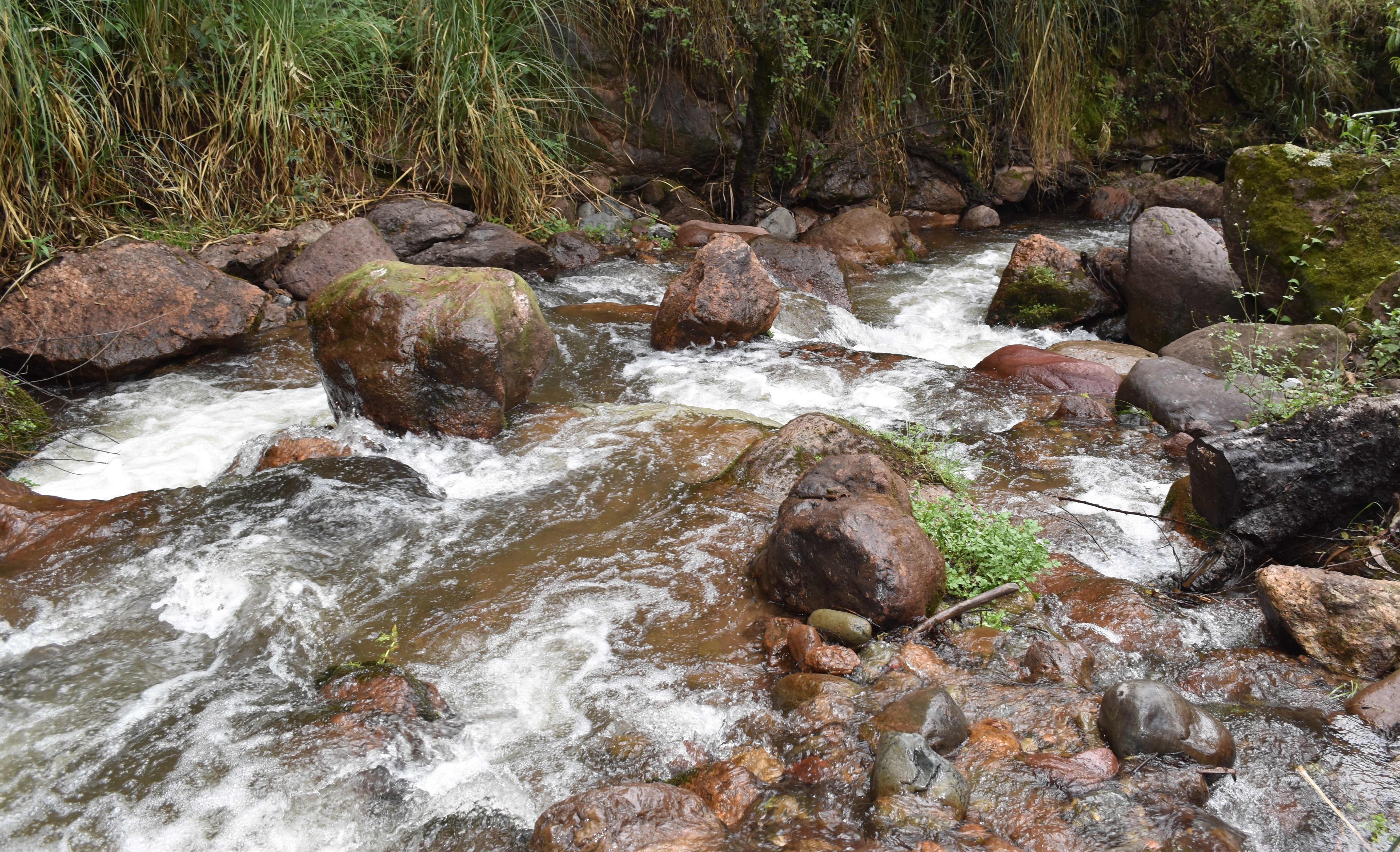 View downstream from the study site / Visita rio abajo del lugar del estudio (November 2024) (John Forrest)
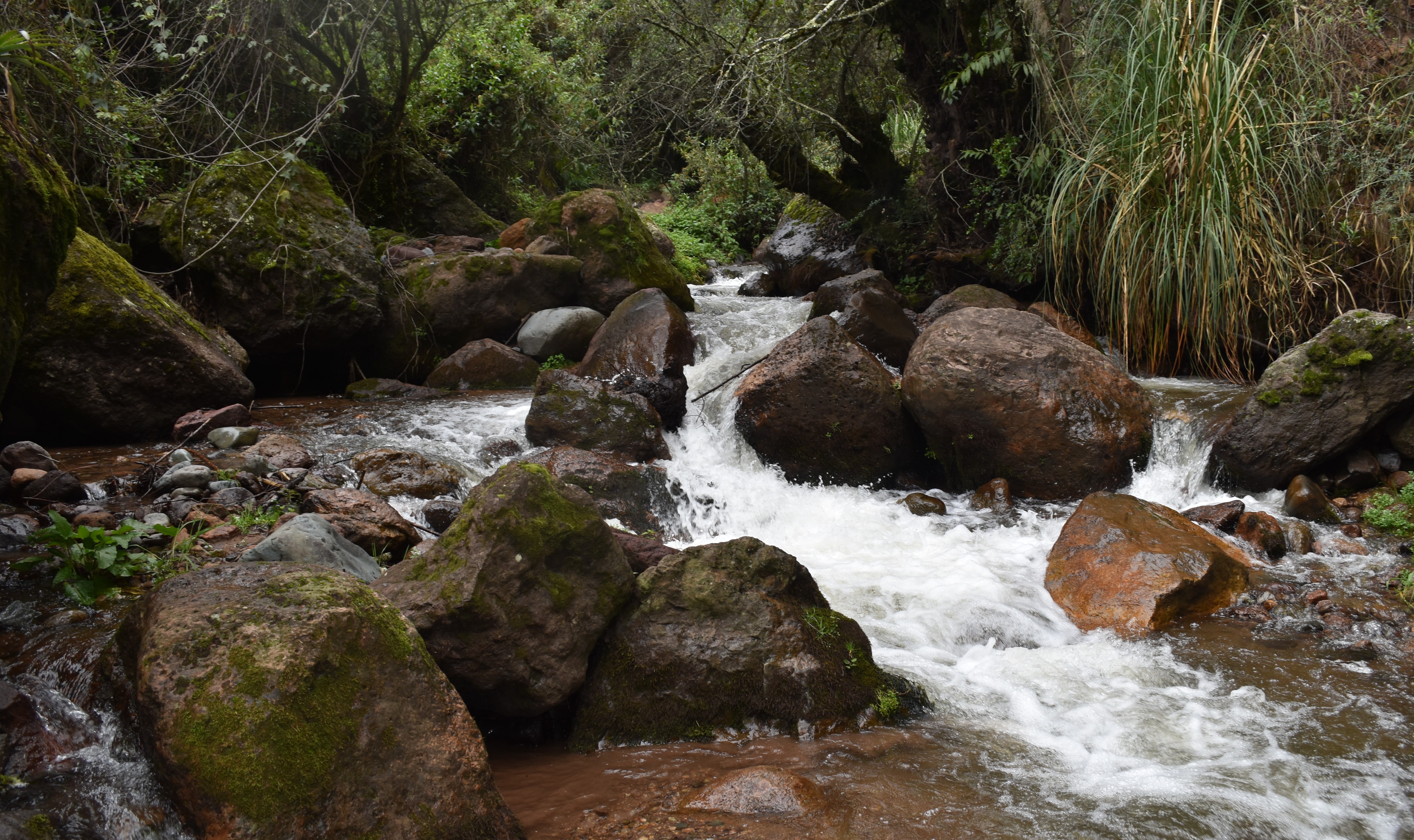 View upstream from the study site / Vista rio arriba desde el lugar del estudio (November 2024) (John Forrest)
Site description
Q2.3U is located in a fairly wide hanging valley high in the sierra Razuhuillca. The valley slopes are steep sided and there is a small flood-plain.
The study site is situated where the Huanta to Razuhuillca road fords the River Huanta – the concrete base of the ford makes it easier to take measurements – about 1km below the village of Razuhuillca. Even if the river level rises, vehicles can provide access to both banks of the river.
Q2.3L is located above the Occachaca waterfall in a steep, wooded valley before it enters any significant areas of human activity. The valley between Q2.3U and Q2.3L is steep sided, wooded and inaccessible.
Descripción del sitio
Q2.3U se encuentra en un valle colgante bastante amplio en lo alto de la sierra Razuhuillca. Las laderas del valle son abruptas y hay una pequeña llanura de inundación.
El sitio de estudio está situado donde el camino de Huanta a Razuhuillca vadea el Río Huanta - la base de concreto del vado hace más fácil tomar medidas - aproximadamente 1km río abajo del pueblo de Razuhuillca. Incluso si el nivel del río sube, los vehículos pueden proporcionar acceso a ambos orillas del rio.
Q2.3L se encuentra por encima de la Cascada Occachaca en un valle escarpado y boscoso antes de entrar en cualquier área significativa de actividad humana. El valle entre Q2.3U y Q2.3L es escarpado, boscoso e inaccesible.
Data analysis
Discharge at site Q2.3 reflects seasonal precipitation patterns in the sierra Razuhuillca with higher discharge in the wet season (March) or once the rains arrive (November) and lower discharge in the dry season (June).
However, the size of the catchment above the site is small and there are several bofedales above the site that can absorb large quantities of water so the overall discharge, even in the wet season, is small.
In February 2025 more than twice as much water was recorded flowing in the channel than in the two previous, dry season, visits though the data was recorded at a site lower in the catchment than before. It was also nearly five times more than the highest discharge recorded at Q2.3U, in March 2023.
The pH has an average of just below 8.0 and is always lowest in the wet season - in February 2025 it was the lowest of all visits. The conductivity recorded is low on average due to the geology of the area - sedimentary rocks contain few metals - but was highest in June 2025 at almost double the figure recorded on the two previous visits to this site (Q2.3L). The alkalinity levels recorded are low again relfecting the geology of the site. The relatively low pH and alkalinity levels may also be explained by much of the discharge originating from a reservoir above Q2.4 and, possibly, as a consequecne of some coniferous plantations, now reaching maturity, higher up the catchment.
Análisis de datos
La descarga en el sitio Q2.3U refleja los patrones estacionales de precipitación en la sierra Razuhuillca con una descarga más alta en la estación húmeda (marzo) o una vez que llegan las lluvias (noviembre) y una descarga más baja en la estación seca (junio).
Sin embargo, el tamaño de la cuenca por encima del sitio es pequeño y hay varios bofedales por encima del sitio que pueden absorber grandes cantidades de agua por lo que la descarga total, incluso en la estación húmeda, es pequeña.
En febrero de 2025 se registró más del doble de agua fluyendo por el canal que en las dos visitas anteriores, en temporada seca. También fue casi cinco veces más que la descarga más alta registrada en Q2.3U, en marzo de 2023.
El pH tiene un promedio ligeramente inferior a 8,0 y siempre es más bajo en la temporada húmeda; en febrero de 2025 fue el más bajo de todas las visitas. La conductividad registrada es baja en promedio debido a la geología de la zona —las rocas sedimentarias contienen pocos metales—, pero fue más alta en junio de 2025, casi el doble de la cifra registrada en las dos visitas anteriores a este sitio (Q2.3L). Los niveles de alcalinidad registrados son de nuevo bajos, lo que refleja la geología del sitio. Los niveles relativamente bajos de pH y alcalinidad también pueden explicarse por el hecho de que gran parte de la descarga proviene de un embalse situado por encima de Q2.4 y, posiblemente, como consecuencia de algunas plantaciones de coníferas, que ahora están alcanzando la madurez, en la parte alta de la cuenca.
River & water quality data / Datos fluviales y de calidad del agua
The following river and water quality data was collected from this site:
En este lugar se recogieron los siguientes datos fluviales y de calidad del agua:
| Site / Sitio: Q2.3 | Q2.3U - March / marzo 2023 | Q2.3U - June / junio 2023 | Q2.3U - November / noviembre 2023 | Q2.3U - March / marzo 2024 | Q2.3U - June / junio 2024 | Q2.3L - November / noviembre 2024 | Q2.3L - February / febrero 2025 | Q2.3L - June / junio 2025 | Q2.3L - November / noviembre 2025 |
|---|---|---|---|---|---|---|---|---|---|
| Season / Temporada: | Austral Summer / Verano | Austral Winter / Invierno | Austral Winter / Invierno | Austral Summer / Verano | Austral Winter / Invierno | Austral Winter / Invierno | Austral Summer / Verano | Austral Winter / Invierno | Austral Winter / Invierno |
| Date / Fecha: | 19.3.23 | 25.6.23 | 22.11.23 | 25.3.24 | 30.6.24 | 29.11.24 | 26.2.25 | 2.7.25 | 4.12.25 |
| Time / Hora: | 8.30 | 11.00 | 8.45 | 8.30 | 9.30 | 9.00 | 12.00 | 8.45 | 9.15 |
| Width / Ancho (m) | 6.00 | 6.00 | 4.60 | 5.10 | 4.40 | 5.75 | 7.00 | 7.00 | 7.50 |
| Depth / Profundidad (Av.) (m) | 0.08 | 0.05 | 0.06 | 0.05 | 0.06 | 0.23 | 0.32 | 0.27 | 0.31 |
| CSA / Area traversal (Av.) (m²) | 0.50 | 0.30 | 0.276 | 0.255 | 0.264 | 1.38 | 2.24 | 1.89 | 2.325 |
| Velocity / Velocidad (Av.) (m/s) | 1.17 | 0.930 | 1.290 | 1.336 | 0.906 | 0.855 | 1.18 | 0.326 | 0.473 |
| Discharge / Caudal (Av.) (m³/s) | 0.589 | 0.279 | 0.356 | 0.341 | 0.239 | 1.180 | 2.437 | 0.616 | 1.100 |
| Riverbed sediment / Sedimentos | Mainly boulders / Mas rocas | Boulders & cobbles / Rocas y piedras | Mainly boulders / Mas rocas | Mainly boulders / Mas rocas | Mainly boulders / Mas rocas | Mainly boulders / Mas rocas | Mainly boulders / Mas rocas | Mainly boulders / Mas rocas | Mainly boulders / Mas rocas |
| Temperature (Atmospheric) (°C) | 9.0 | 11.5 | 14.2 | 12.4 | 9.0 | 13.5 | 17.3 | 10.3 | 18.0 |
| Temperature (Water / Agua) (°C) | 10.83 | 9.68 | 12.56 | 9.72 | 10.03 | 11.20 | 12.46 | 8.25 | 11.37 |
| Atmospheric pressure / presión (mbar) | 680.3 | 681.2 | 681.2 | 665.7 | 681.6 | 740.8 | 743.9 | 728.1 | 726.8 |
| Dissolved oxygen / Oxigeno disuelto (ppm) (MP)* | 5.78 | 6.83 | 4.49 | 2.95 | 3.76 | 7.47 | 4.54 | 4.55 | 3.73 |
| Dissolved oxygen / Oxigeno disuelto (%) (MP)* | 89.9 | 102.4 | 71.6 | 45.8 | 55.3 | 71.8 | 79.3 | 75.1 | 50.1 |
| pH | 7.99 | 8.05 | 8.09 | 7.57 | 7.75 | 8.10 | 7.37 | 8.06 | 8.06 |
| Conductivity / Conductividad (µS/cm) | 64 | 41 | 64 | 56 | 46 | 55 | 70 | 132 | 58 |
| Total Dissolved Solids (TDS / STD) (ppm) | 32 | 21 | 32 | 28 | 23 | 28 | 35 | 66 | 29 |
| ORP (mV) | 208.9 | 109.0 | 59.2 | 51.2 | 44.3 | 136.8 | 97.7 | 219.0 | 170.8 |
| Turbidity / Turbidez | Clear: slightly green / poco verde | Clear / Transparente | Clear / Transparente | Clear / Transparente | Clear / Transparente | Clear / Transparente | Clear / Transparente | Clear / Transparente | Clear / Transparente |
| Alkalinity/Alkalinidad (Titración) (mg/l CaCO₃)(1.6N) | 32 | 41 | 47 | 58 | 60 | 70 | 71 | 56 | 36 |
| Alkalinity Field Tester (Hanna) (ppm CaCO₃) | 20 | 30 | 39 | 30 | 15 | 37 | 42 | 47 | 36 |
| *Also refer to MT results post-2023 |