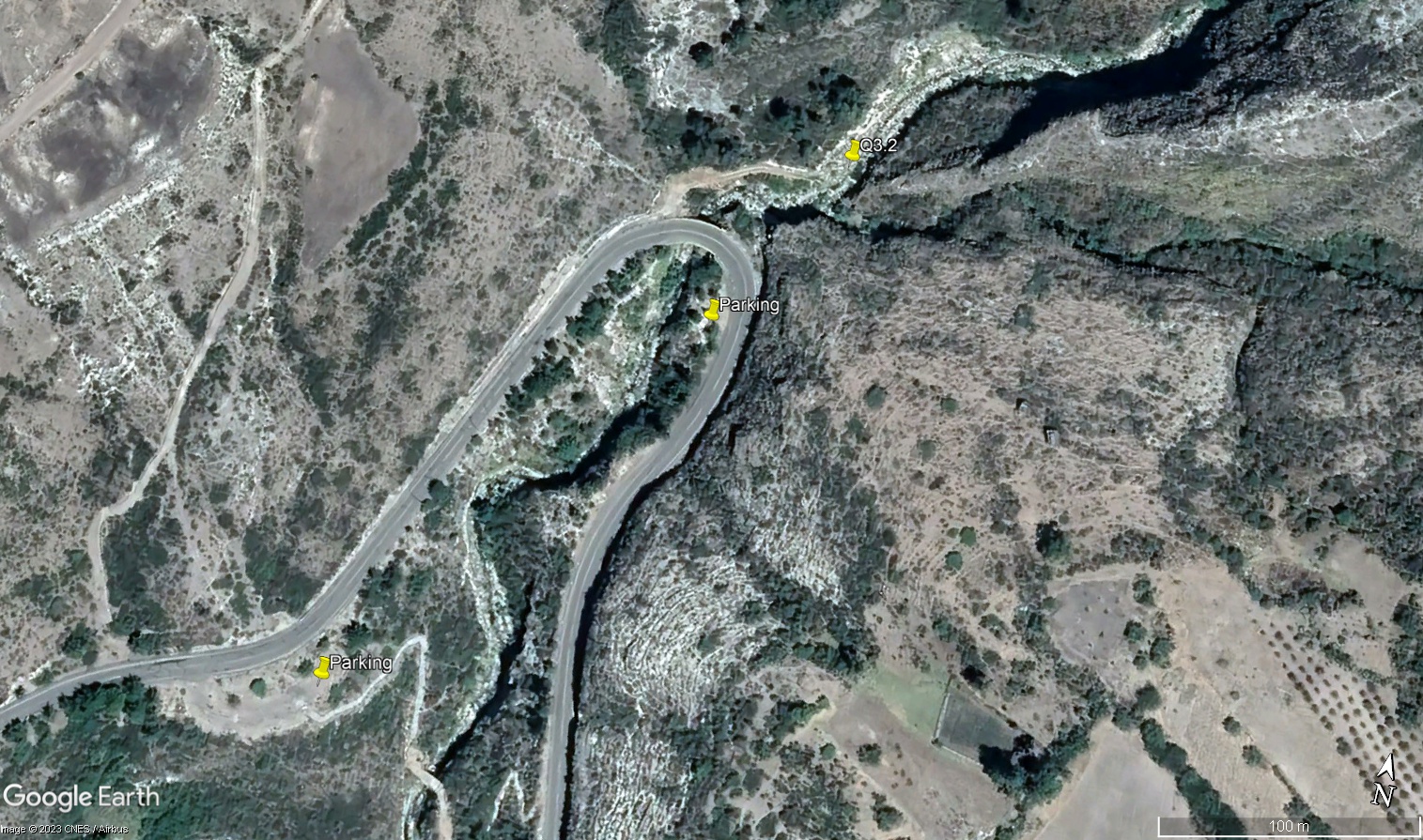
Q3.2 - Middle Chihua (Huamanguilla-Iguian) - Puente Ayahuarcuna
Site Q3.2 - Middle Chihua (Huamanguilla-Iguian) - Puente Ayahuarcuna
Site Q3.2M
GPS: S13°005275, W74°208628. Elevation: 2855m asl.
 Aerial view of study site / Vista aérea del lugar del estudio (March 2023) (John Forrest)
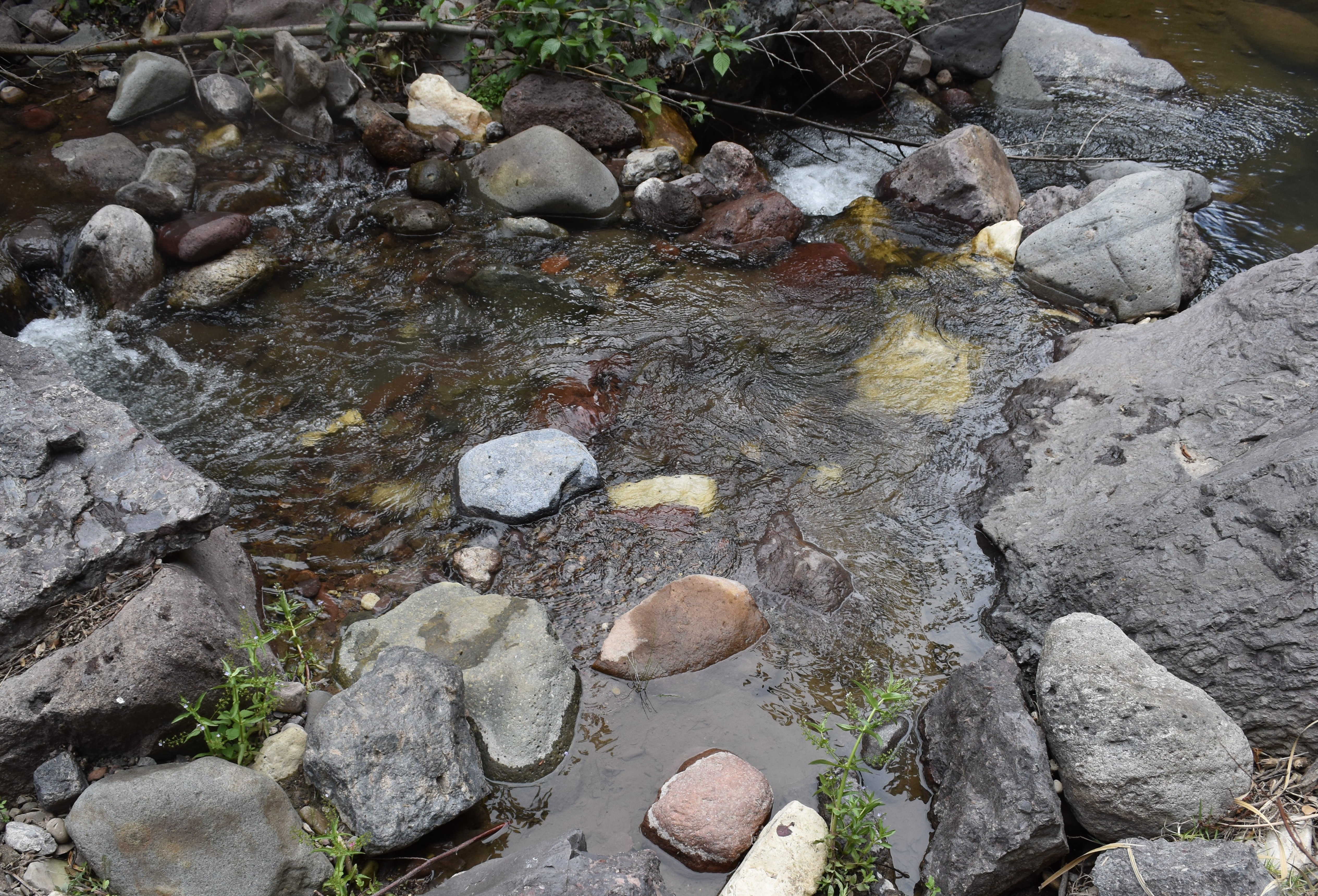
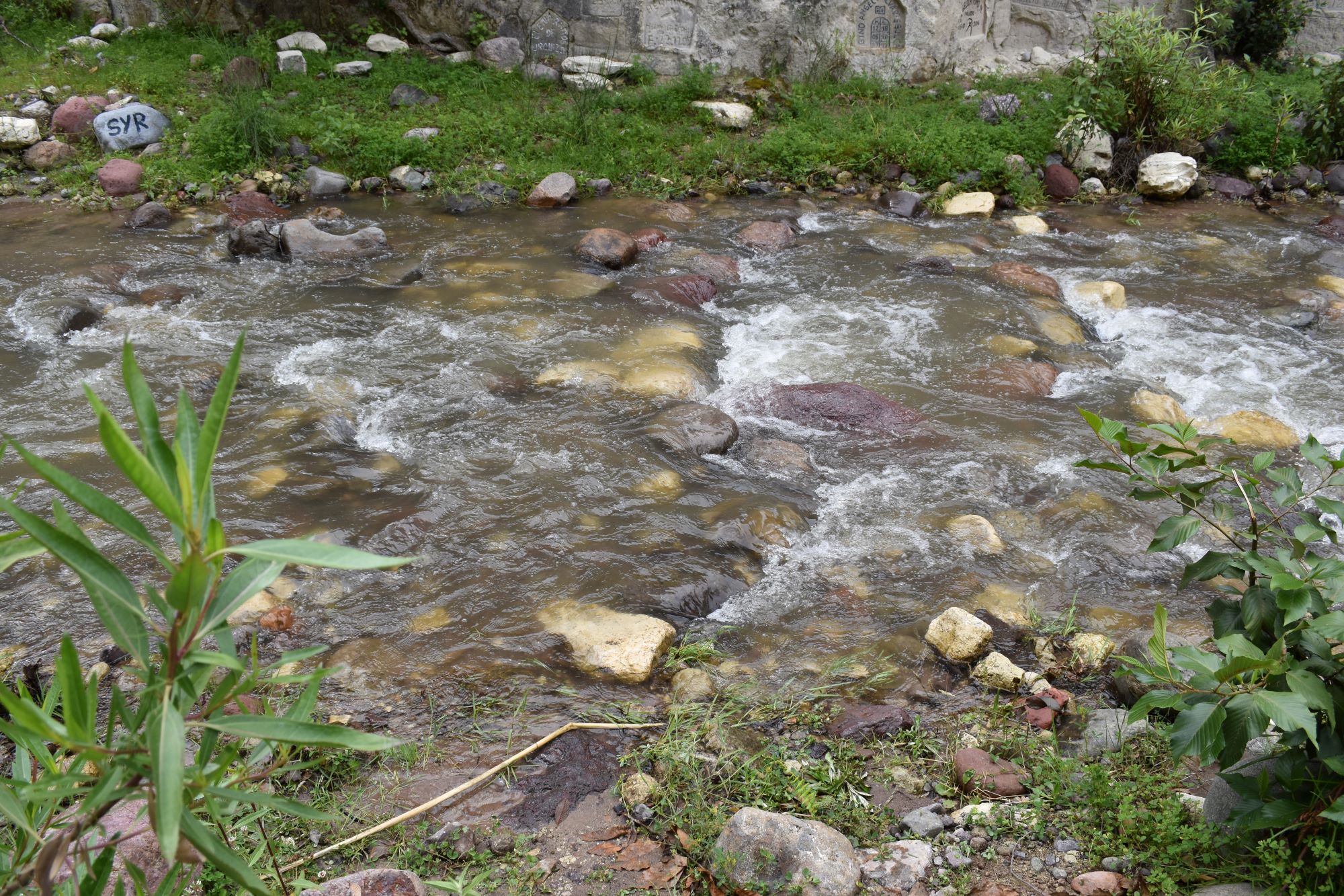 The study site / El lugar del estudio (March 2023) (John Forrest)
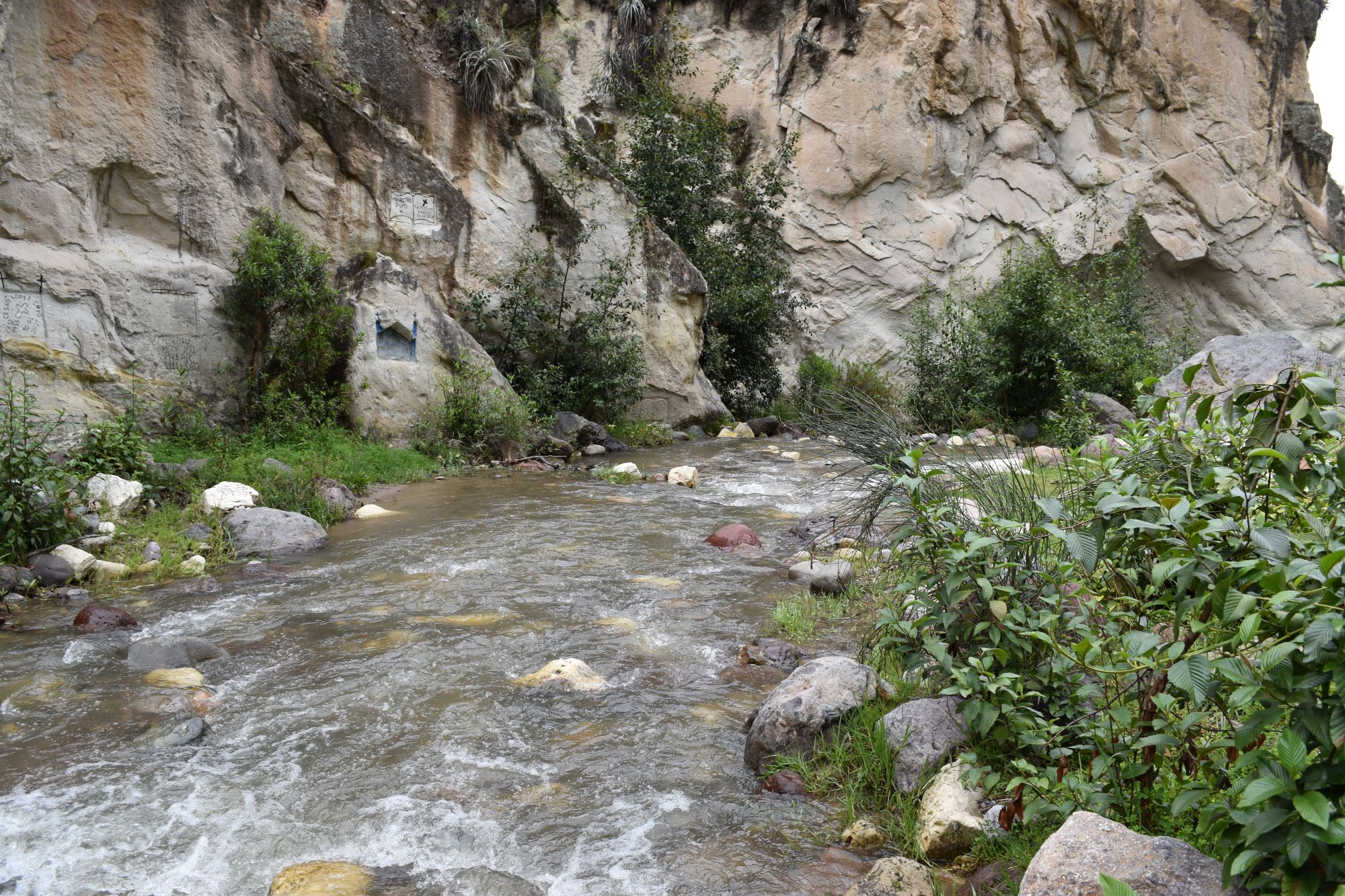 View downstream from the study site / Visita rio abajo del lugar del estudio (March 2023) (John Forrest)
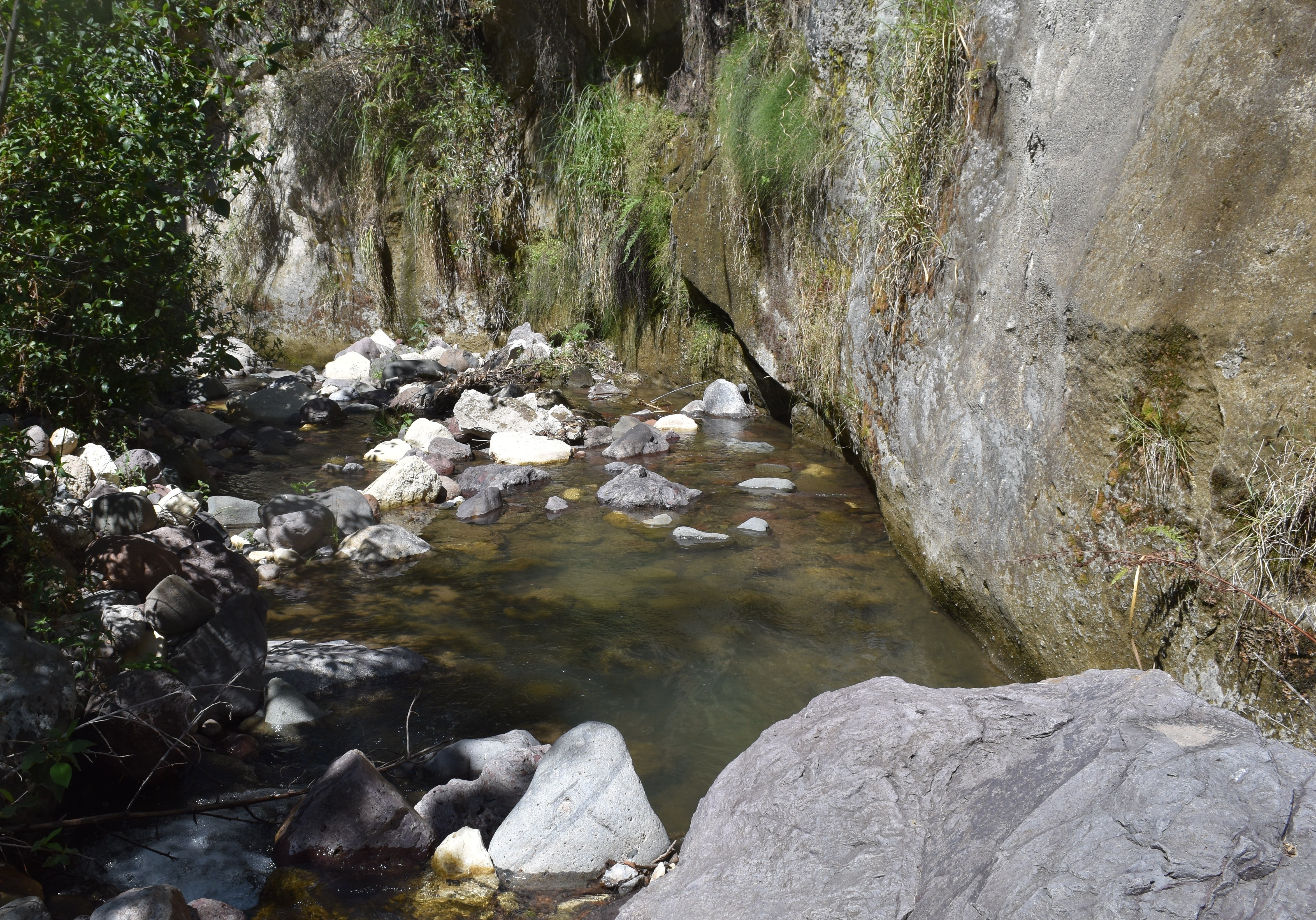
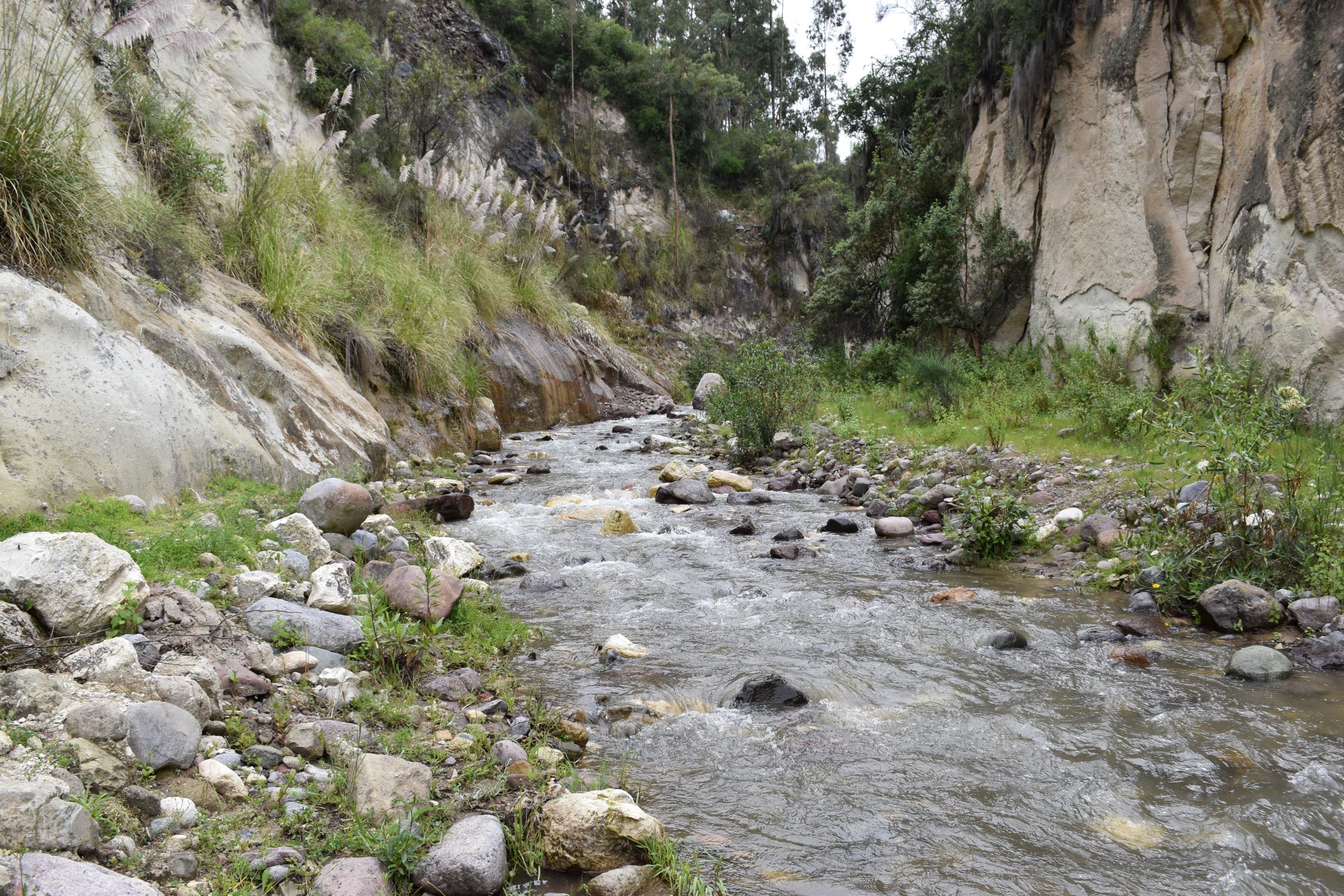 View upstream from the study site / Vista rio arriba desde el lugar del estudio (March 2023) (John Forrest)
Site Q3.2L
GPS: S13°005535, W74°208965. Elevation: 2854m asl.
 The study site / El lugar del estudio (November 2025) (John Forrest)
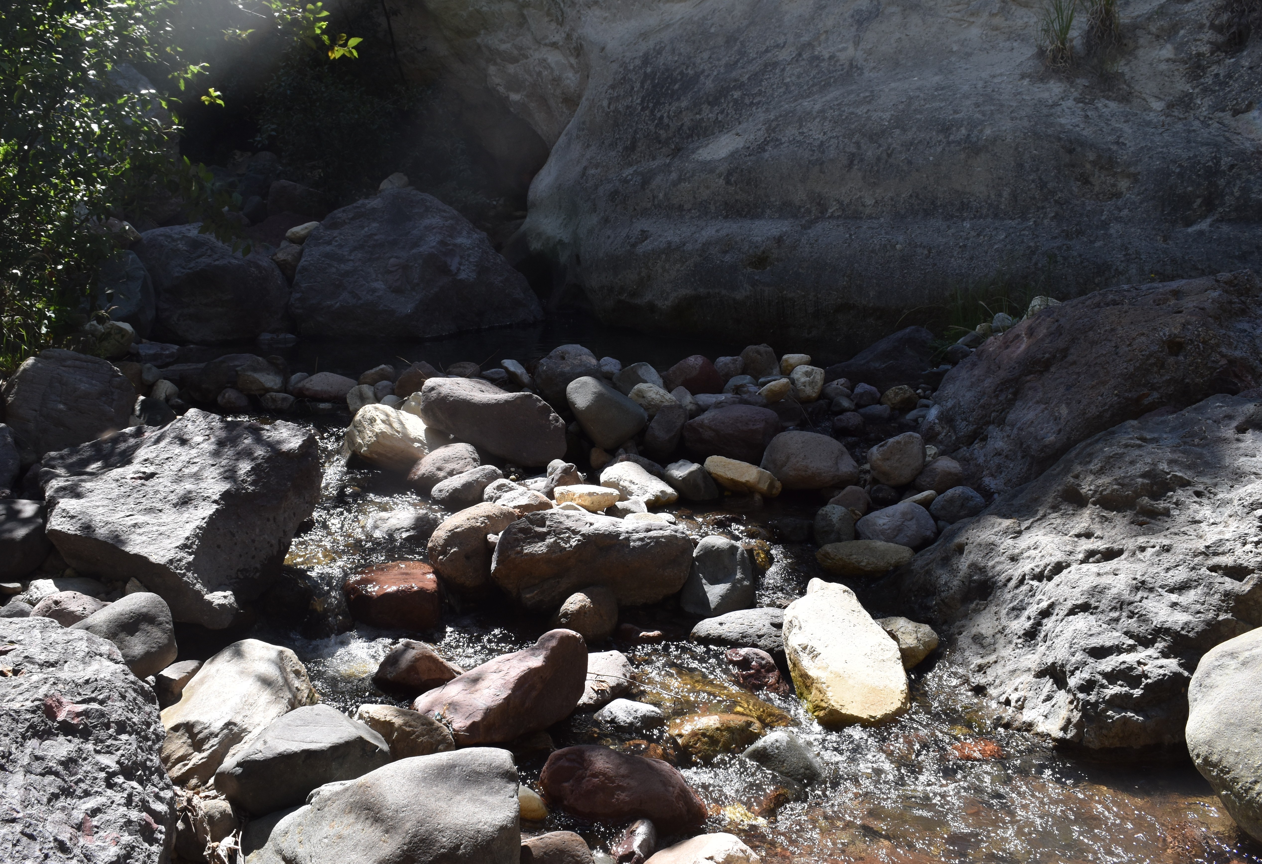
 View downstream from the study site / Visita rio abajo del lugar del estudio (November 2025) (John Forrest)
 View upstream from the study site / Vista rio arriba desde el lugar del estudio (March 2023) (John Forrest)
Site description
Q3.2 is located in a very narrow, steep sided valley where the river has incised about 20 metres in to the landscape.
Q3.2M is situated about 100 metres upstream from the Ayahuarcuna bridge on the Huanta to Ayacucho road and above the point were a small tributary enters the river Chihua (Huamanguilla-Iguian) on the left bank. Access for taking measurements is from the right bank above the confluence with the small tributary, however, its precise position may vary with a rise in the river level.
Q3.2L is located about 50 metres upstream from the Ayahuarcuna bridge and below the point were a small tributary enters the river Chihua (Huamanguilla-Iguian) on the left bank. Access for taking measurements is from the right bank below the confluence with the small tributary, however, its precise position may vary with a rise in the river level.
Access to both sites is down an abandoned track to the left of the Ayahuarcuna bridge looking upstream. NB.This track is sometimes waterlogged for much of its length. At the end of the track continue upstream to Q3.2U and turn downstream through vegetation to reach Q3.2L.
Descripción del sitio
Q3.2 se encuentra en un valle muy estrecho y escarpado donde el río ha erosionado unos 20 metros en el paisaje.
Q3.2M se encuentra a unos 100 metros río arriba del puente Ayahuarcuna, en la carretera de Huanta a Ayacucho, y por encima del punto donde un pequeño afluente desemboca en el río Chihua (Huamanguilla-Iguian), en la margen izquierda. El acceso para tomar las mediciones se realiza desde la margen derecha, por encima de la confluencia con el pequeño afluente; sin embargo, su posición exacta puede variar con la crecida del río.
El sitio Q3.2L se encuentra a unos 50 metros rio arriba del puente Ayahuarcuna y debajo del punto donde un pequeño afluente se une al río Chihua en la orilla izquierda. El acceso para tomar las mediciones se realiza desde la orilla derecha, debajo de la confluencia con el pequeño afluente; sin embargo, su ubicación exacta puede variar con el aumento del nivel del río.
El acceso a ambos sitios se realiza por un camino abandonado a la izquierda del puente Ayahuarcuna, mirando río arriba. Nota: este camino a veces está inundado en gran parte de su recorrido. Al final del camino, continúe río arriba hasta Q3.2U y gire río abajo a través de la vegetación para llegar a Q3.2L.
Data analysis
The river Chihua (Huamanguilla-Iguian) flows all year round and is the only major tributary close to Huanta to do so. This suggests that it has a closer correlation with rainfall levels than the other tributaries and that less water is extracted from it for urban and irrigation purposes. However, the discharge figures, even in the rainy season, are relatively low.
The greatest discharge in 2023 and 2024 were recorded in March, while the February 2025 figure was the highest of them all to coincide with the rainy season. In 2023, a very dry year, the lowest discharge was recorded in November prior to the arrival of the new rainy season. In 2024, a wetter year, the discharge was higher in November than June as the rains had already returned.
The lowest pH, conductivity and alkalinity were recorded when the discharge was greatest in each year. The lowest pH was recorded in February 2025 at only 7.01, while conductivity figures have always been very low: just 41 (µS/cm) in March 2024 and a high of just 231 (µS/cm) in June 2024. Alkalinity levels have always been very low, with the lowest figure - just 35 (µS/cm) - recorded in February 2025.
The river Chihua cuts through the northern edge of the Molinoyocc volcanic pumice and ash deposits forming a deep incision below the main Huanta to Ayacucho road. The nature of this material is reflected in the lower pH as well as the very low conductivity and alkalinity, which is not found in the other two tributaries.
Análisis de datos
El río Chihua (Huamanguilla-Iguian) fluye todo el año y es el único afluente importante cercano a Huanta que lo hace. Esto sugiere que tiene una correlación más estrecha con los niveles de precipitación que los otros afluentes y que se extrae menos agua de él para fines urbanos y de riego. Sin embargo, las cifras de descarga, incluso en la temporada de lluvias, son relativemente bajas.
Las mayores descargas en 2023 y 2024 se registraron en marzo, mientras que la cifra de febrero de 2025 fue la más alta de todas al coincidir con la estación lluviosa. En 2023, un año muy seco, el caudal más bajo se registró en noviembre, antes de la llegada de la nueva temporada de lluvias. En 2024, un año más húmedo, la descarga fue mayor en noviembre que en junio, pues las lluvias ya habían regresado.
Los valores más bajos de pH, conductividad y alcalinidad se registraron cuando el caudal fue mayor en cada año. El pH más bajo se registró en febrero de 2025, con tan solo 7,01, mientras que los valores de conductividad siempre han sido muy bajos: apenas 41 (µS/cm) en marzo de 2024 y un máximo de solo 231 (µS/cm) en junio de 2024. Los niveles de alcalinidad también han sido siempre muy bajos, con el valor más bajo — tan solo 35 (µS/cm) — registrado en febrero de 2025.
El río Chihua atraviesa el borde norte de los depósitos de piedra pómez y ceniza volcánica de Molinoyocc, formando una profunda incisión bajo la carretera principal que une Huanta con Ayacucho. La naturaleza de este material se refleja en su bajo pH, así como en su muy baja conductividad y alcalinidad, características que no se encuentran en los otros dos afluentes.
River & water quality data / Datos fluviales y de calidad del agua
The following river and water quality data was collected from this site:
En este lugar se recogieron los siguientes datos fluviales y de calidad del agua:
| Site / Sitio: Q3.2 | Q3.2M - March / marzo 2023 | Q3.2M - June / junio 2023 | Q3.2M - Nov. / nov. 2023 | Q3.2M - March / marzo 2024 | Q3.2M - June / junio 2024 | Q3.2M - Nov. / nov. 2024 | Q3.2M - February / febrero 2025 | Q3.2M - June / junio 2025 | Q3.2L - Nov. / nov. 2025 | Q3.2M - March / marzo 2026 |
|---|---|---|---|---|---|---|---|---|---|---|
| Season / Temporada: | Austral Summer / Verano | Austral Winter / Invierno | Austral Winter / Invierno | Austral Summer / Verano | Austral Winter / Invierno | Austral Winter / Invierno | Austral Summer / Verano | Austral Winter / Invierno | Austral Winter / Invierno | Austral Summer / Verano |
| Date / Fecha: | 22.3.23 | 22.6.23 | 24.11.23 | 21.3.24 | 25.6.24 | 27.11.24 | 23.2.25 | 29.6.25 | 1.12.25 | 19.3.26 |
| Time / Hora: | 9.00 | 8.45 | 11.45 | 9.00 | 9.00 | 10.30 | 9.00 | 9.15 | 9.00 | 9.45 |
| Width / Ancho (m) | 5.60 | 1.90 | 1.82 | 5.40 | 3.25 | 4.80 | 6.00 | 2.60 | 1.90 | 5.50 |
| Depth / Profundidad (Av.) (m) | 0.73 | 0.10 | 0.103 | 0.29 | 0.10 | 0.18 | 0.45 | 0.20 | 0.20 | 0.37 |
| CSA / Area traversal (Av.) (m²) | 4.09 | 0.19 | 0.188 | 1.570 | 0.325 | 0.864 | 2.70 | 0.52 | 0.380 | 2.035 |
| Velocity / Velocidad (Av.) (m/s) | 0.68 | 0.17 | 0.127 | 0.606 | 0.150 | 0.292 | 1.40 | 0.188 | 0.212 | 0.918 |
| Discharge / Caudal (Av.) (m³/s) | 2.760 | 0.032 | 0.024 | 0.951 | 0.049 | 0.252 | 3.578 | 0.098 | 0.081 | 1.869 |
| Riverbed sediment / Sedimentos | Mainly boulders / Mas rocas | Mainly boulders / Mas rocas | Pebbles & cobbles / Piedras y piedritas | Mixed / Una mezcla | Mainly boulders / Mas rocas | Mainly boulders / Mas rocas | Pebbles & cobbles / Piedras y piedritas | Boulders & pebbles / Rocas y piedras | Mainly boulders / Mas rocas | Mainly boulders / Mas rocas |
| Temperature (Atmospheric) (°C) | 17.0 | 24.0 | 20.8 | 19.0 | 21.1 | 19.9 | 16.9 | 16.3 | 16.0 | 16.8 |
| Temperature (Water / Agua) (°C) | 11.97 | 11.62 | 19.02 | 12.63 | 11.29 | 14.99 | 11.30 | 12.26 | 15.08 | 11.9 |
| Atmospheric pressure / presión (mbar) | 762.0 | 763.3 | 764.6 | 764.7 | 753.9 | 764.8 | 763.9 | 768.2 | 751.7 | 763.2 |
| Dissolved oxygen / Oxigeno disuelto (ppm) (MP)* | 7.70 | 10.12 | 6.97 | 3.66 | 4.84 | 6.43 | 4.79 | 4.56 | 3.55 | 10.91 |
| Dissolved oxygen / Oxigeno disuelto (%) (MP)* | 96.7 | 126.3 | 102.2 | 60.6 | 59.6 | 75.0 | 76.9 | 56.7 | 47.8 | 135.7 |
| pH | 8.07 | 8.55 | 8.71 | 7.89 | 8.36 | 7.72 | 7.01 | 7.51 | 7.71 | 8.15 |
| Conductivity / Conductividad (µS/cm) | 38 | 190 | 196 | 41 | 123 | 67 | 52 | 231 | 155 | 69 |
| Total Dissolved Solids (TDS / SDT) (ppm) | 19 | 95 | 98 | 20 | 62 | 34 | 26 | 120 | 78 | 34 |
| ORP (mV) | 251.3 | 176.2 | 152.9 | 95.8 | 111.6 | 86.1 | 93.0 | 60.6 | 118.8 | 234.2 |
| Turbidity / Turbidez | Turbid: slightly grey / Turbidez: poco gris | Clear / Transparente | Clear / Transparente | Turbid: slightly grey Turbidez: poco gris | Turbid?: slightly grey / Turbidez?: poco gris | Turbid?: slightly grey / Turbidez?: poco gris | Turbid: light brown grey / Turbidez: marron gris | Turbid: whiteish / Turbidez: poco blanco | Clear / Transparente | Turbid: greeny white / Turbidez: poco verde blanco |
| Alkalinity/Alkalinidad (Titración) (ppm CaCO₃)** | 41 | 120 | 145 | 44 | 102 | 70 | 35 | 98 | 90 | 43 |
| Alkalinity Field Tester (Hanna) (ppm CaCO₃) | 40 | 116 | 114 | 22 | 83 | 47 | 12 | 59 | 82 | 37 |
| *Also refer to MT DO results post-2023 / Consulte también los resultados de MT DO posteriores a 2023. | ** 1.6N |