Field Trip Schedule
HYDROLOGY
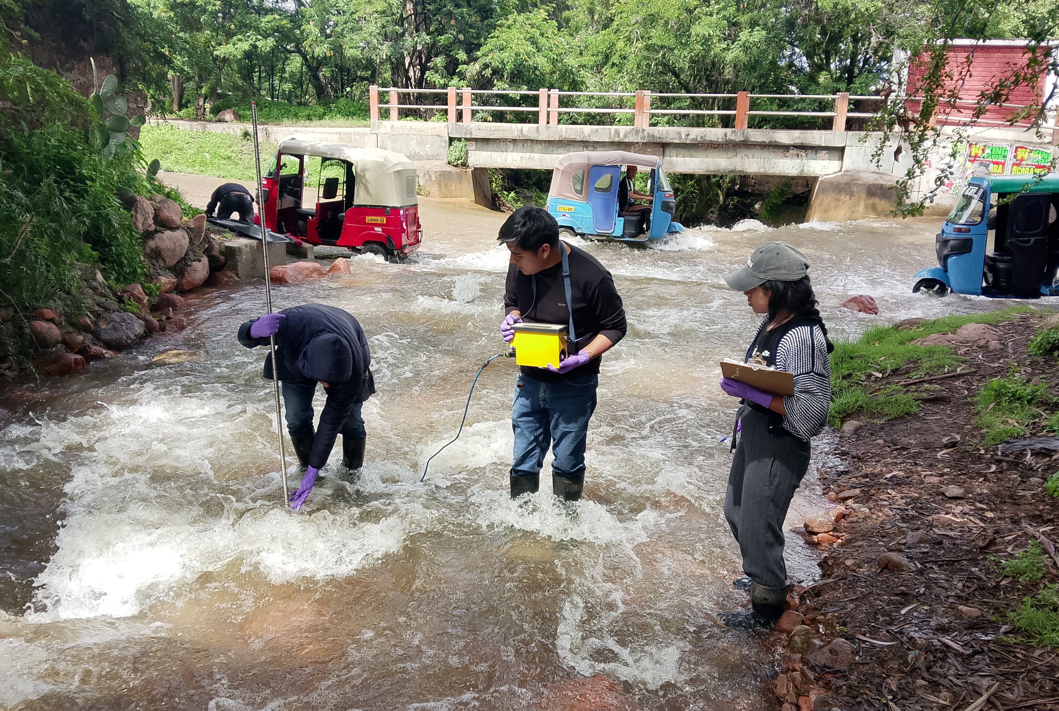
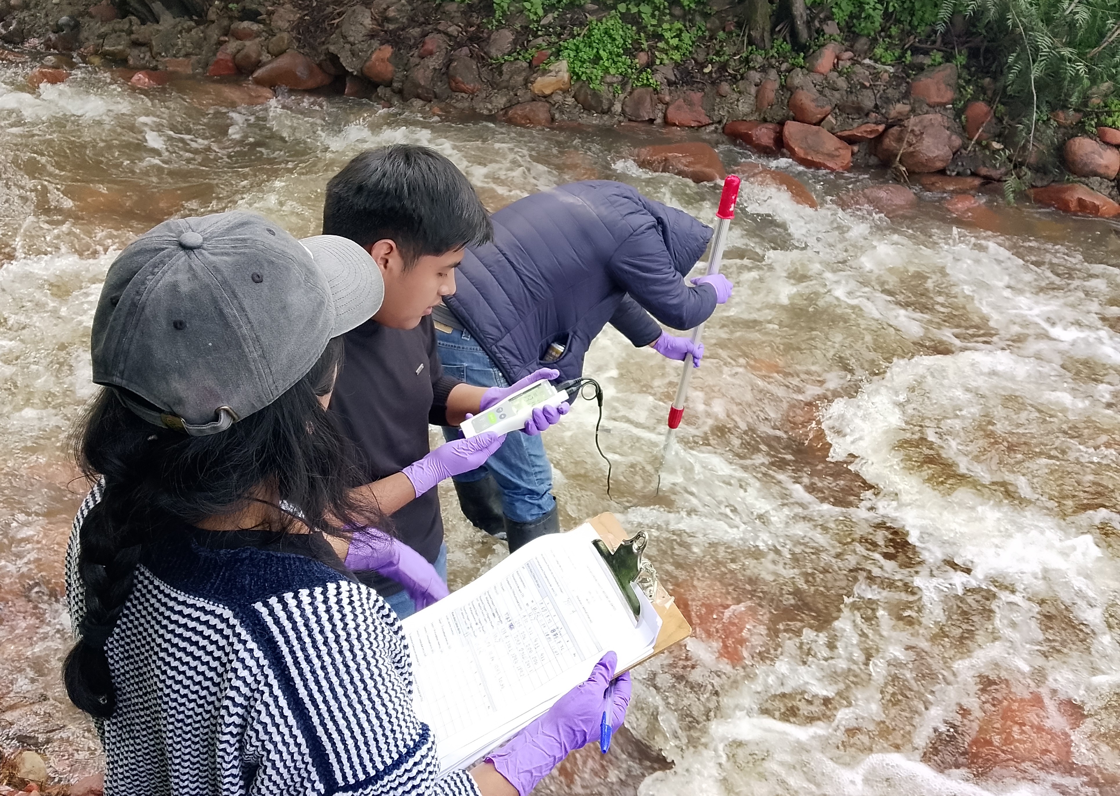
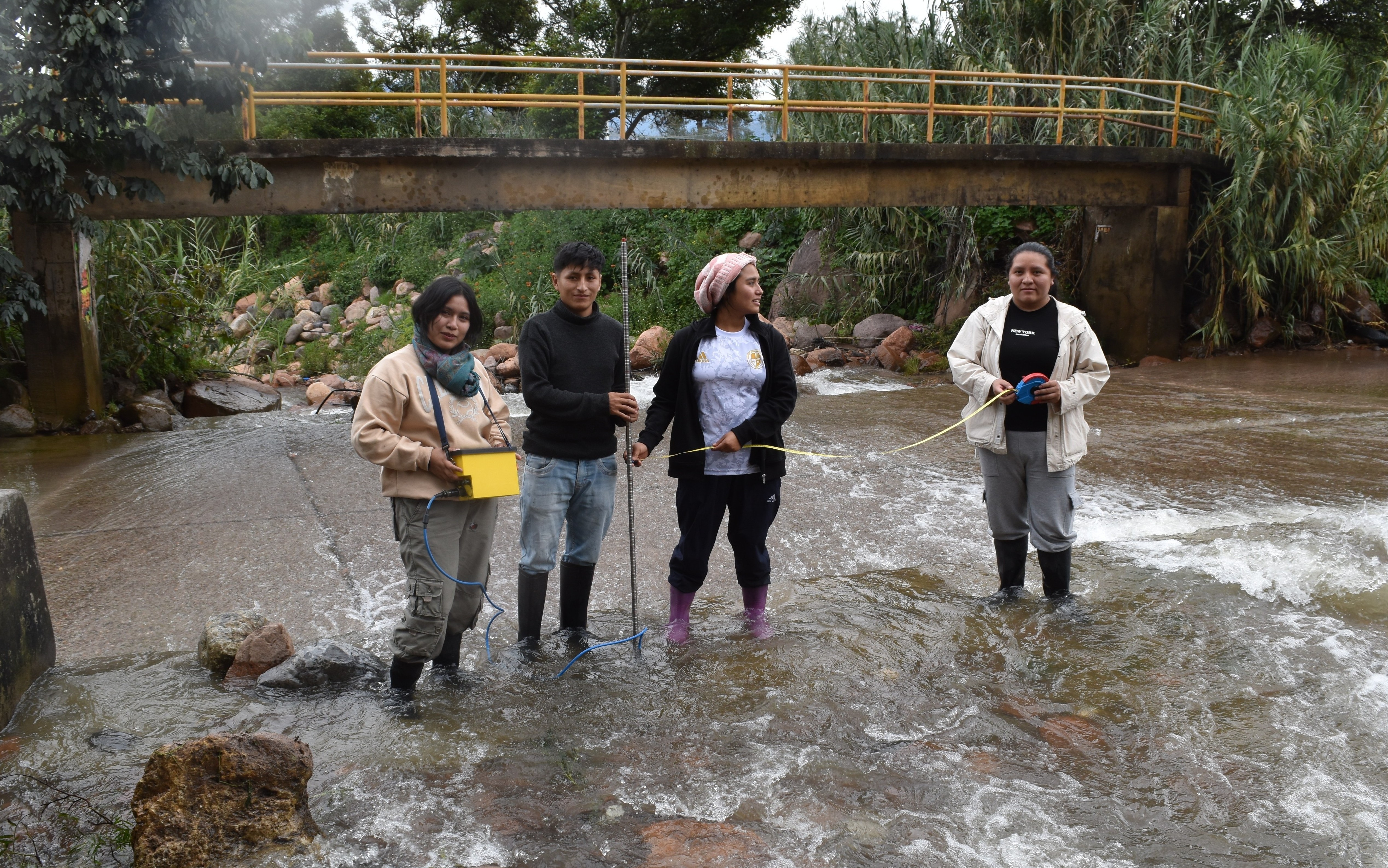
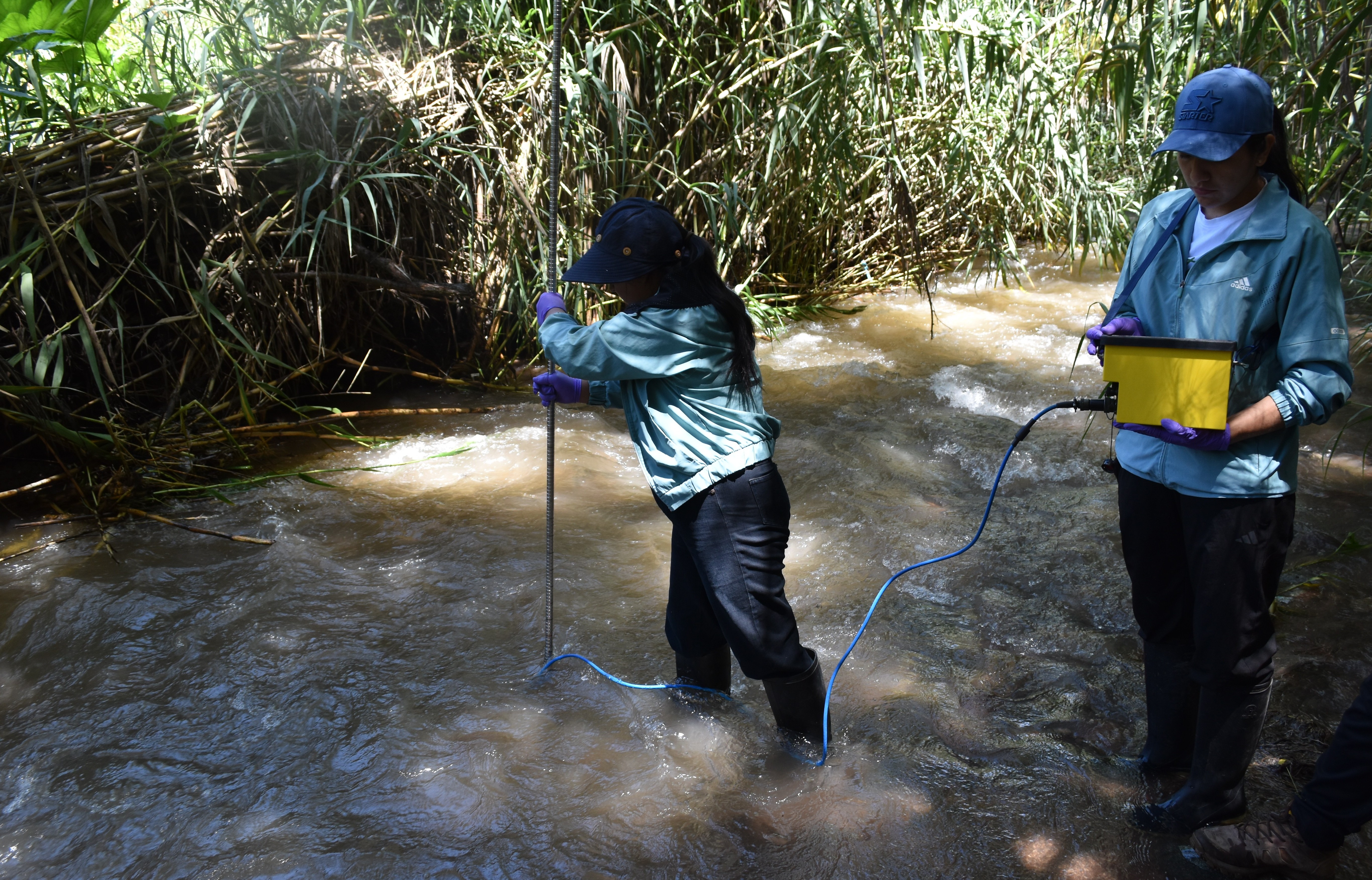
Students in the field / Estudiantes en el campo
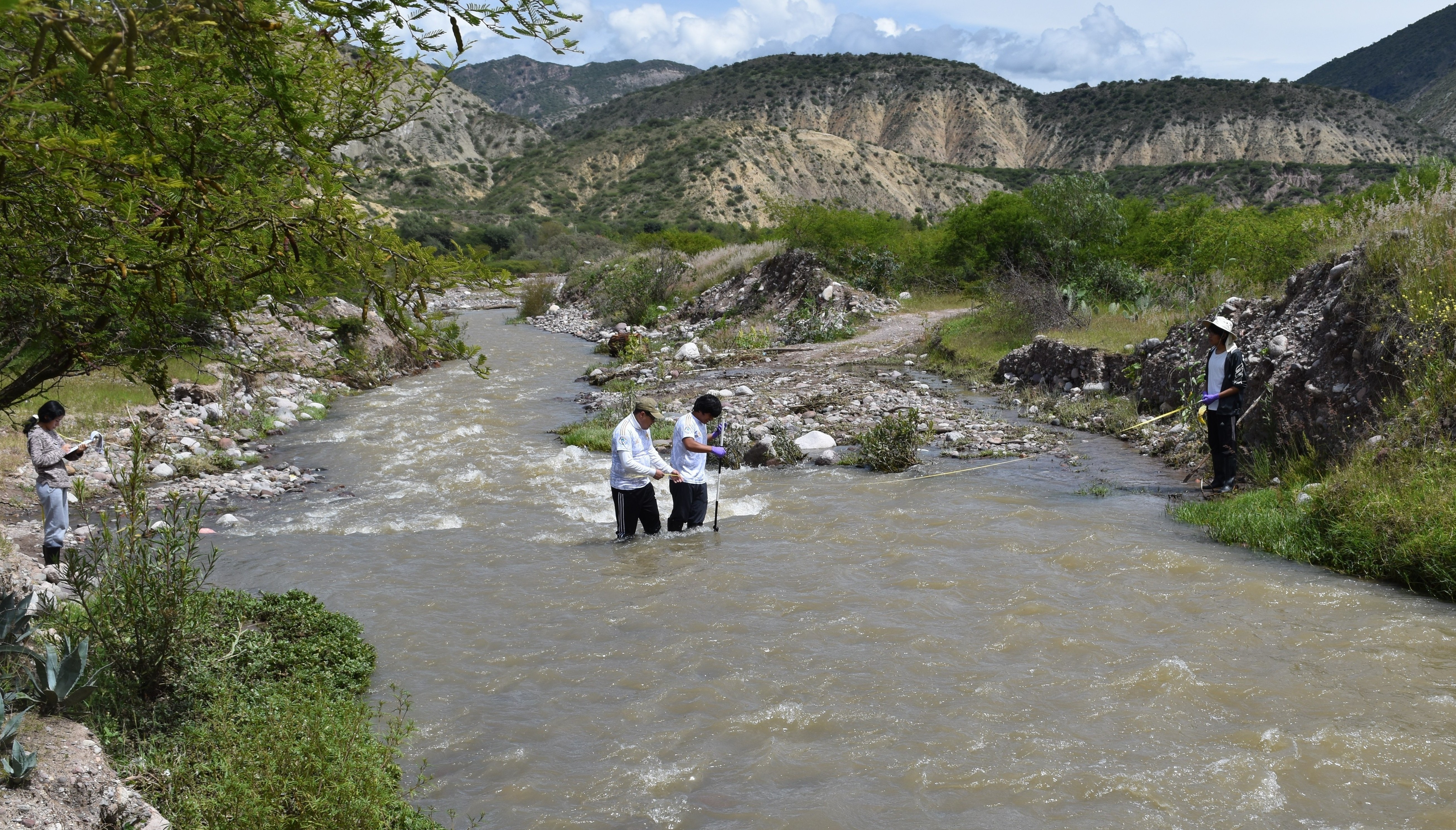
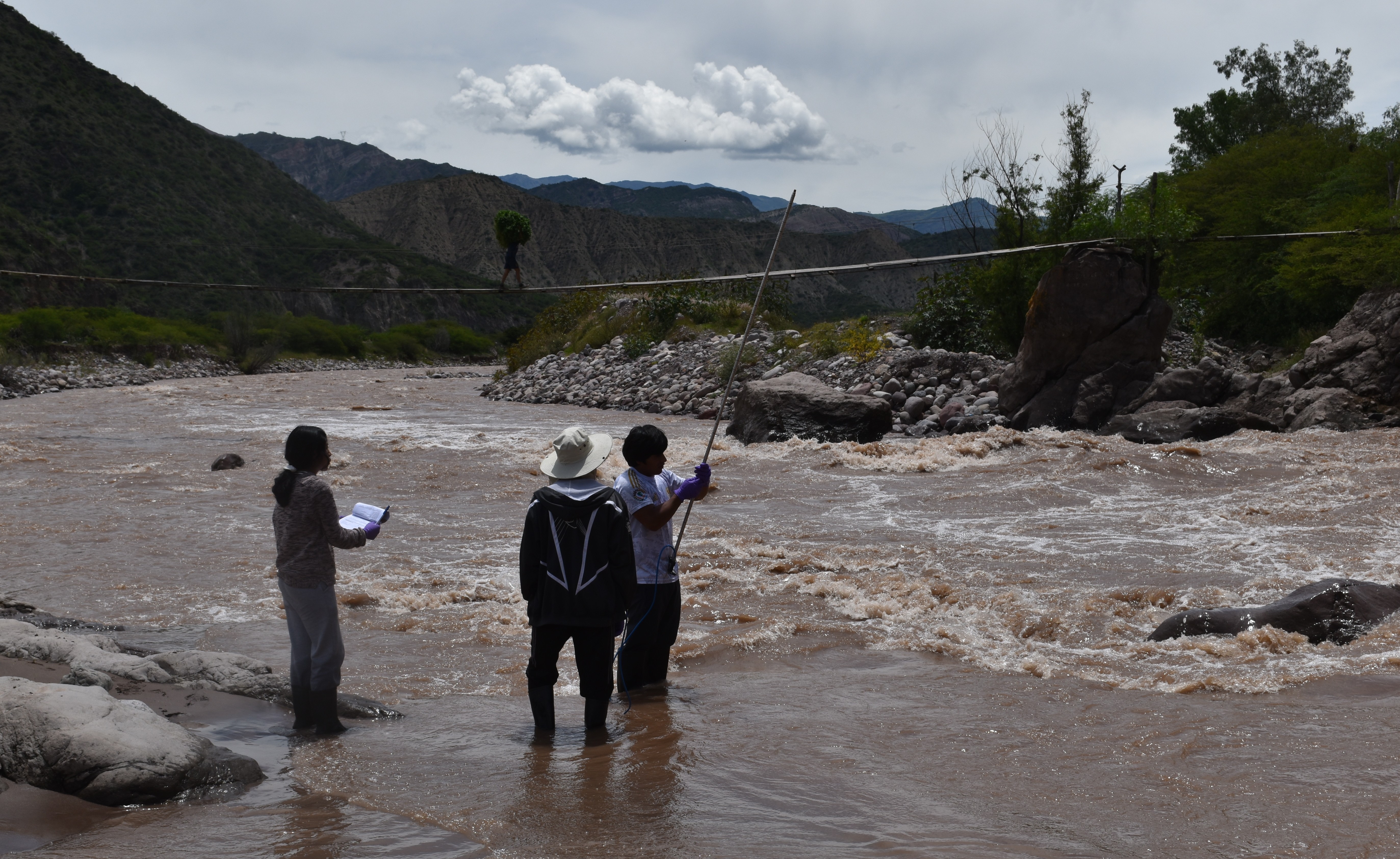
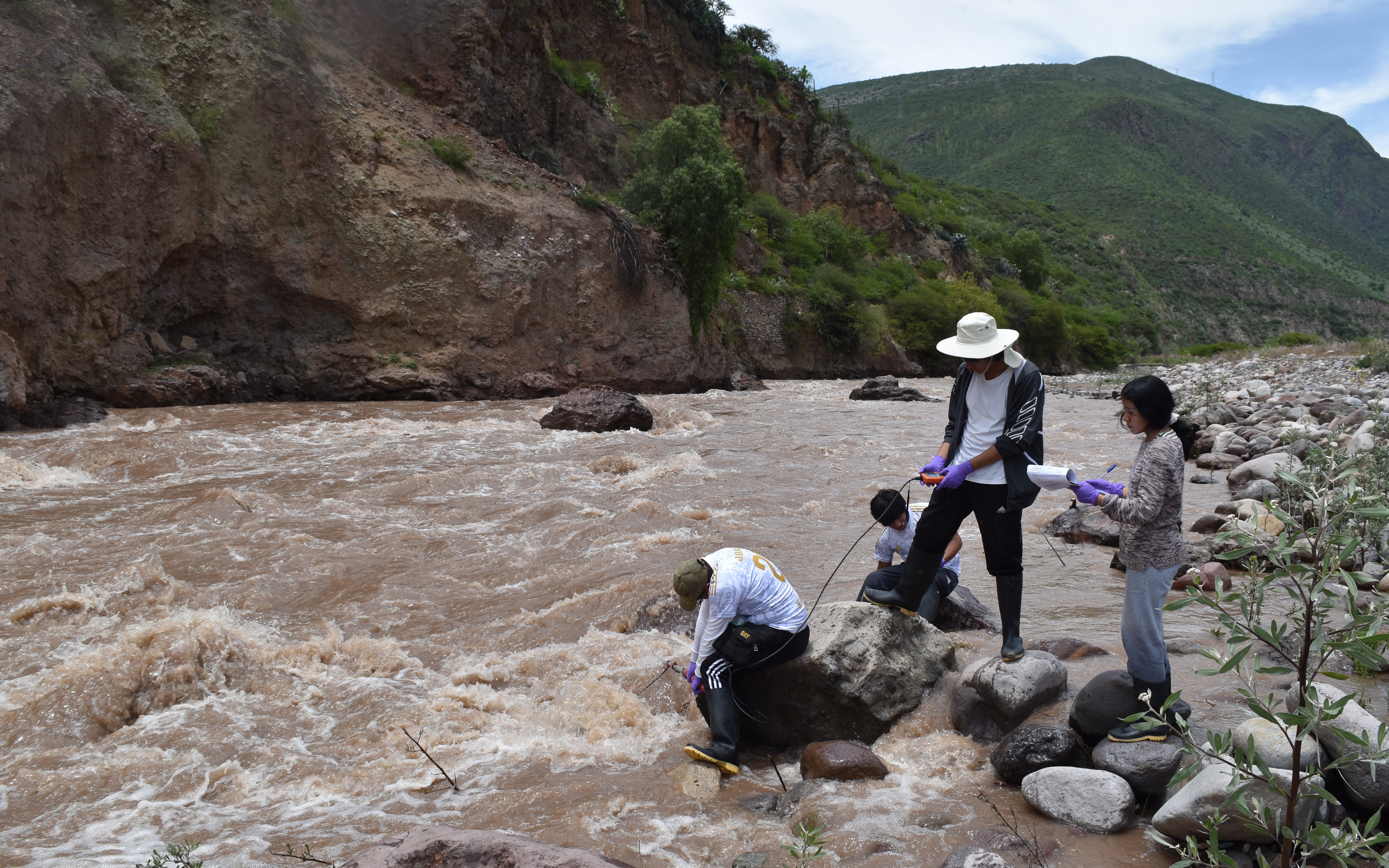
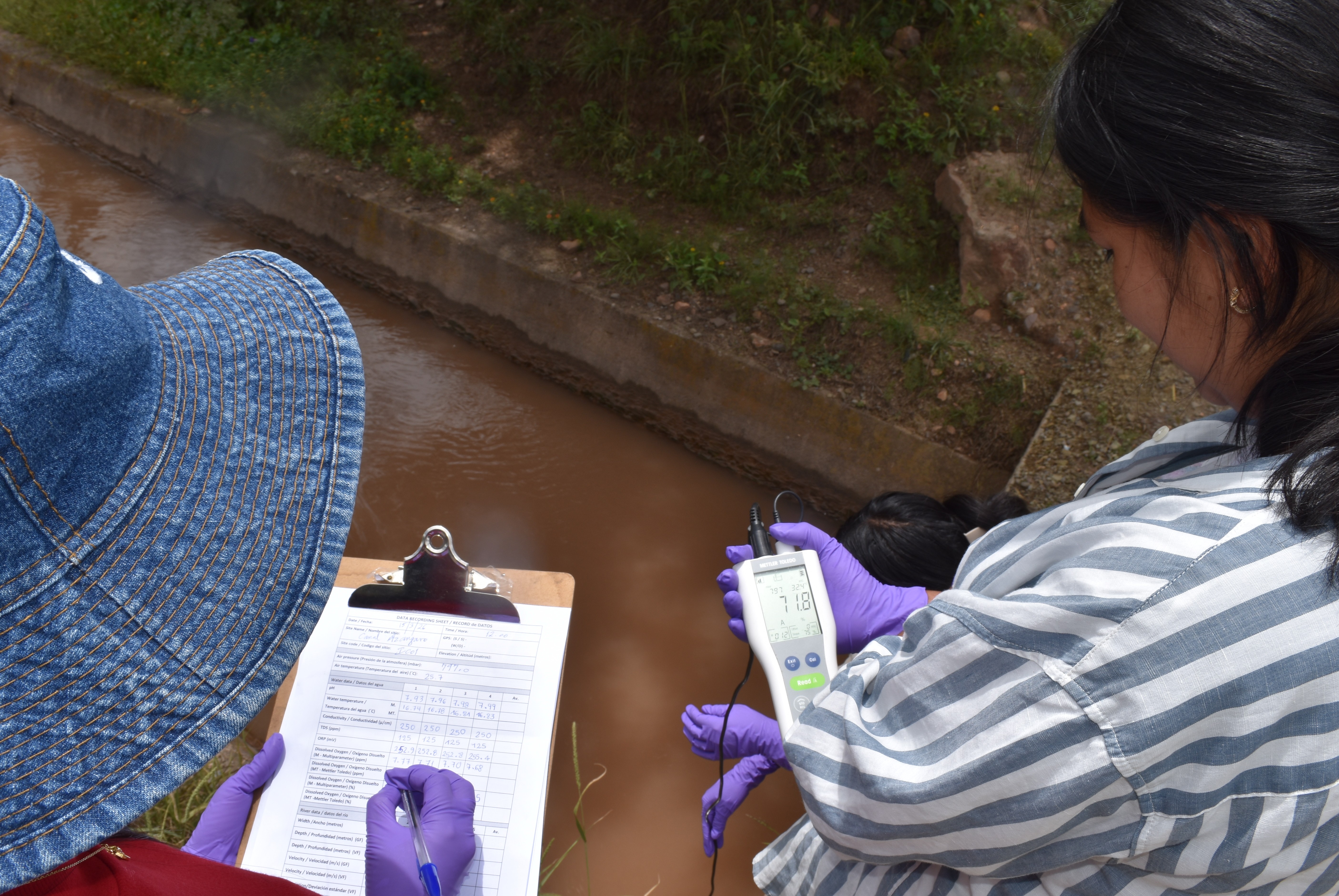
UNAH staff and students went in to the field on several days to collect water samples as well as water quality and water channel characteristic data at each site. This data will be used to establish a water quality database which UNAH can continue to develop. Despite being on holiday, there were plenty of student volunteers to participate in the trips. These trips are often the students first detailed experience of collecting detailed environmental data and samples in the field / Docentes y estudiantes de la UNAH salieron al campo durante varios días para recoger muestras de agua, así como datos sobre la calidad del agua y las características de los canales en cada sitio. Estos datos se utilizarán para crear una base de datos sobre la calidad del agua que la UNAH podrá seguir desarrollando. A pesar de estar de vacaciones, hubo muchos estudiantes voluntarios que participaron en las salidas. Estos viajes suelen ser la primera experiencia concreta que tienen los estudiantes en la recopilación de datos medioambientales detallados y la toma de muestras sobre el campo.
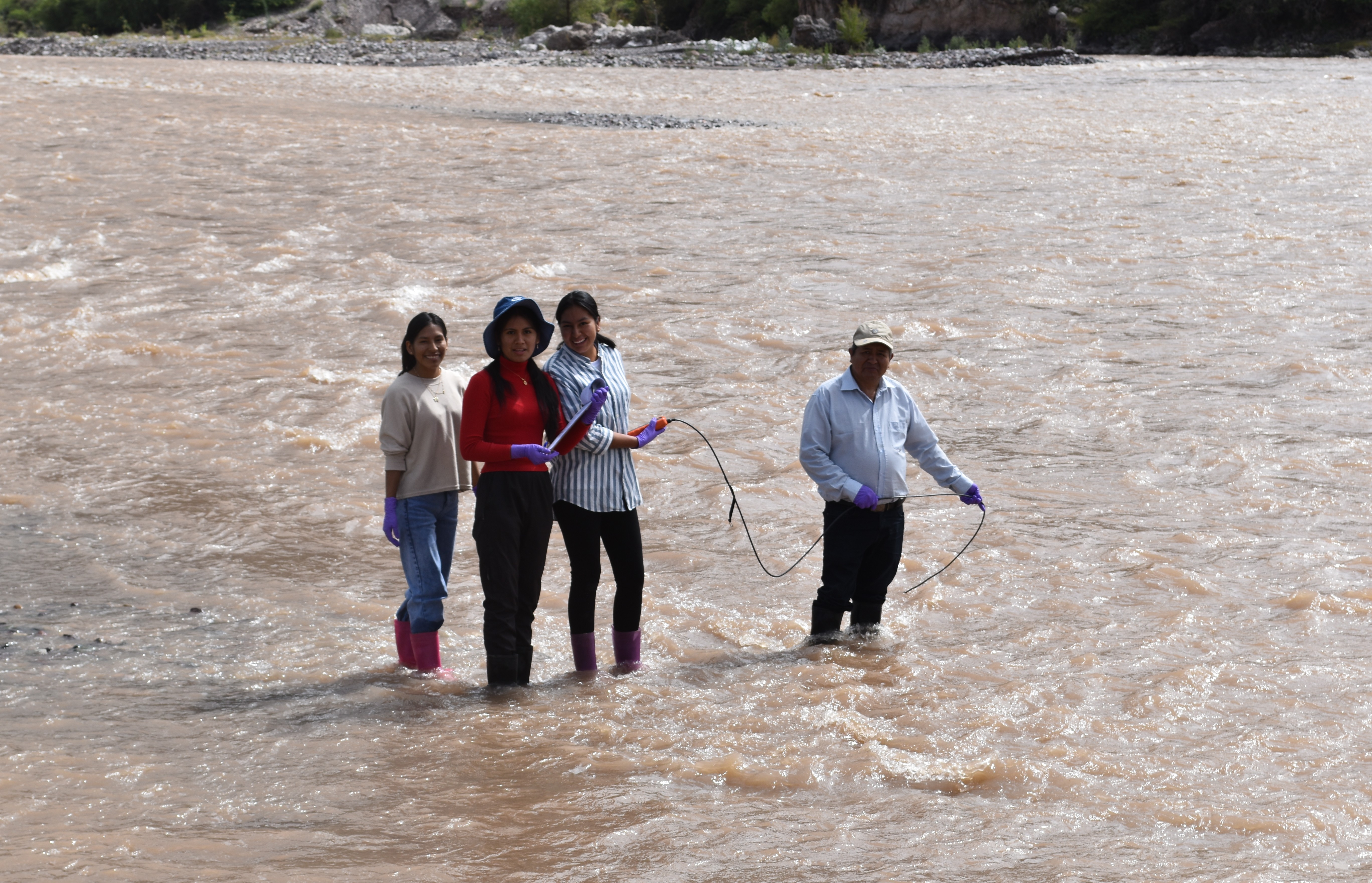
Dr Santos and students using a multiparameter at RC01 on the river Cachi with great care in-line with risk assessment procedures in the wide but shallow river. / Dr Santos y estudiantes usando un multiparametro en RC01 en el rio Cachi con mucho cuidado, siguiendo los procedimientos de evaluación de riesgos en el rio ancho pero poco profundo.
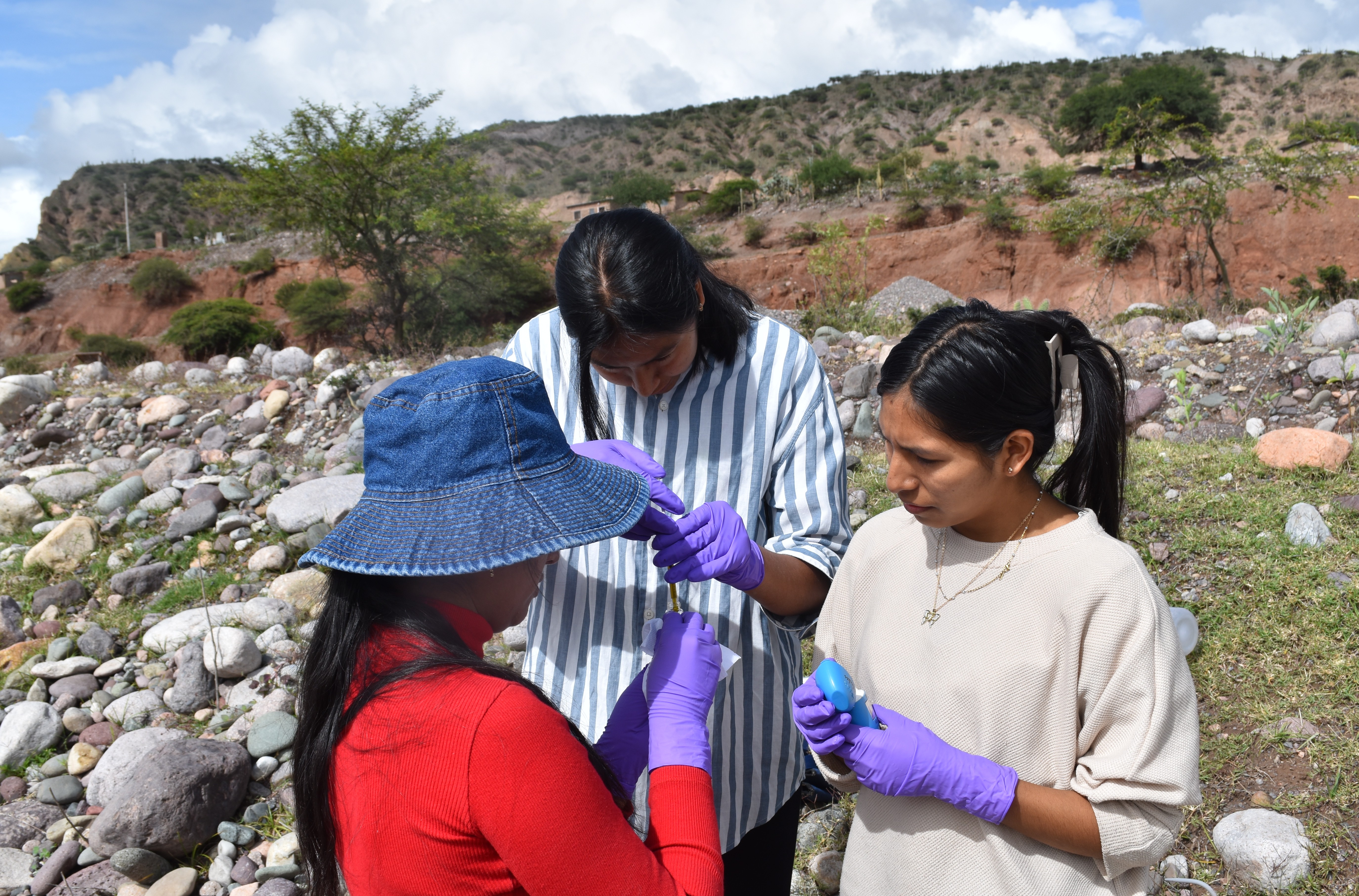
Students using a field tester at site RC01 on the river Cachi to analyse alkalinity levels in the water. / Estudiantes utilizando un medidor de campo en el sitio RC01 en el rio Cachi para analizar los niveles de alcalinidad del agua.
Students collecting water samples at site Q1.1, from the river Opanccay. / Los estudiantes recogiendo de muestras de agua en el sitio Q1.1, del rio Opanccay.
Students using a Valeport velocity meter to record the depth and velocity of the river at site Q1.1, river Opanccay. / Los estudiantes utilizan un medidor de velocidad Valeport para registrar la profundidad y la velocidad del río en el sitio Q1.1, rio Opanccay.
Students using a Valeport velocity meter to record the depth and velocity of the river at site Q1.2N, just upriver from the ford on the river Luricocha. / Los estudiantes utilizan un medidor de velocidad Valeport para registrar la profundidad y la velocidad del rio en el sitio Q1.2N, rio arriba del baden en el río Luricocha.
Students using a Mettler Toledo FiveGo meter to record dissolved oxygen levels in the water at site Q1.2N, river Luricocha. / Los estudiantes utilizando un medidor FiveGo de Mettler Toledo para registrar los niveles de oxígeno disuelto en el agua en el sitio Q1.2N, río Luricocha.
Students using a Valeport velocity meter to record the depth and velocity of the riverr at site Q1.2S, just above the ford, on the river Opanccay. / Los estudiantes utilizan un medidor de velocidad Valeport para registrar la profundidad y la velocidad del rio en Q1.2S, poco rio arriba del baden en el rio Opanccay.
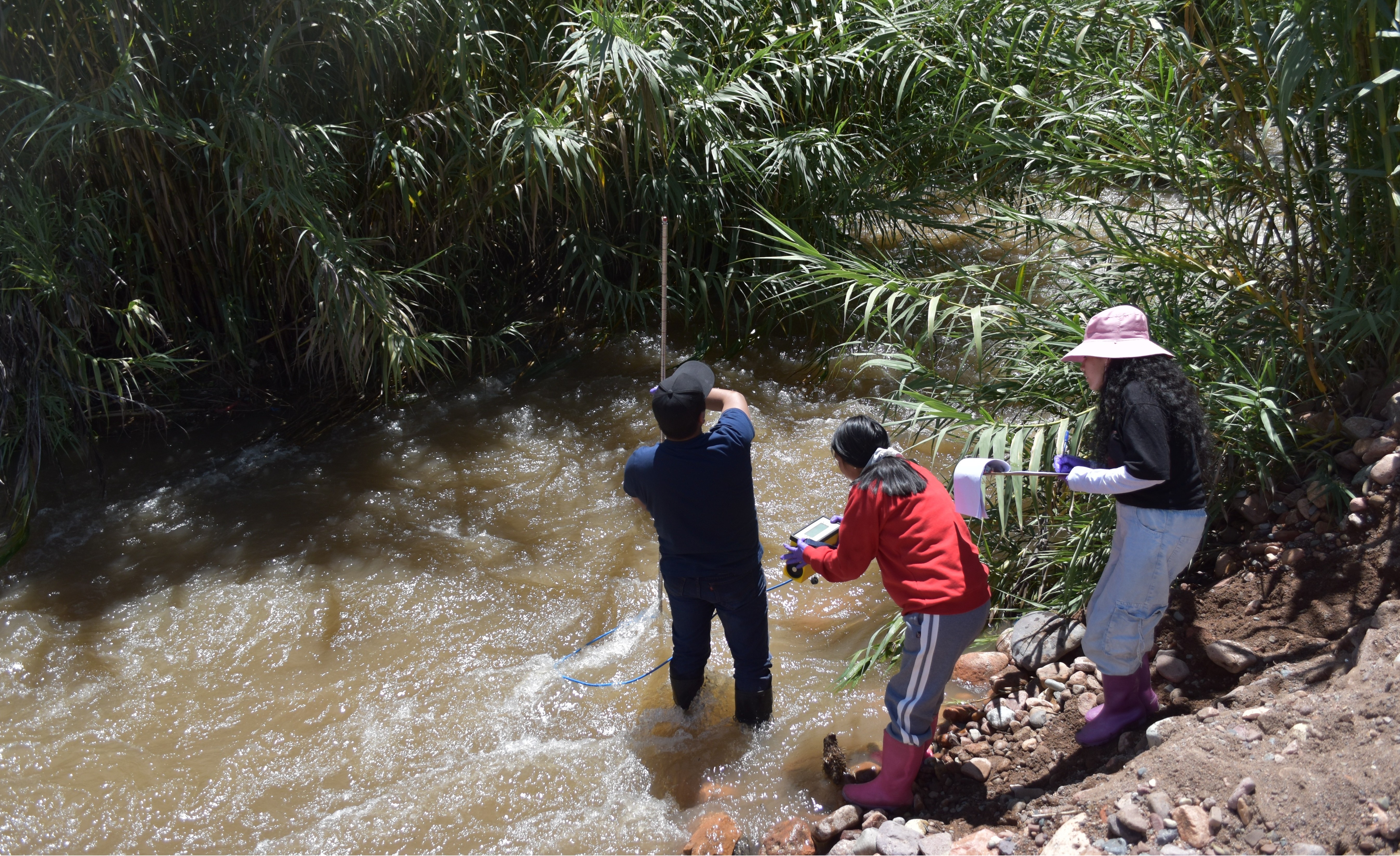
Students using a Valeport velocity meter to record the depth and velocity of the river at site Q2.1, on the river Huanta. / Los estudiantes utilizan un medidor de velocidad Valeport para registrar la profundidad y la velocidad del rio en el sitio Q2.1, en el río Huanta.
Students collecting water samples at site Q2.2L1, from the river Huanta. / Los estudiantes recogiendo de muestras de agua en el sitio Q2.2L1, del rio Huanta.
Students using a multiparameter at site Q3.2, on the river Chihua. / Los estudiantes usando un multiparametro en Q3.2, en el rio Chihua.
Students using a Valeport velocity meter to record the depth and velocity of the river Cachi at RC02 (note the man crossing the bridge). / Los estudiantes utilizan un medidor de velocidad Valeport para registrar la profundidad y la velocidad del rio Cachi en el sitio RC02 (Nota el hombre cruzando el puente).
Students using a multiparameter at site RC02, on the river Cachi. / Los estudiantes usando un multiparametro en RC02, en el rio Cachi.
Students using a Mettler Toledo FiveGo meter to record dissolved oxygen levels in the water of the main irrigation canal at IC01. / Los estudiantes utilizando un medidor FiveGo de Mettler Toledo para registrar los niveles de oxígeno disuelto en el agua en el canal de irrigacion grande, en el sitio IC01.
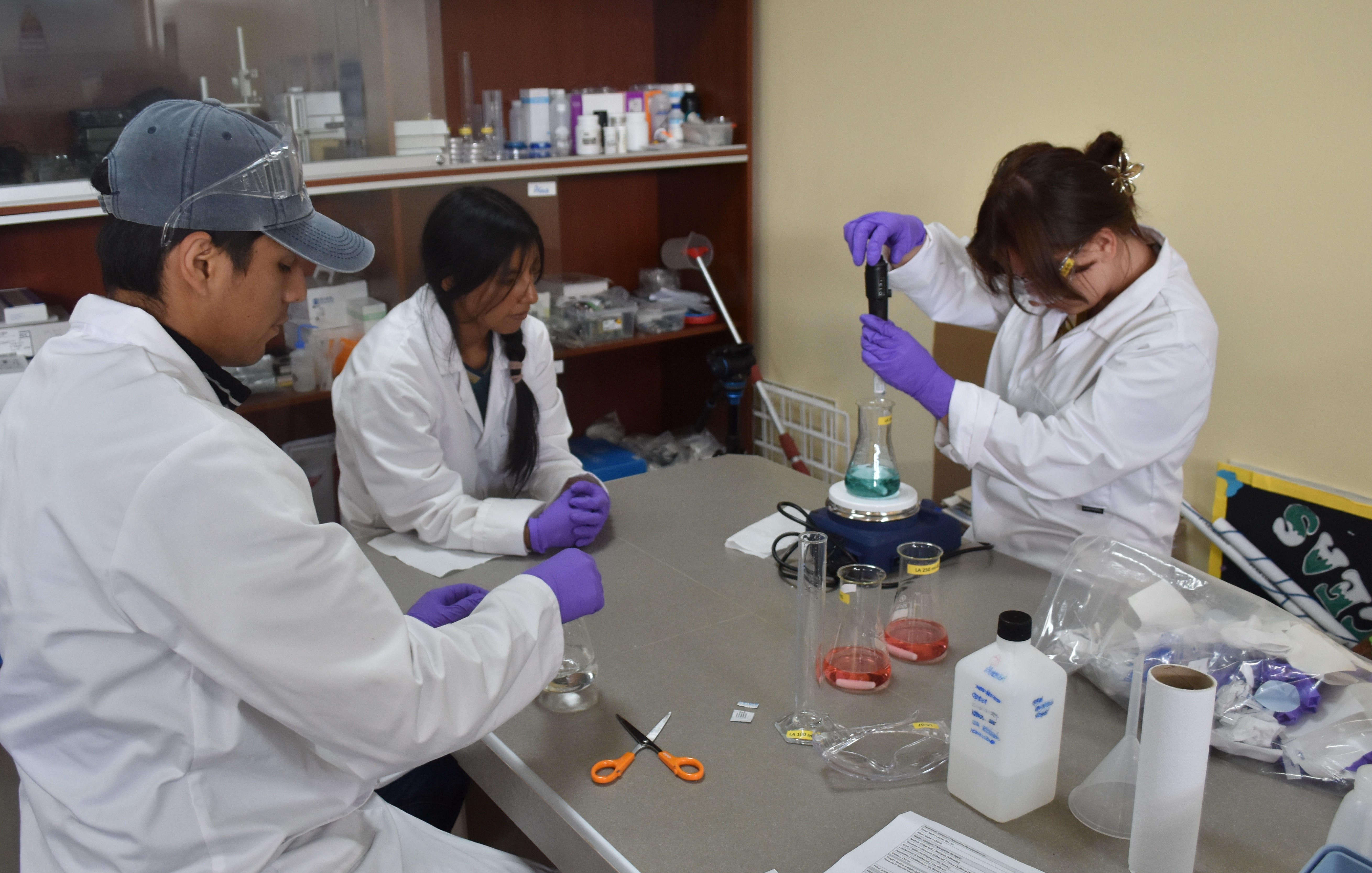
Students in the laboratory / Estudiantes en el laboratorio
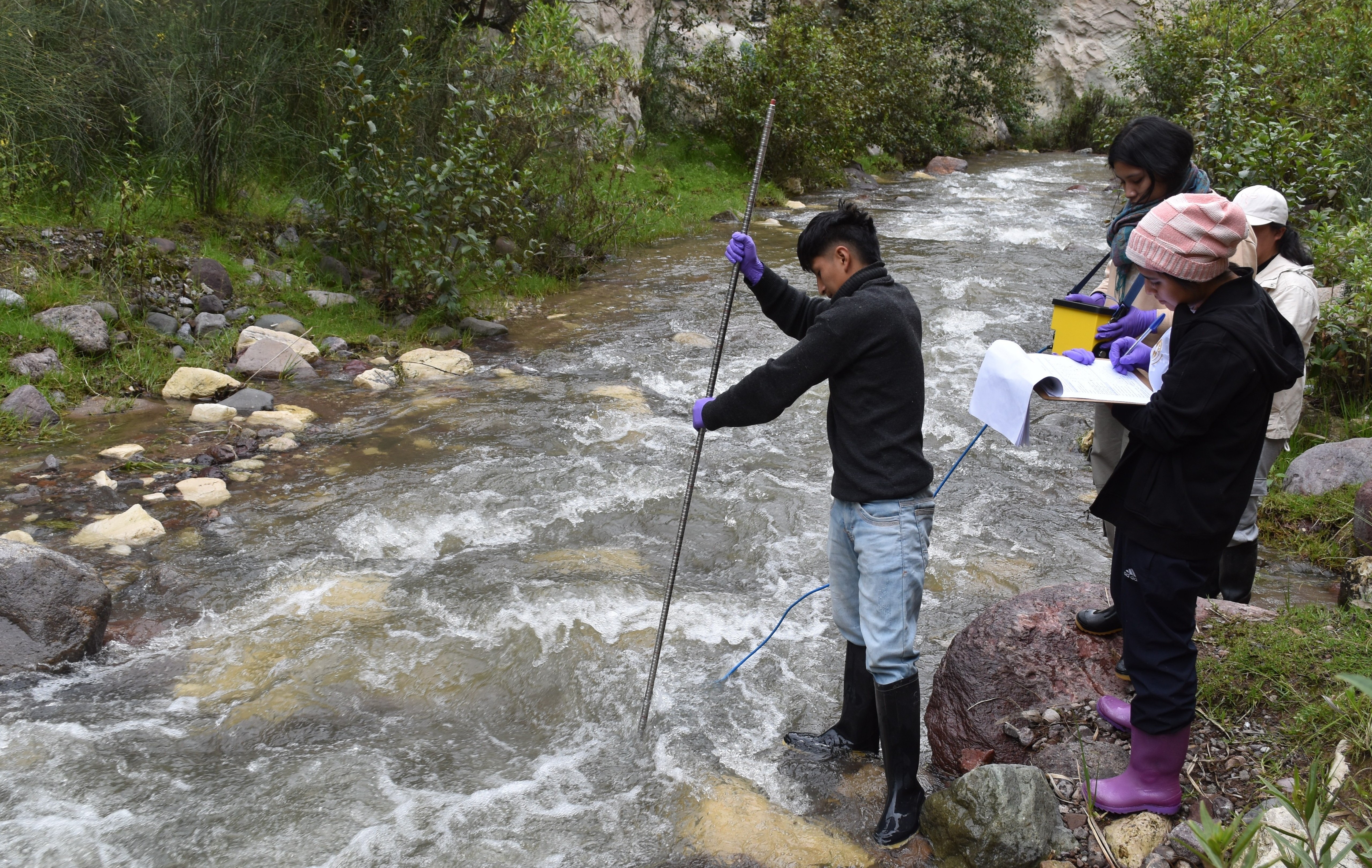
On returning to the laboratory, UNAH staff and students prepared the water samples for further analysis for coliformes, metals, etc at a later date. They then analysed the water samples for alkalinity using a couple of different techniques / Al regresar al laboratorio, los docentes y estudiantes de la UNAH prepararon las muestras de agua para su posterior análisis de coliformes, metales, etc. Sin embargo, sí analizaron la alcalinidad del agua utilizando un par de técnicas diferentes.
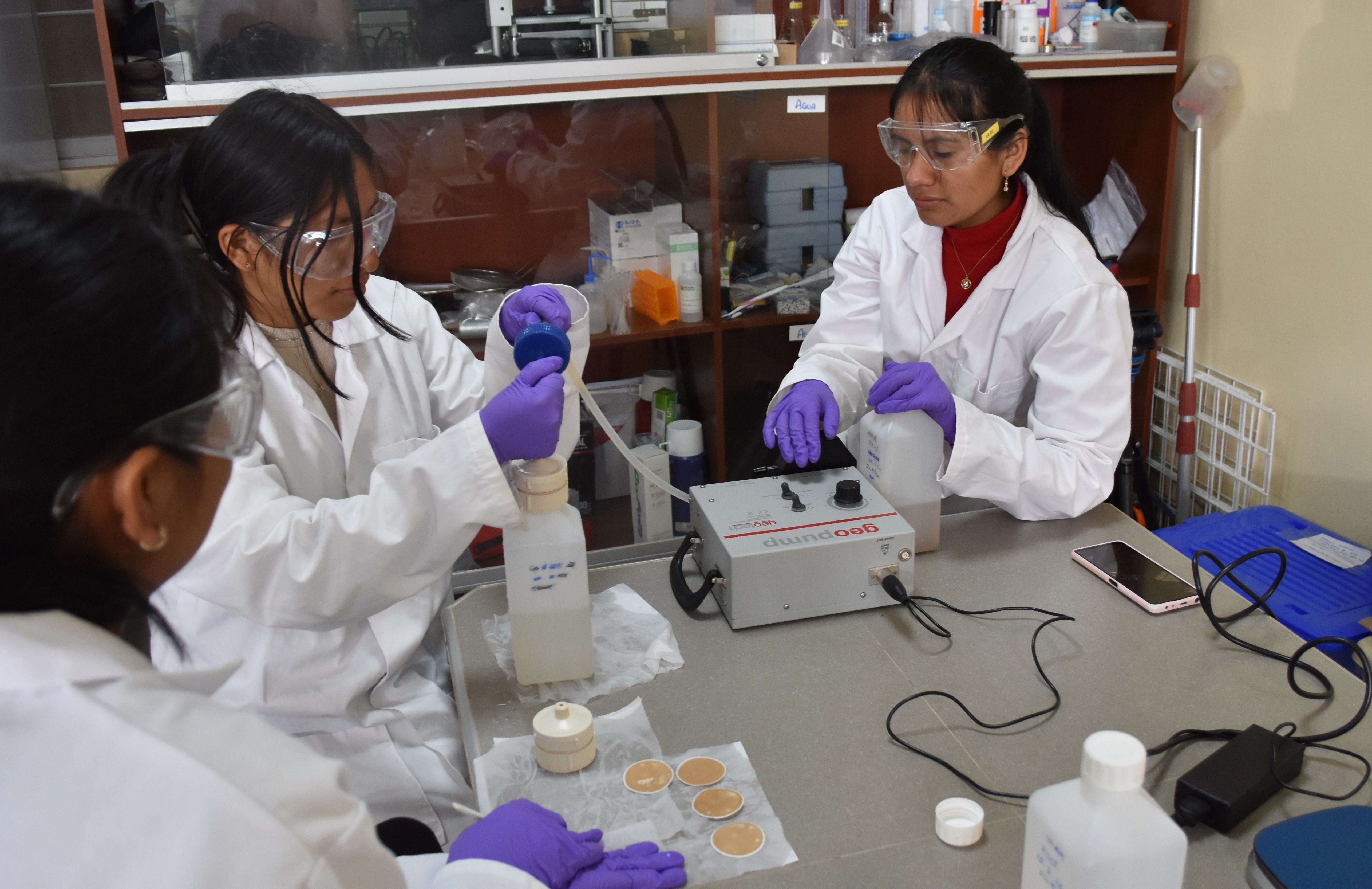
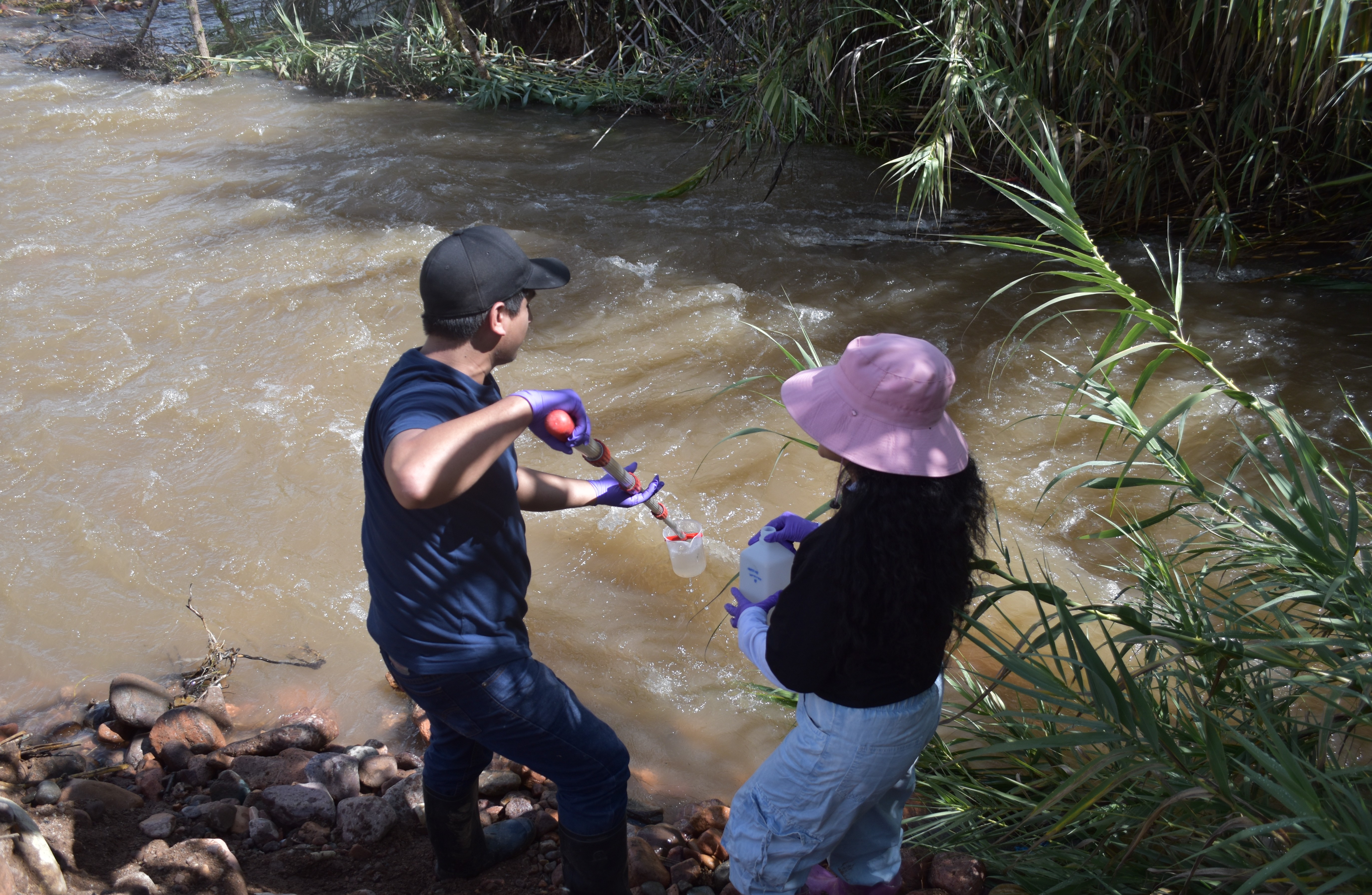
UNAH students using the Geopump to filter a water sample prior to further analysis. / Un docente y estudiantes de la UNAH utilizando la Geobomba para filtrar una muestra de agua antes de su posterior análisis.
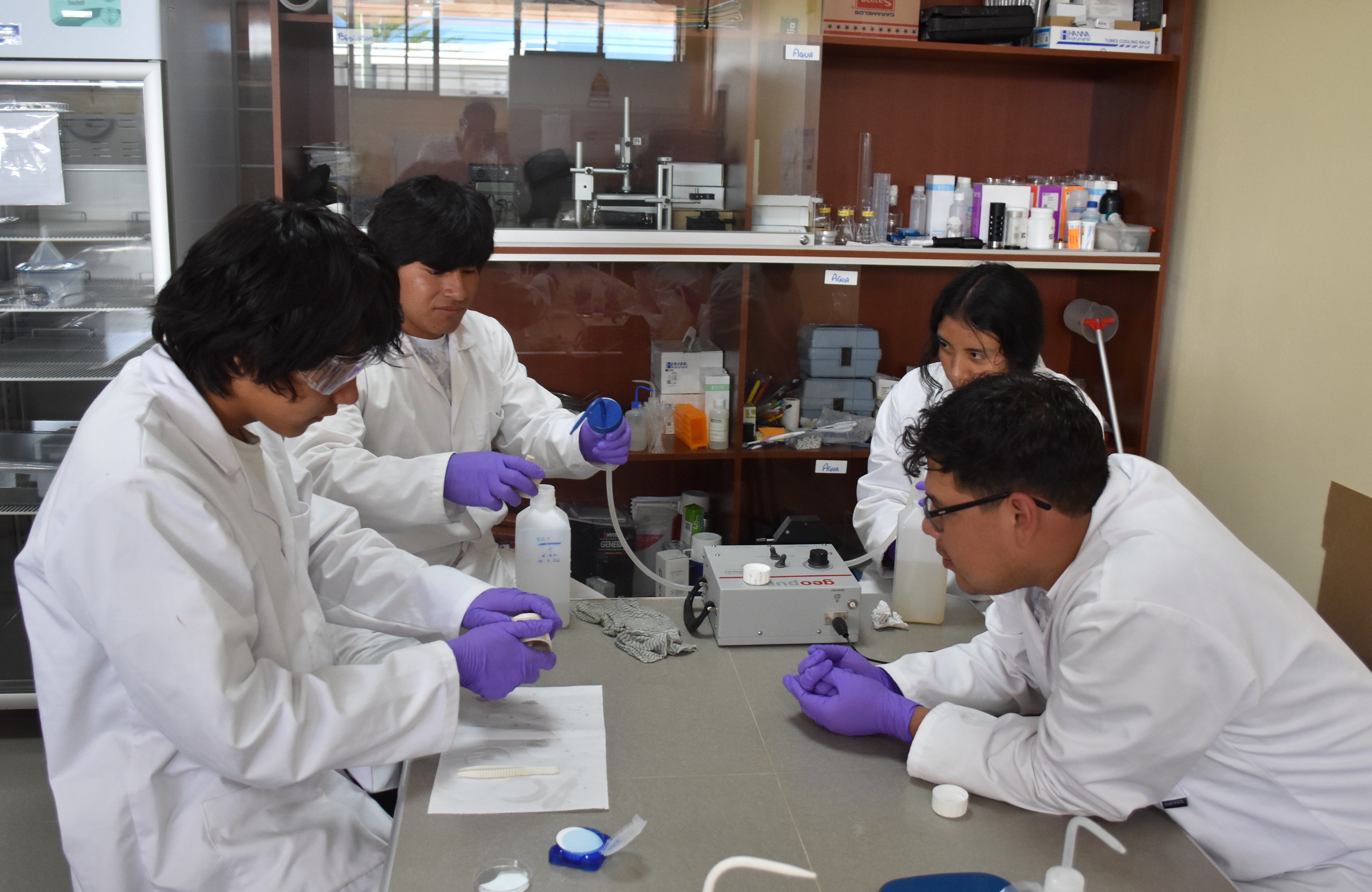
UNAH students using the Geopump to filter a water sample prior to further analysis. / Un docente y estudiantes de la UNAH utilizando la Geobomba para filtrar una muestra de agua antes de su posterior análisis.
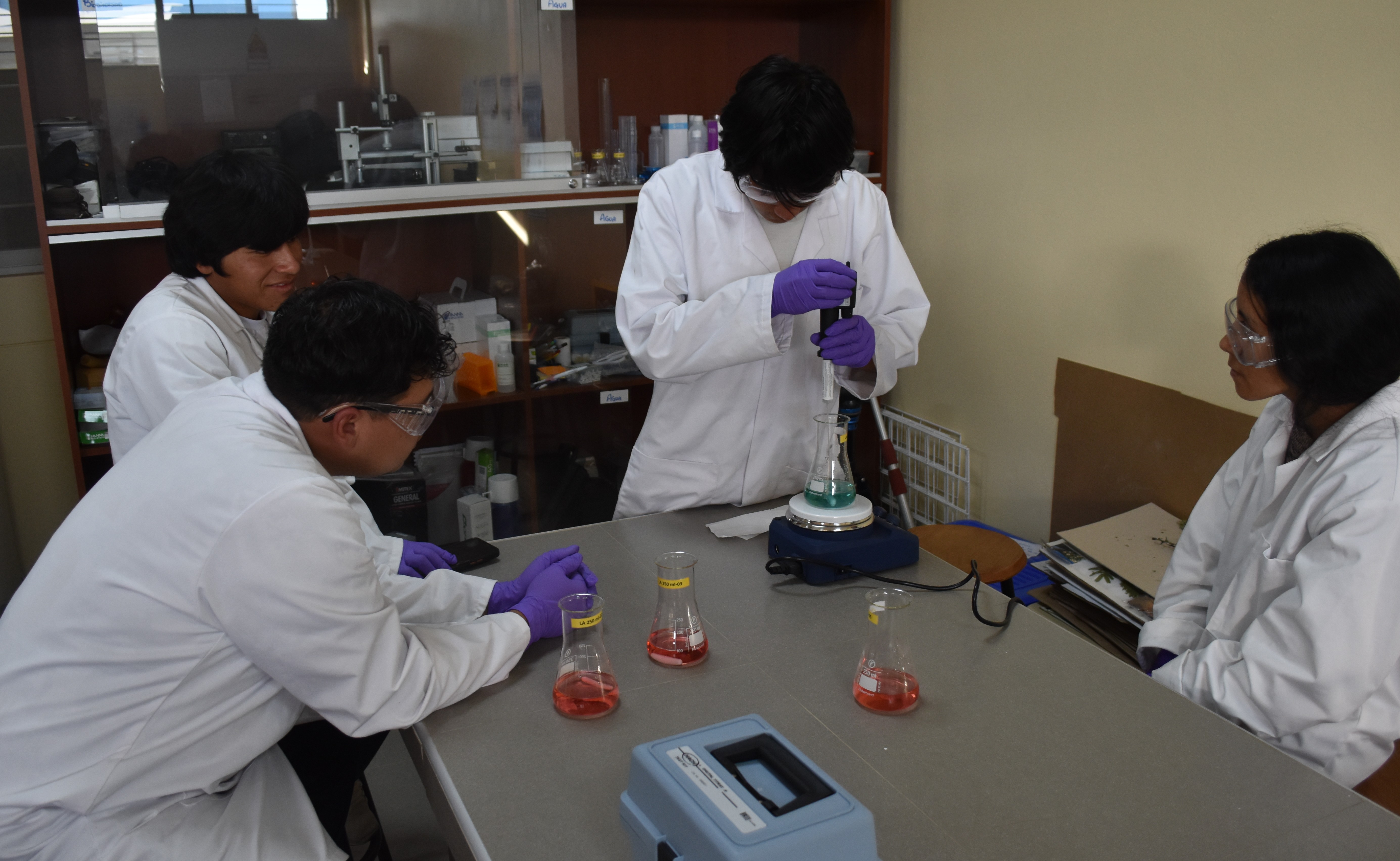
UNAH students carrying out titration to assess the alkalinity level of water sample. / Docentes y estudiantes de la UNAH realizando una titulación para evaluar el nivel de alcalinidad de una muestra de agua.
UNAH students carrying out titration to assess the alkalinity level of water sample. / Docentes y estudiantes de la UNAH realizando una titulación para evaluar el nivel de alcalinidad de una muestra de agua.
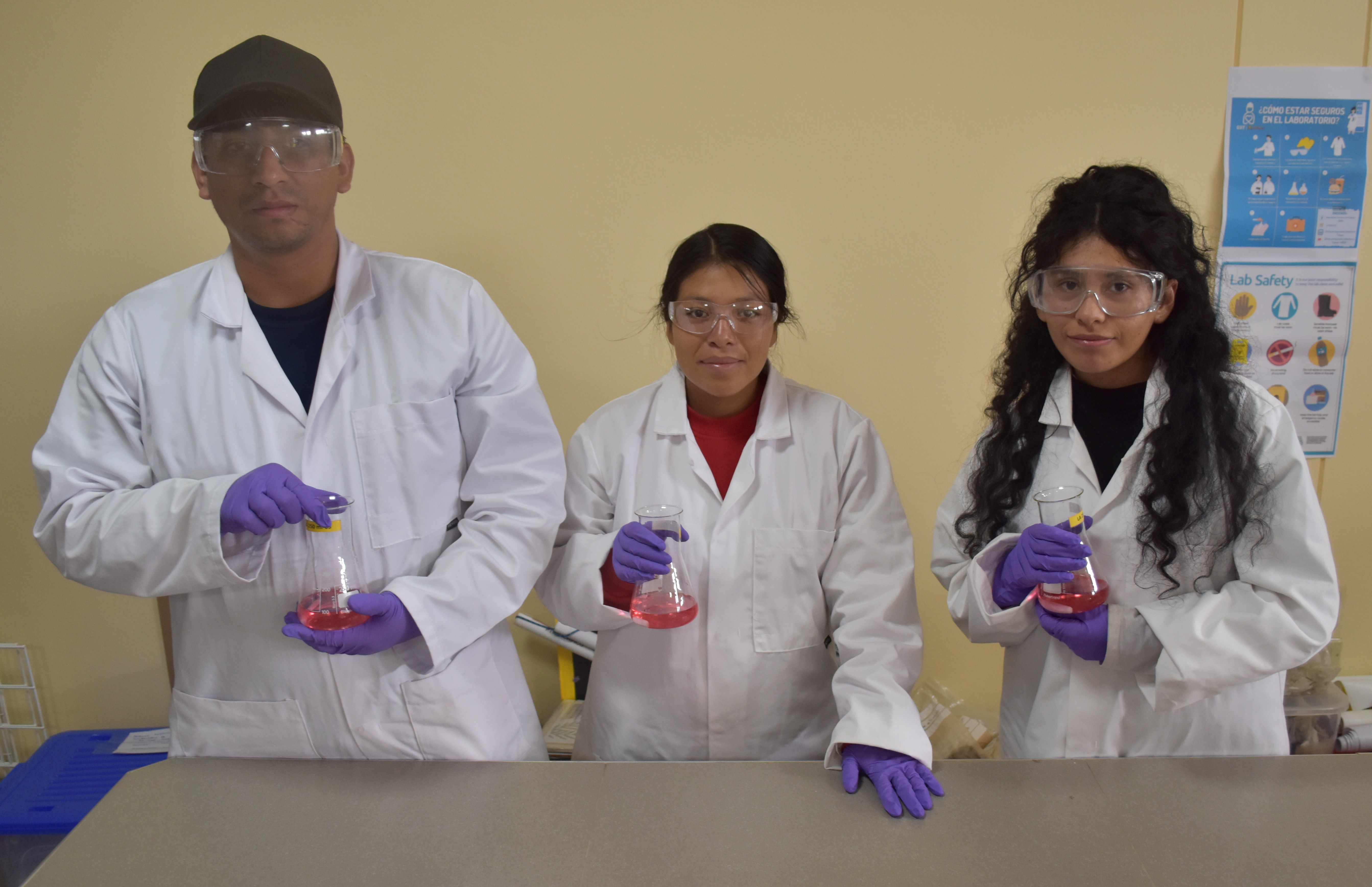
UNAH students holding the results of their titration to assess the alkalinity level of a water sample. / Los estudiantes de la UNAH con los resultados de su titulación para evaluar el nivel de alcalinidad de una muestra de agua.
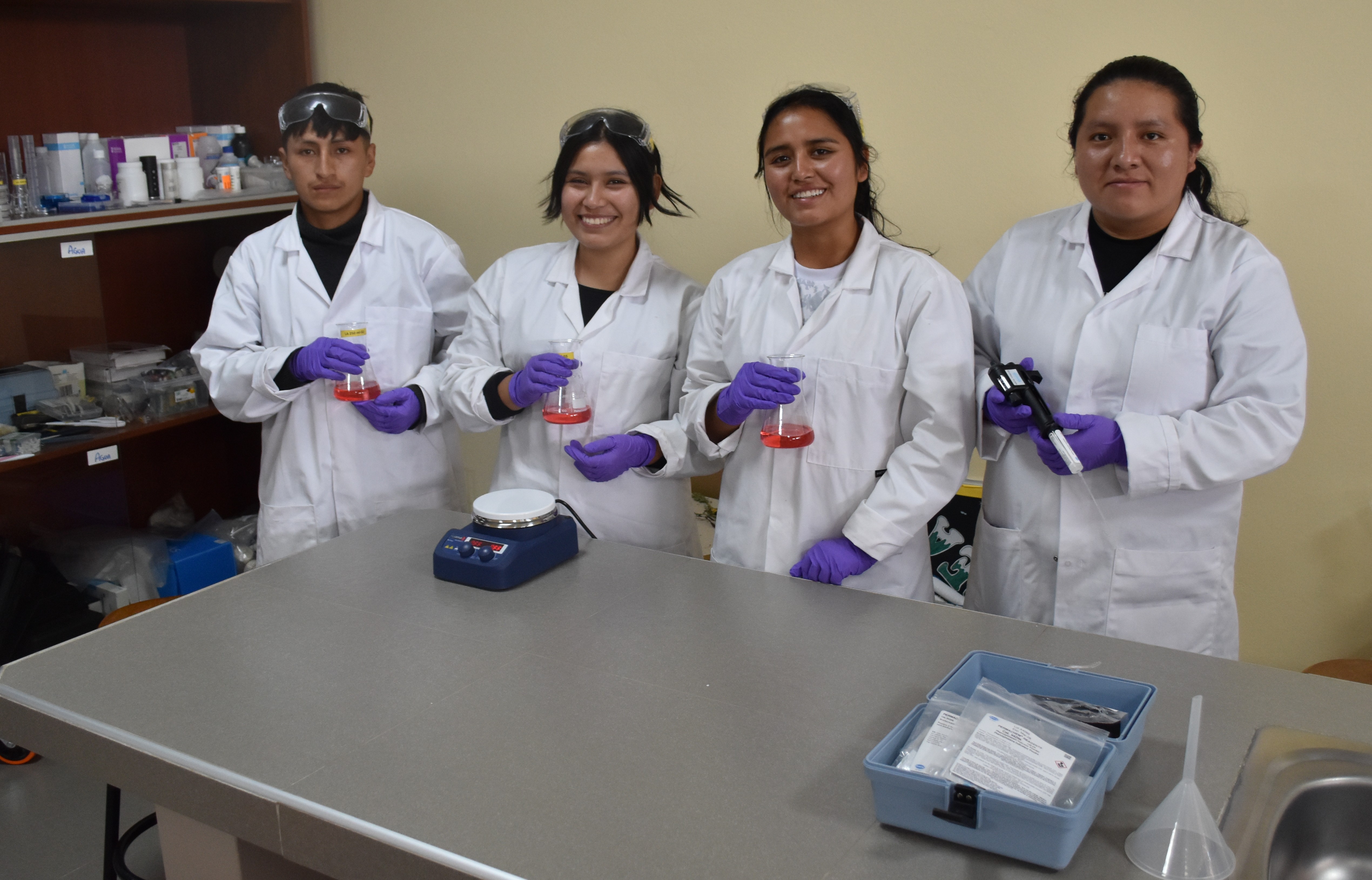
UNAH students holding the results of their titration to assess the alkalinity level of a water sample. / Los estudiantes de la UNAH con los resultados de su titulación para evaluar el nivel de alcalinidad de una muestra de agua.
Investigative River Walks
After ten visits to the four main river Cachi tributaries close to Huanta, further investigation was required to explain, for example, why there is often water flowing in the tributaries at their confluence with the river Cachi but the same tributaries are dry in their middle sections.
Four walks were conducted from a point where each descends from the sierra Razuhuillca towards the river Cachi - -River Luricocha: from above Luricocha to Recreo Napolis. -River Opanccay: from the Sirenaccayoc waterfall to Recreo Napolis. -River Huanta: from the Occachaca waterfall to San Luis. -River Chihua: from the old road bridge above Cangari to Cangari.
The main focus of the walks was to identify new inflows and outflows along these sections of each river which might explain the absence or presence of water. However, other aspects of change along their courses such as changes in natural vegetation, biodiversity and land use were also recorded. Any one of these variables could form the basis of more in depth studies.
Paseos de investigación por los ríos
Tras diez visitas a los cuatro principales afluentes del río Cachi cercanos a Huanta, se hizo necesario realizar más investigaciones para explicar, por ejemplo, por qué a menudo hay agua fluyendo en los afluentes en su confluencia con el río Cachi, pero esos mismos afluentes están secos en sus tramos intermedios.
Se realizaron cuatro caminatas desde distintos puntos en los que cada una desciende desde la sierra Razuhuillca hacia el río Cachi: -Río Luricocha: desde la parte alta de Luricocha hasta Recreo Nápoles. -Río Opanccay: desde la cascada de Sirenaccayoc hasta Recreo Nápoles. -Río Huanta: desde la cascada de Occachaca hasta San Luis. -Río Chihua: desde el antiguo puente de la carretera a Cangari hasta Cangari.
El objetivo principal de las caminatas era identificar nuevas entradas y salidas de agua a lo largo de estos tramos de cada río que pudieran explicar la ausencia o la presencia de agua. Sin embargo, también se registraron otros aspectos relacionados con los cambios a lo largo de sus cursos, tales como los cambios en la vegetación natural, la biodiversidad y el uso del suelo. Cualquiera de estas variables podría servir de base para estudios más detallados.
Walk 1 - River Luricocha
Start / Inicio: Bridge & Ford above Luricocha / El Puente y Baden sobre Luricocha
End / Termino: Recreo Napolis
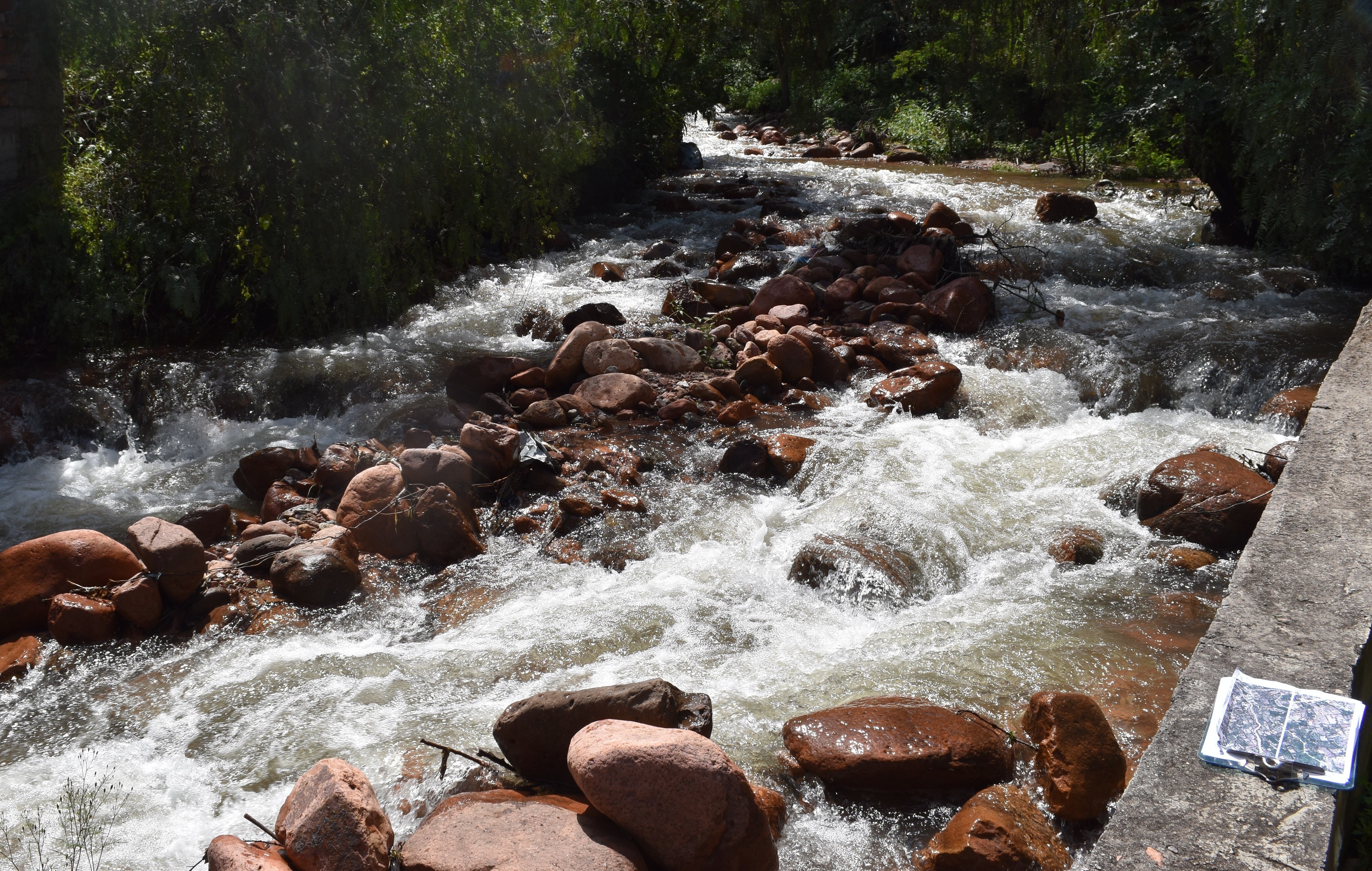
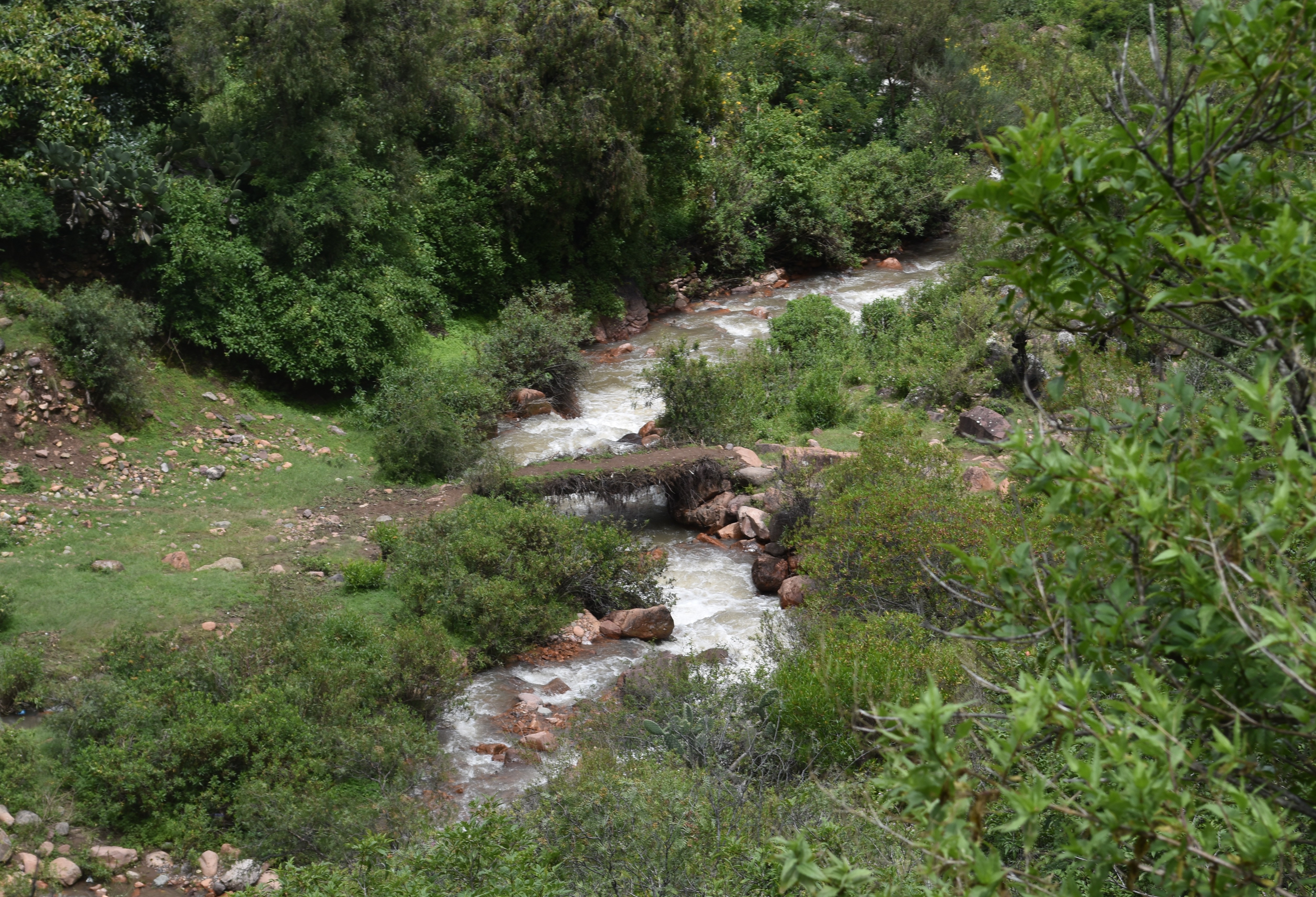
View downstream from the start point at the bridge and ford above Luricocha / Vista río abajo desde el punto de partida, en el puente y el baden situados río arriba de Luricocha. (Photo J.Forrest March 2026)
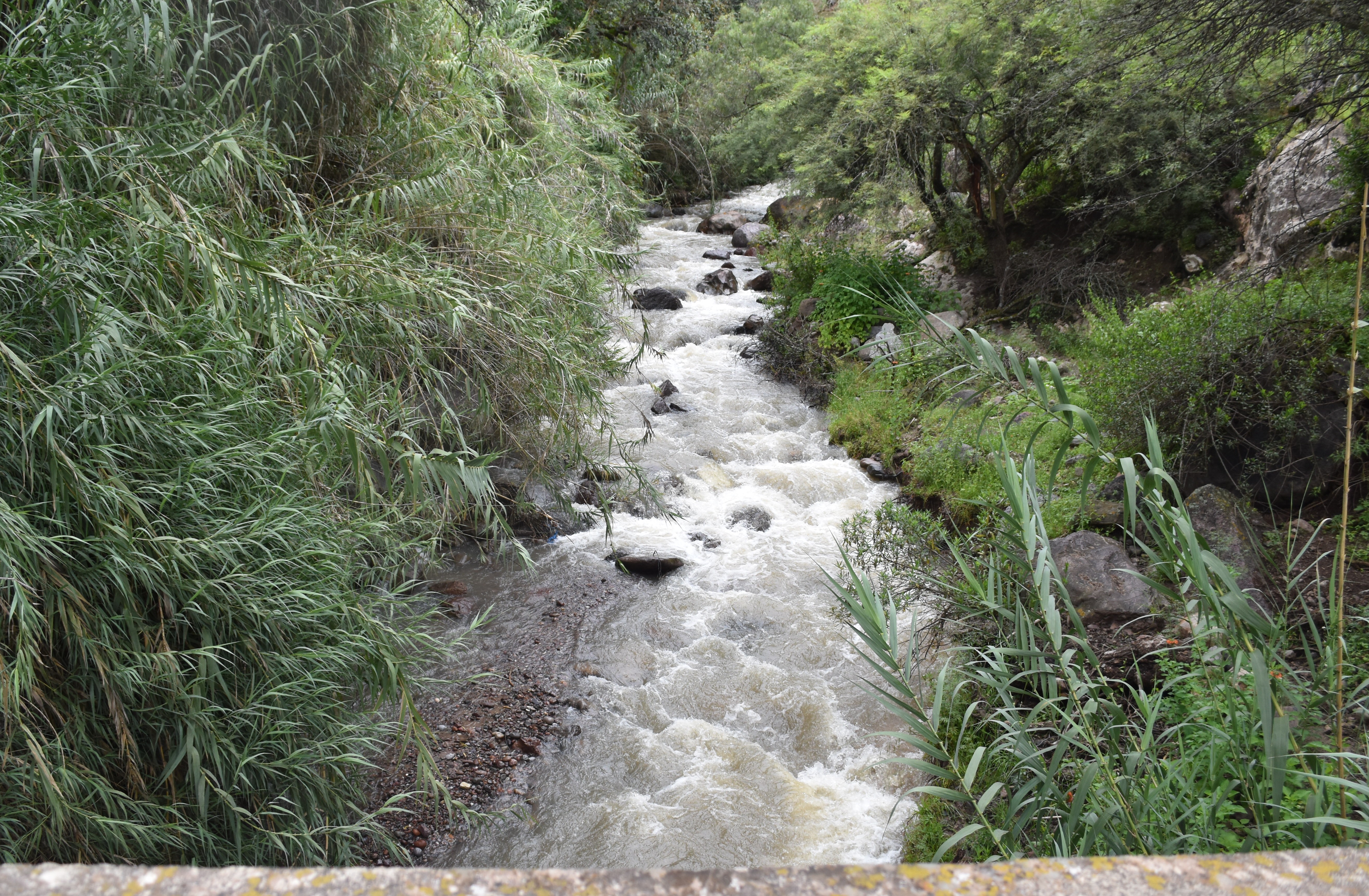
The river flowing passed Recreo El Negrito at Luricocha / El río que pasa por Recreo El Negrito, en Luricocha. (Photo J.Forrest March 2026)
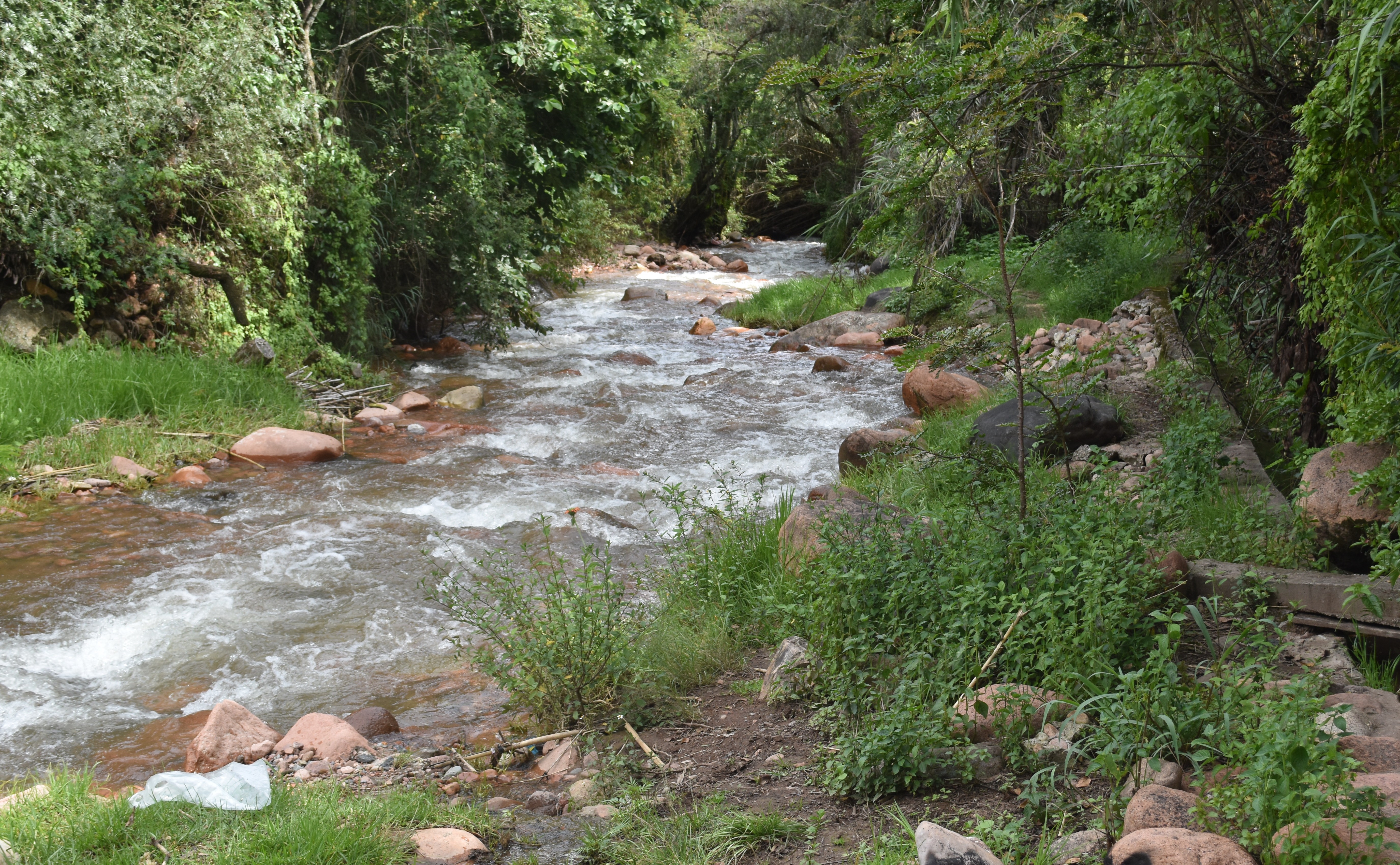
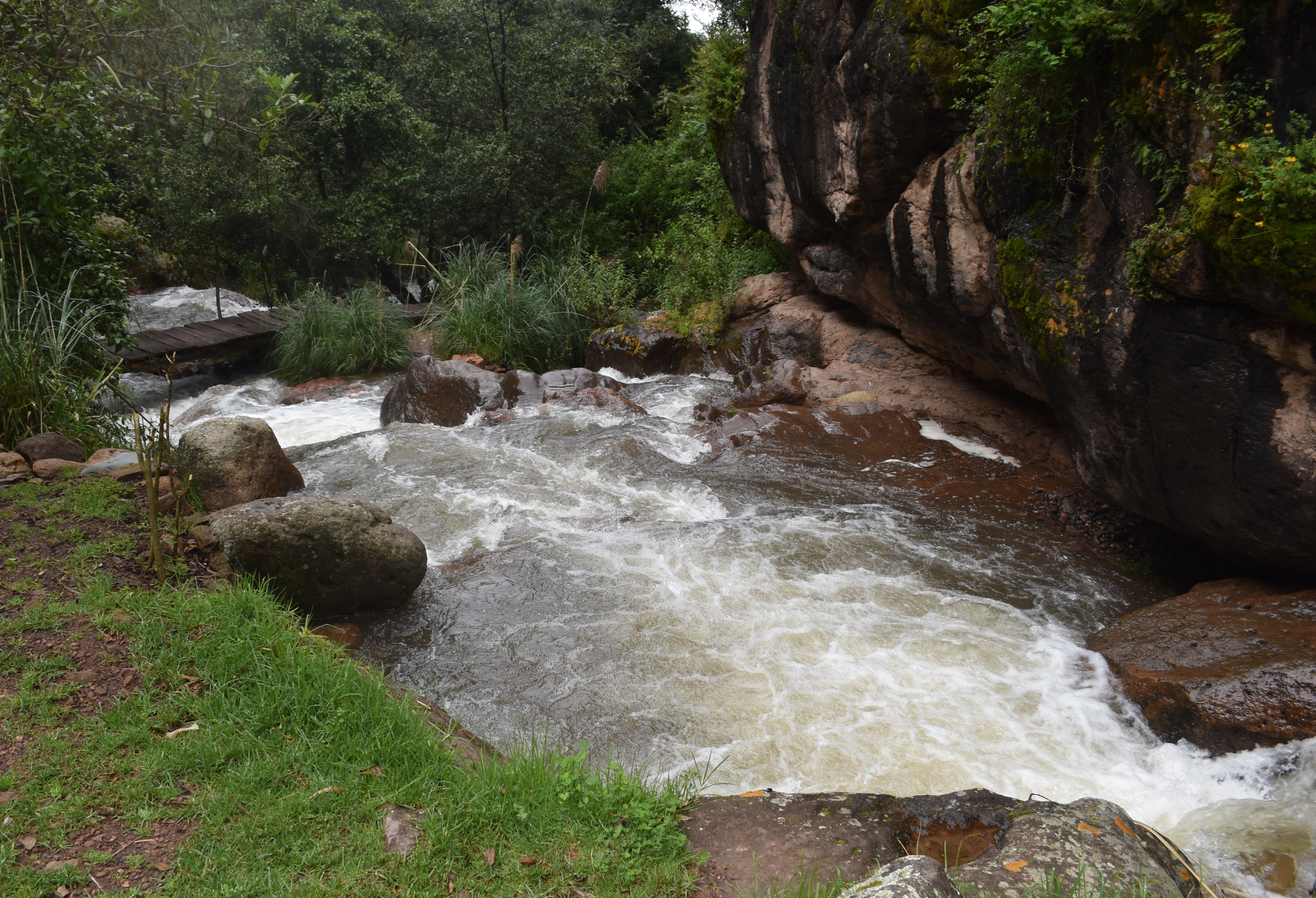
The river just above (100m) the Huanta to Huancayo road / El río situado justo por encima (a 100 m) de la carretera de Huanta a Huancayo. (Photo J.Forrest March 2026)
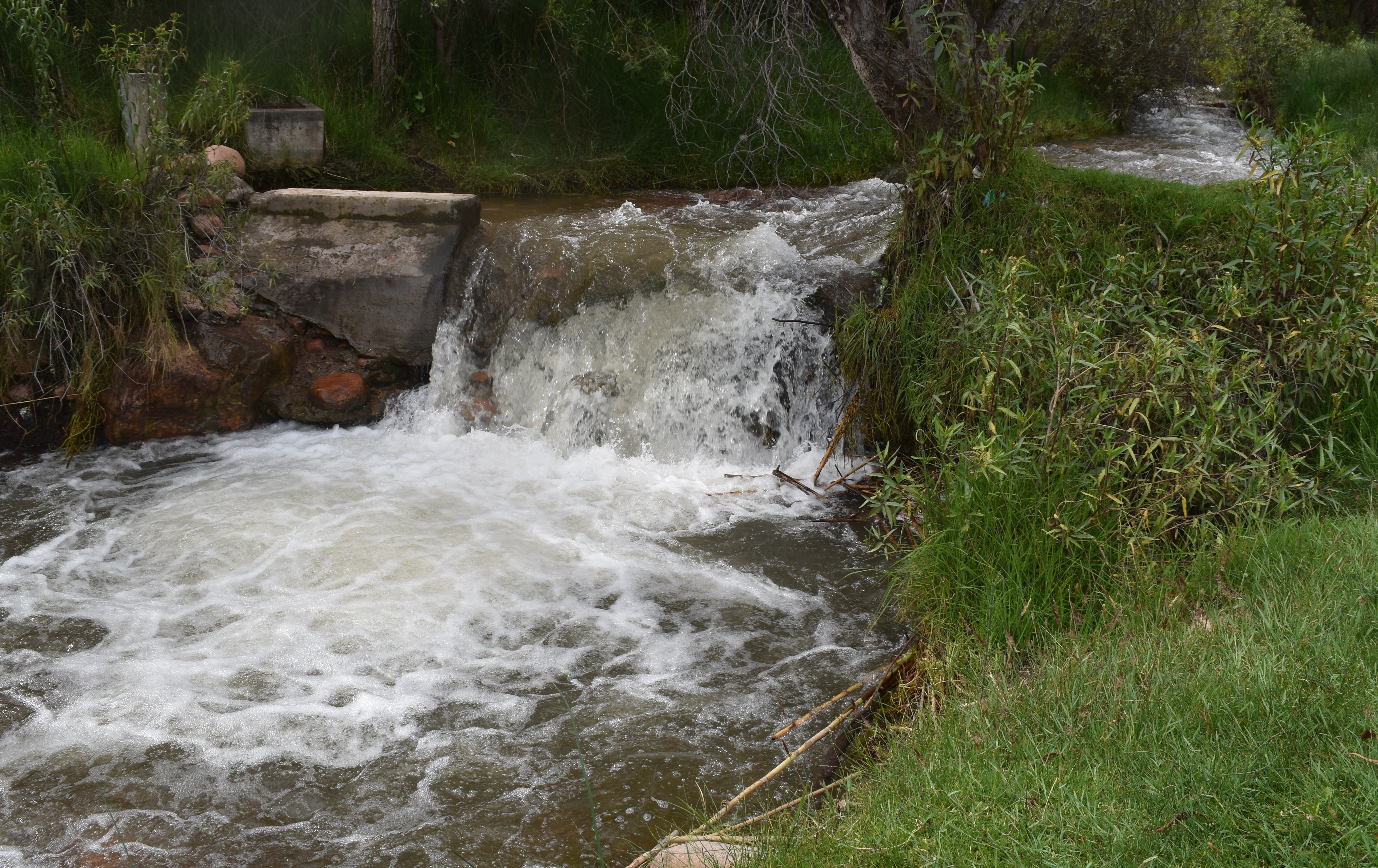
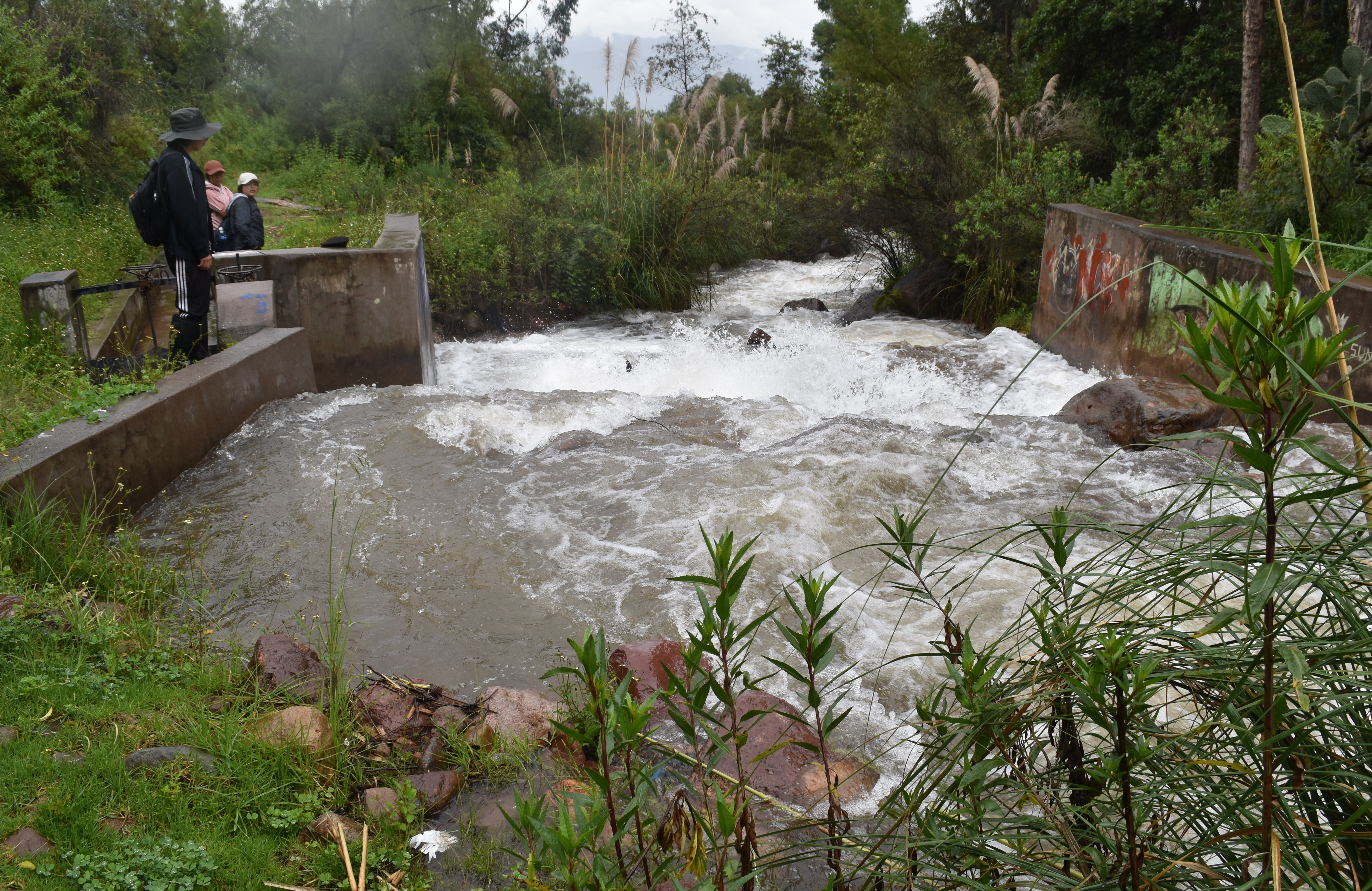
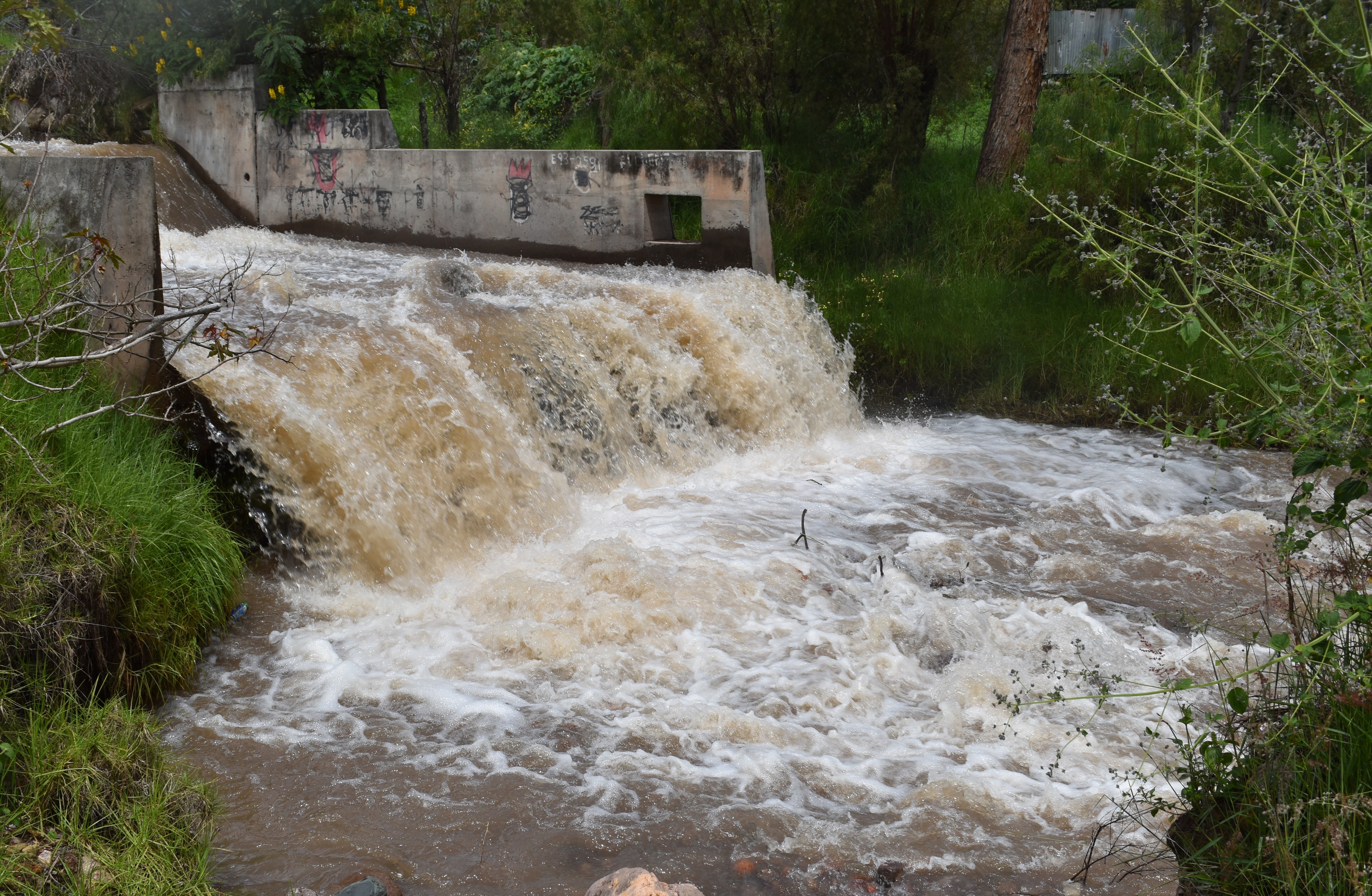
A small irrigation control point on the river below (300 metres) the Huanta to Huancayo road / Un pequeño punto de control de riego situado en el río, 300 metros más abajo de la carretera que va de Huanta a Huancayo. (Photo J.Forrest March 2026)
Walk 2 - River Opanccay
Start / Inicio: Sirenaccayoc waterfall / Catarata Sirenaccayoc
End / Termino: Recreo Napolis
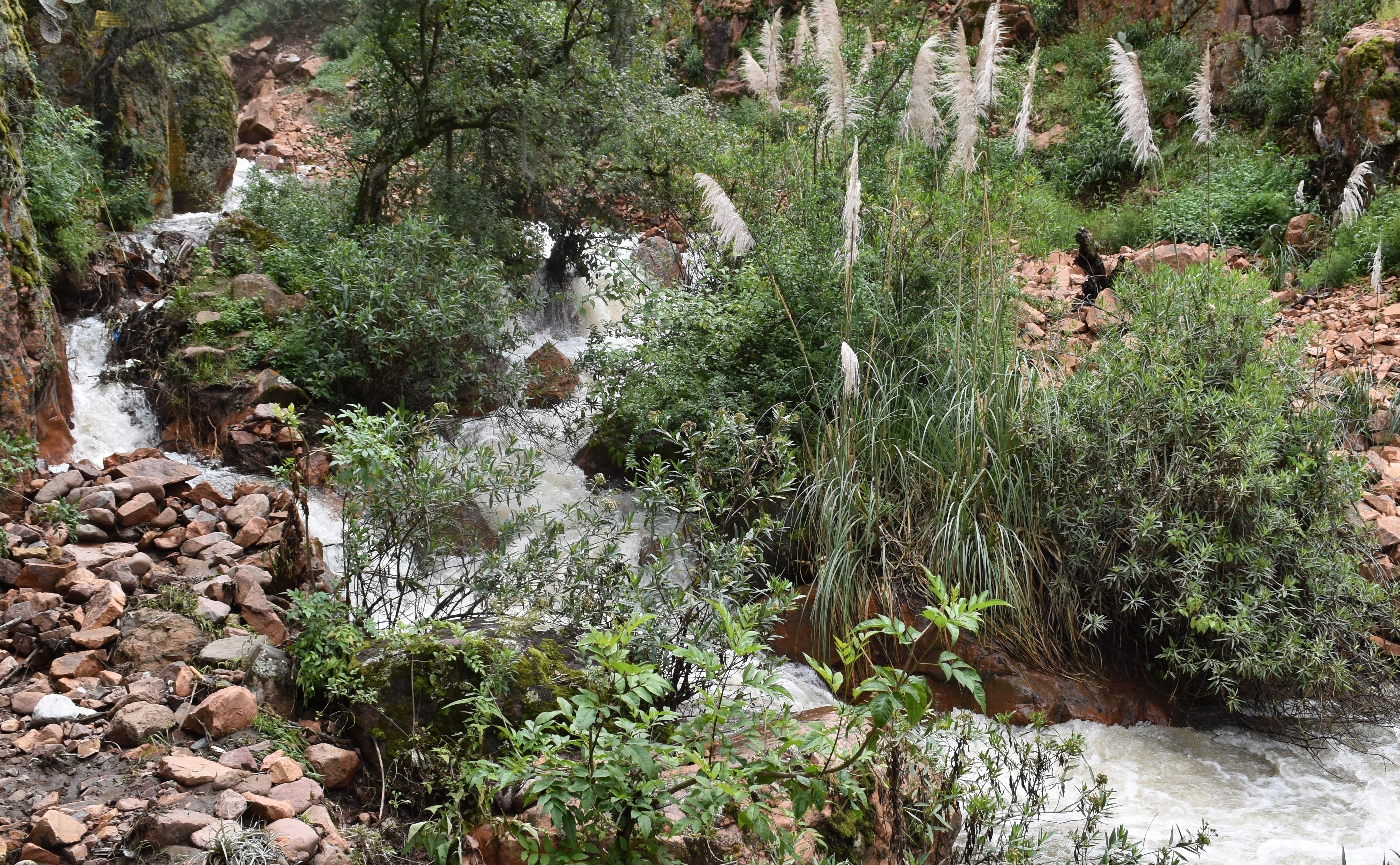
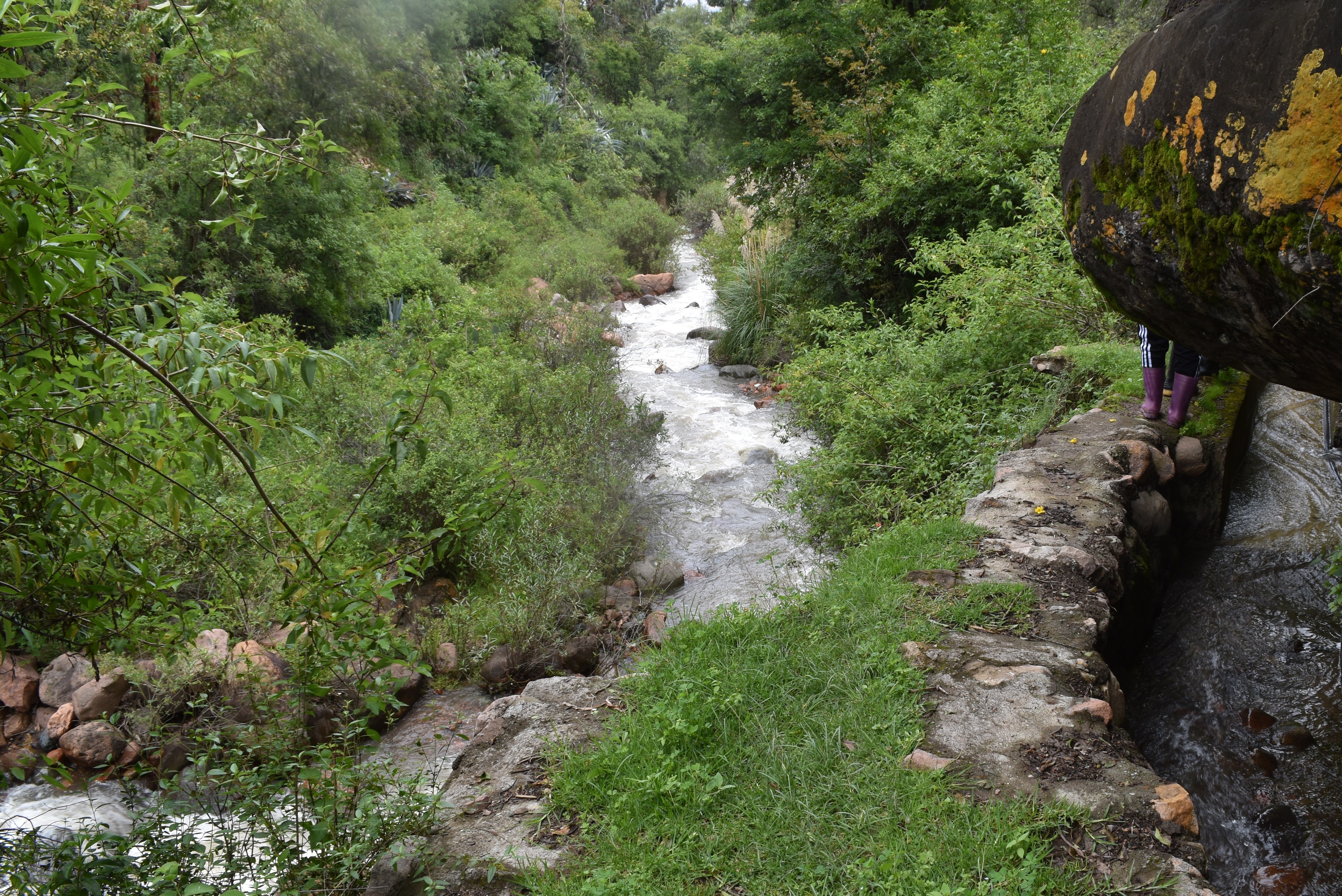
View upstream just below the Sirenaccayoc waterfall (NB. Access path on the left has been completely eroded away) / Vista río arriba, justo debajo de la cascada de Sirenaccayoc (Nota: el sendero de acceso de la izquierda ha quedado completamente erosionado). (Photo J.Forrest March 2026)
Rustic river crossing point below the old Molino and Sirenaccayoc car park / Cruce rústico del río, situado debajo del antiguo molino y del estacionamiento de Sirenaccayoc. (Photo J.Forrest March 2026)
Descending the valley beside the irrigation canal towards the Huanta to Luricocha roads / Bajando por el valle junto al canal de riego hacia las carreteras de Huanta a Luricocha. (Photo J.Forrest March 2026)
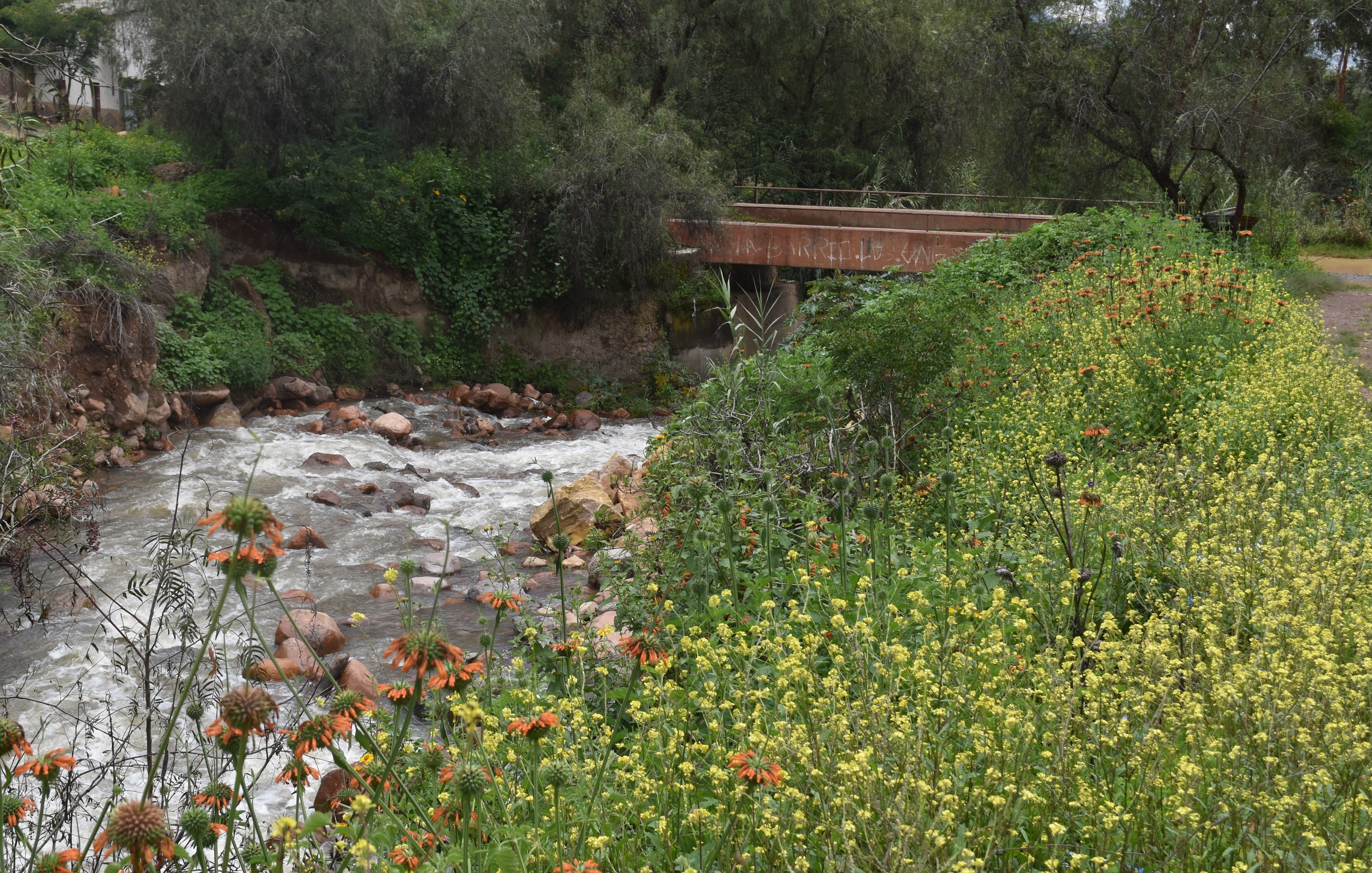
View downstream towards the old Huanta to Luricocha road bridge / Vista río abajo hacia el antiguo puente de la carretera de Huanta a Luricocha. (Photo J.Forrest March 2026)
View downstream from where the track to Recreo Napolis crosses the river / Vista río abajo desde el punto donde el camino que lleva a Recreo Napolis cruza el río. (Photo J.Forrest March 2026)
Walk 3 - River Huanta
Start / Inicio: Occachaca waterfall / Catarata Occachaca
End / Termino: Bocatoma San Luis
View downstream at the Occachaca waterfall / Vista río abajo de la cascada de Occachaca. (Photo J.Forrest March 2026)
View downstream at one of two bocatomas below Huanccayoc and above Huanta / Vista río abajo desde uno de los dos bocatomas situados rio abajo de Huanccayoc y rio arriba de Huanta. (Photo J.Forrest March 2026)
Confluence of the river Huanta (left) and another major tributary (right) below Huanta / Confluencia del río Huanta (izquierda) y otro afluente importante (derecha) debajo de Huanta. (Photo J.Forrest March 2026)
Confluence of the river Huanta (left) and the ‘El Bosque’ tributary (right) below Huanta / Confluencia del río Huanta (izquierda) y del afluente ‘El Bosque’ (derecha) debajo de Huanta. (Photo J.Forrest March 2026)
The lower of two bocatomas below San Luis / El más bajo de los dos bocatomas situados debajo de San Luis. (Photo J.Forrest March 2026)
Walk 4 - River Chihua
Start / Inicio: Old bridge on the old Cangari road / El viejo puente de la antigua carretera de Cangari.
End / Termino: The ford on the Viru Viru to Cangari road / El baden en la carretera de Viru Viru a Cangari.
View upstream of the river Chihua from the old bridge on the Huanta to Cangari road / Vista río arriba del río Chihua desde el antiguo puente de la carretera de Huanta a Cangari. (Photo J.Forrest March 2026)
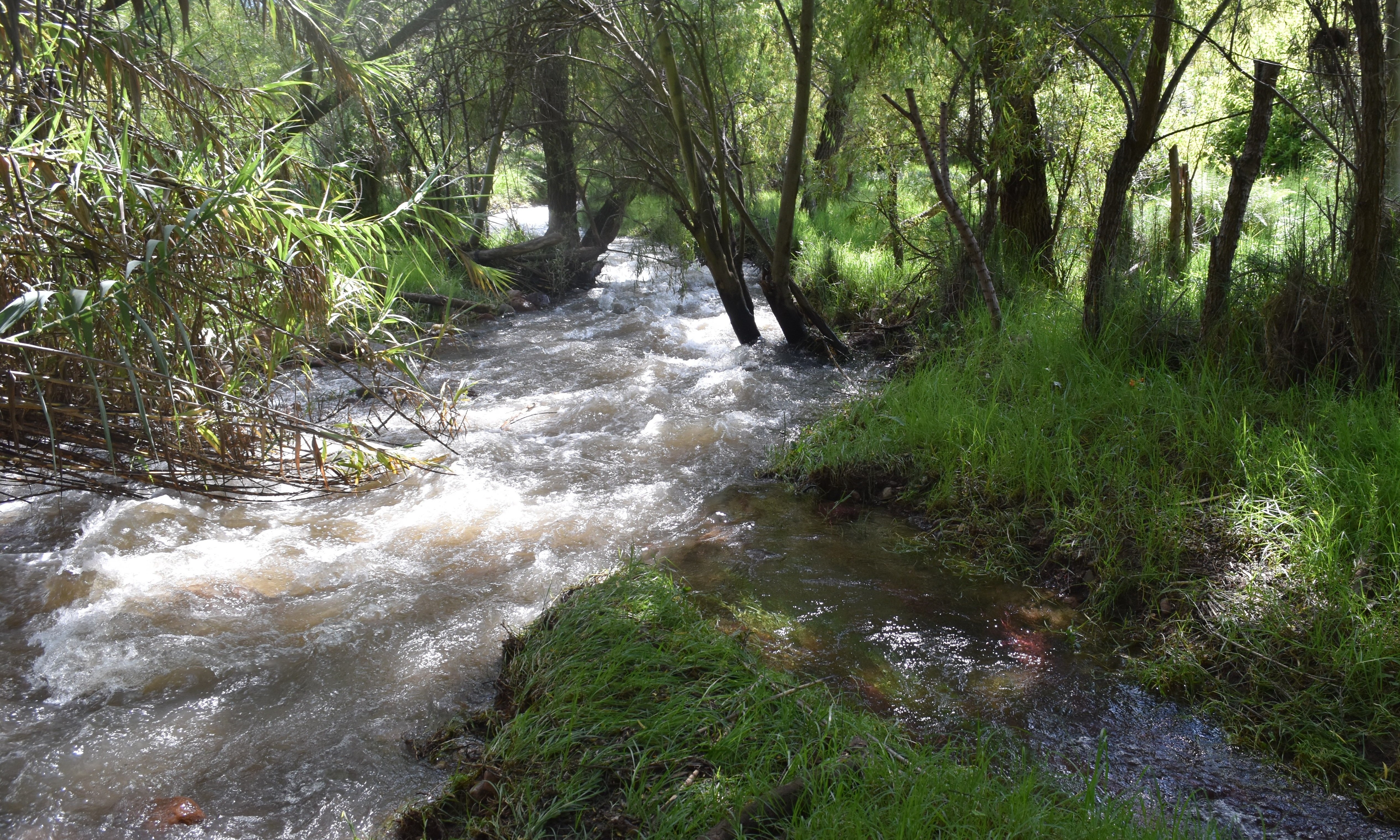
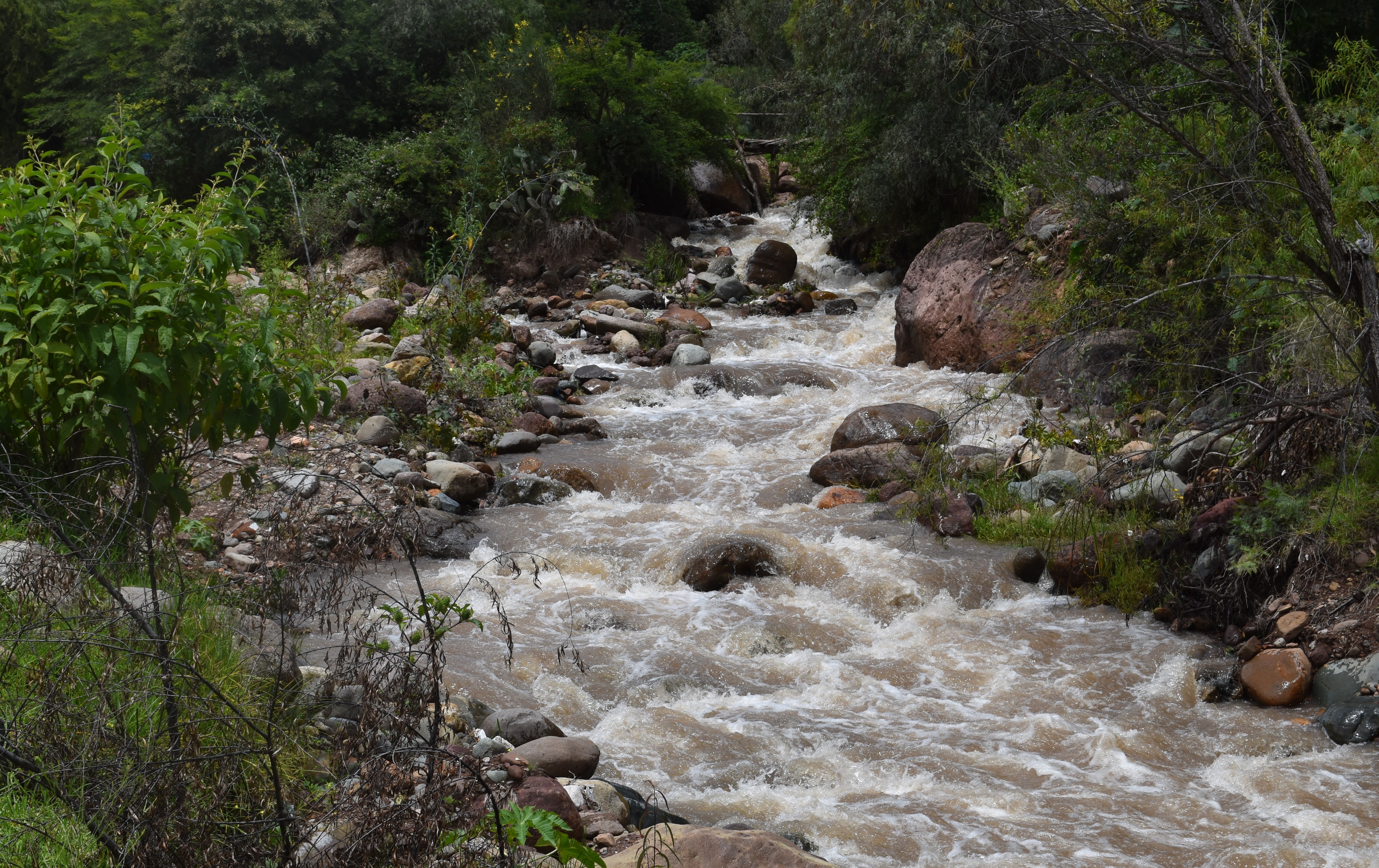
View downstream of the river Chihua just after it crosses the main irrigation canal / Vista rio abajo después de que cruza el canal principal de riego. (Photo J.Forrest March 2026)
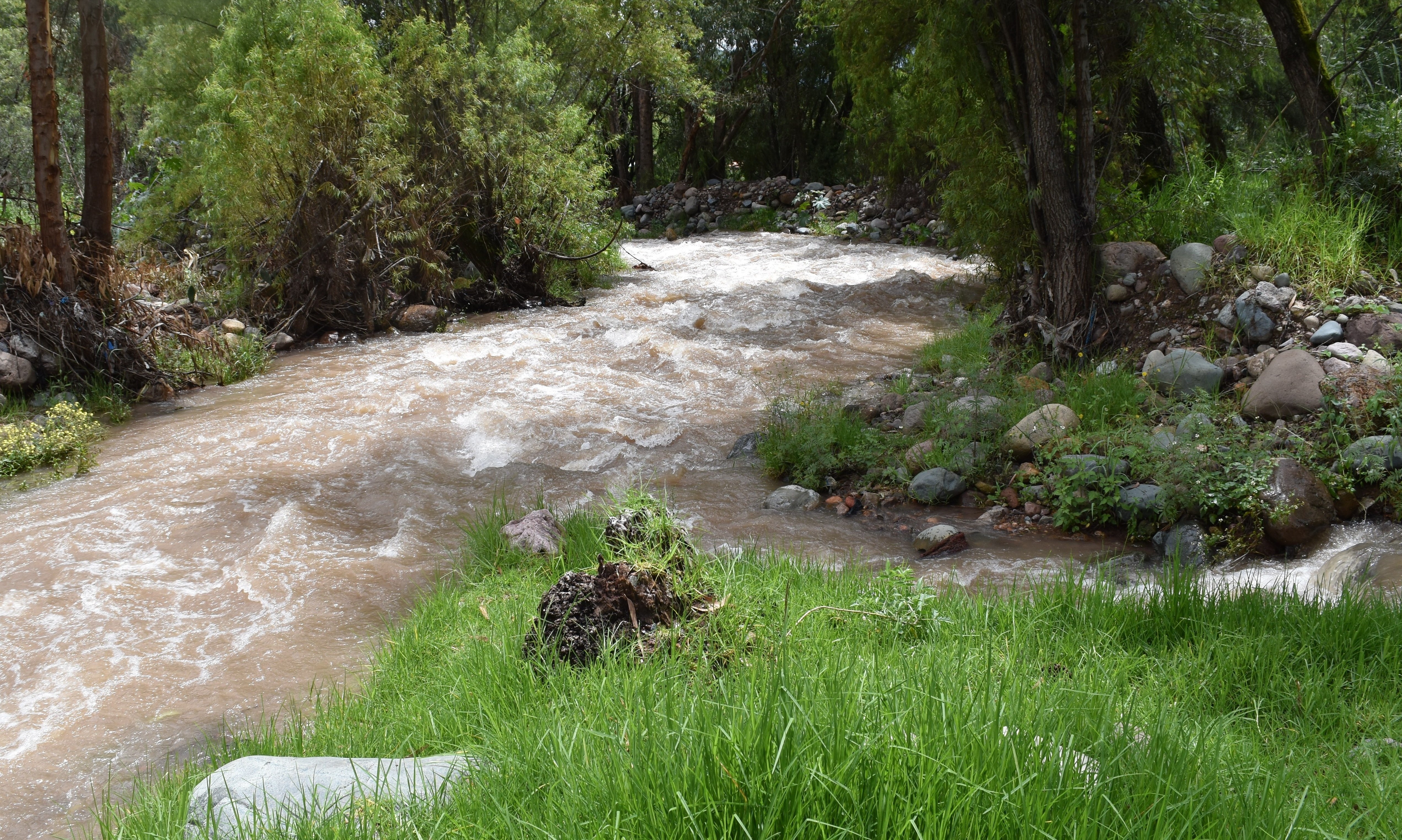
View downstream just upstream from the ford on the Huanta to Cangari direct road / Vista rio abajo justo rio arriba del baden de la carretera directa de Huanta a Cangari. (Photo J.Forrest March 2026)
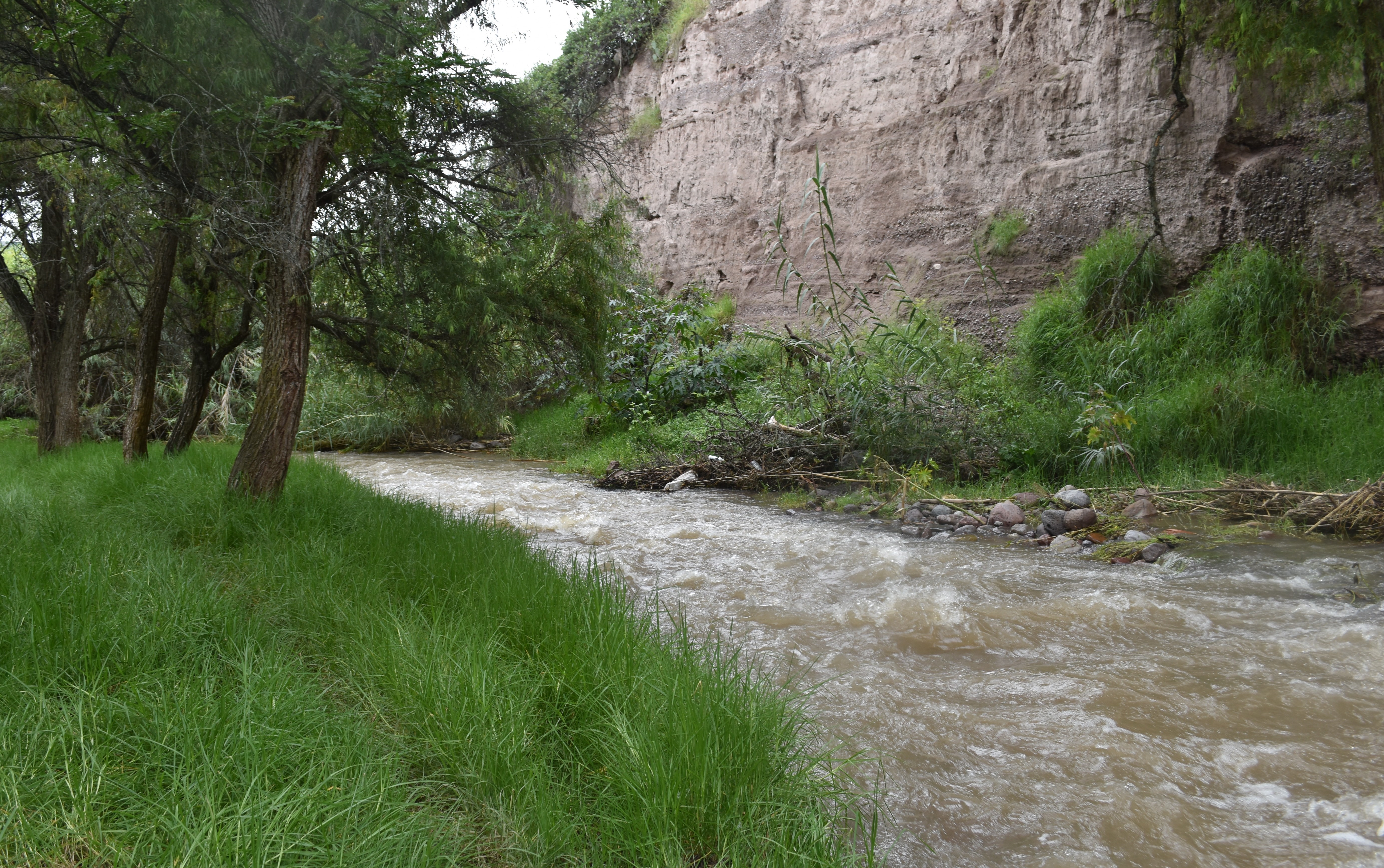
The river flowing passed a river cliff on the lower river Chihua / El río fluye cerca a un acantilado en el curso inferior del río Chihua. (Photo J.Forrest March 2026)
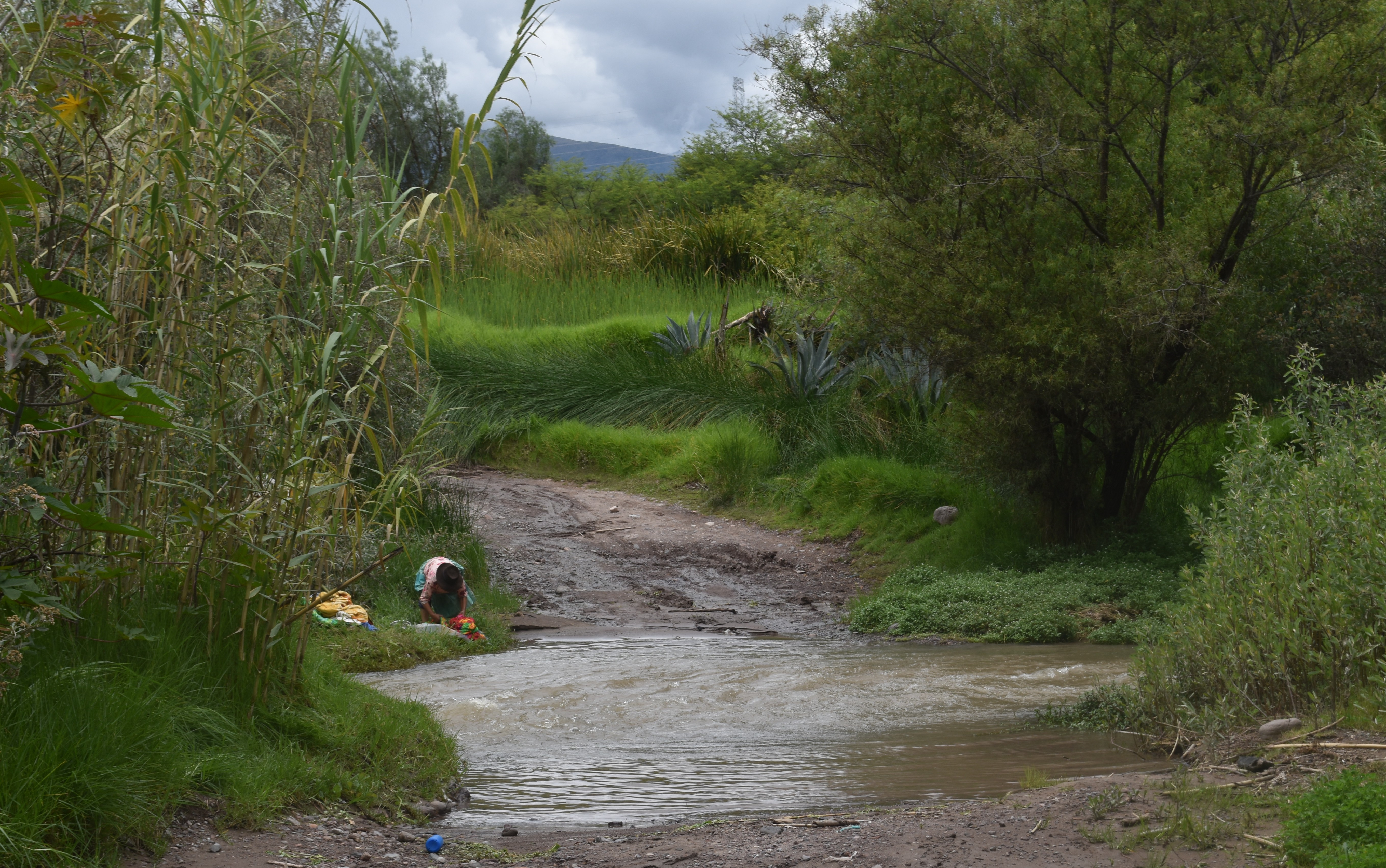
The ford on the Viru Viru to Cangari direct road / El baden de la carretera directa de Viru Viru a Cangari. (Photo J.Forrest March 2026)
BIODIVERSITY / BIOACOUSTICS
Visits were made over several days to dry forest sites with UNAH staff and students. The work to create an inventory of flowering plants and cactuses in the Huanta area continued. A new ultrasonic microphone system designed by the Cavendish Laboratory, in Cambridge, was used successfully in the field for the first time to record bird and insect sounds in the countryside surrounding Huanta.
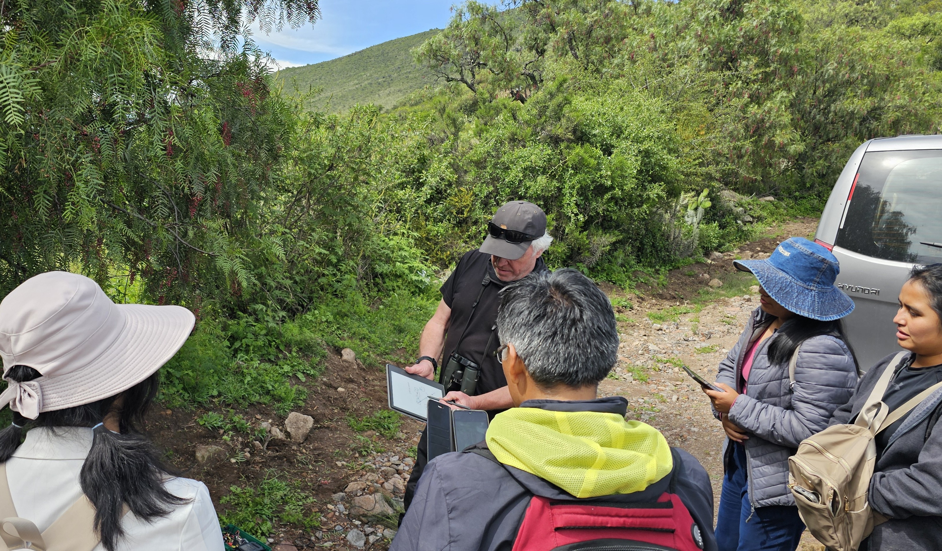
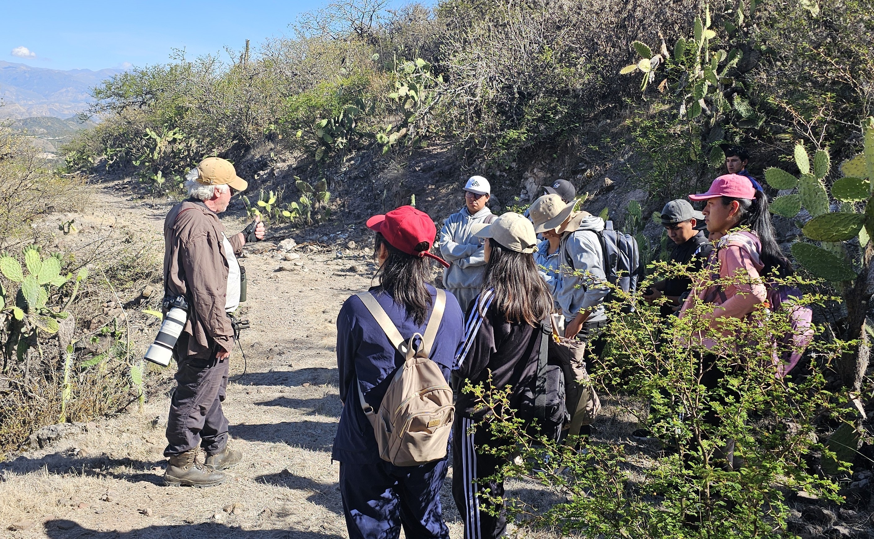
Outlining the fieldwork objectives and protocols to be followed when recording bird calls, to UNAH staff and students / Explicación de los objetivos y protocolos del trabajo de campo que se deben seguir al grabar cantos de aves, dirigida a los docentes y a los estudiantes de la UNAH. (E.Barnes March 2026)
Deploying the new ultrasonic microphone system to record high quality bird and insect calls for the database / Implementación del nuevo sistema de micrófonos ultrasónicos para grabar cantos de aves e insectos de alta calidad para la base de datos. (E.Barnes March 2026)
Outlining the field work objectives for a visit to a dry forest site to record ambient bird and insect calls to add to the database / Descripción de los objetivos del trabajo de campo para una visita a un bosque seco con el fin de grabar los cantos de aves e insectos del entorno para incorporarlos a la base de datos. (E.Barnes March 2026)
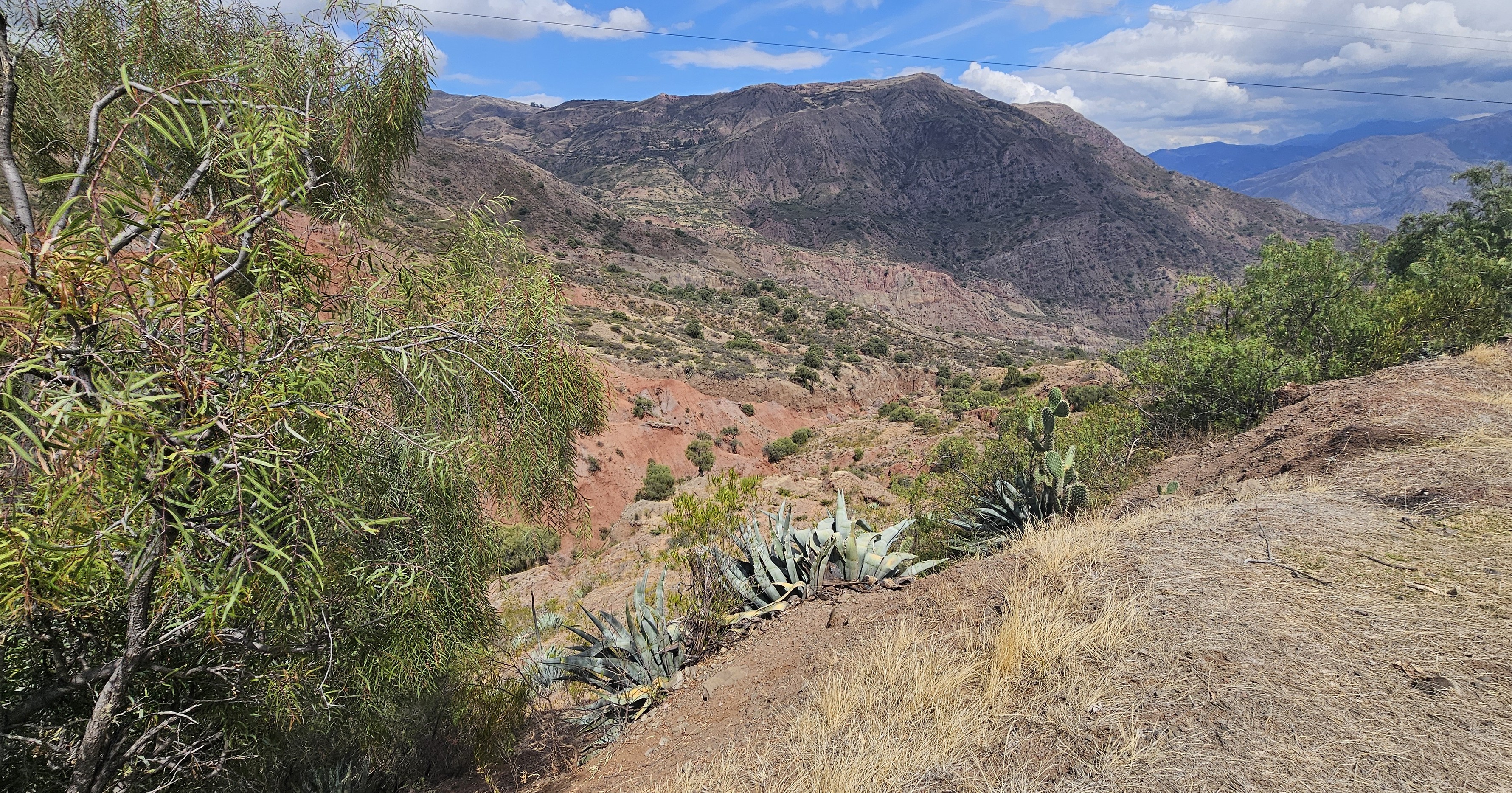
A dry forest site below Marcas, visited to record floral diversity / Un sitio de bosque seco situado más abajo de Marcas, que se visitó para registrar la diversidad floral. (E.Barnes March 2026)
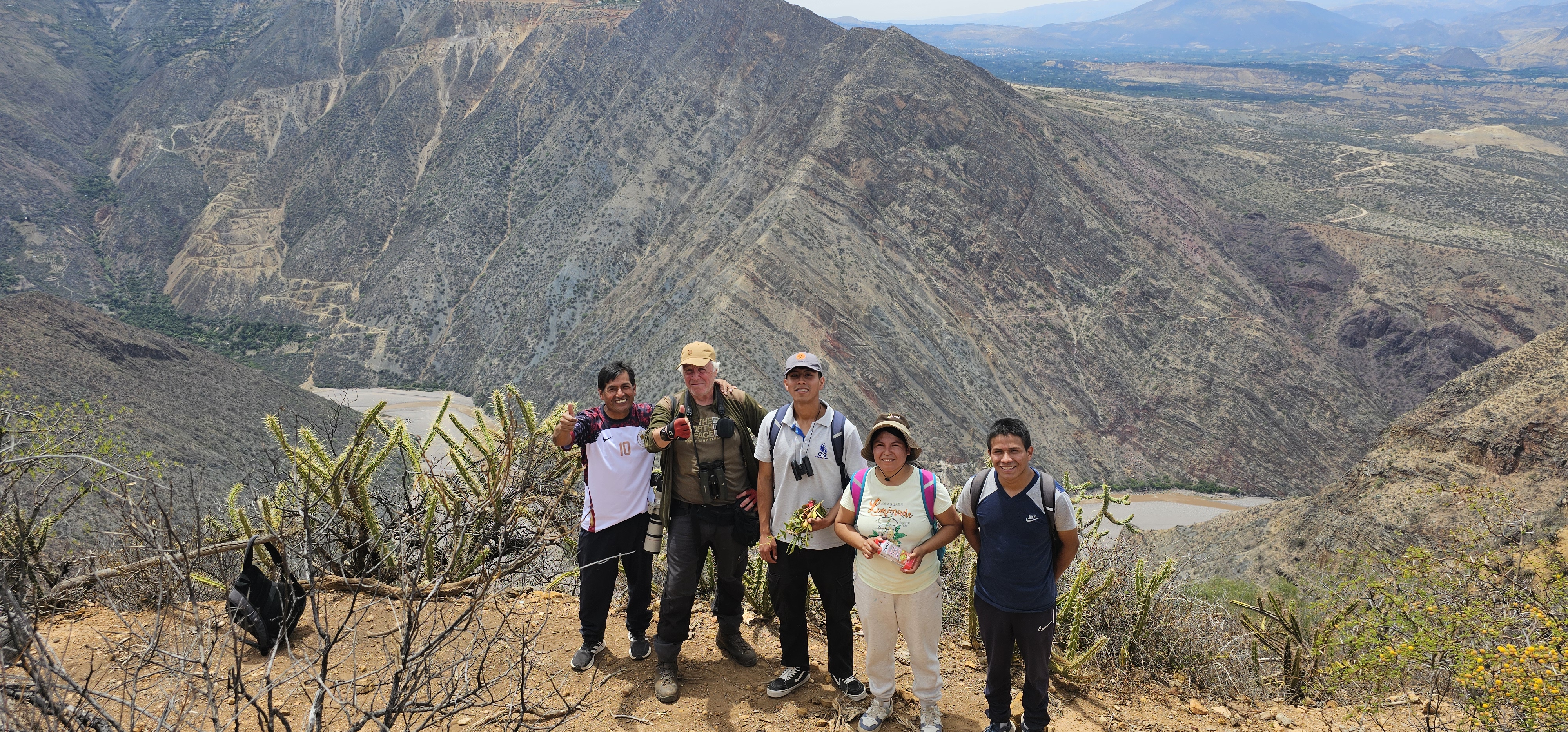
UNAH staff and students at a viewpoint above the river Mantaro, at the end of day spent undertaking fieldwork in the dry forest / Los docentes y estudiantes de la UNAH en un mirador sobre el río Mantaro, al final de una jornada dedicada al trabajo de campo en el bosque seco. (E.Barnes March 2026)